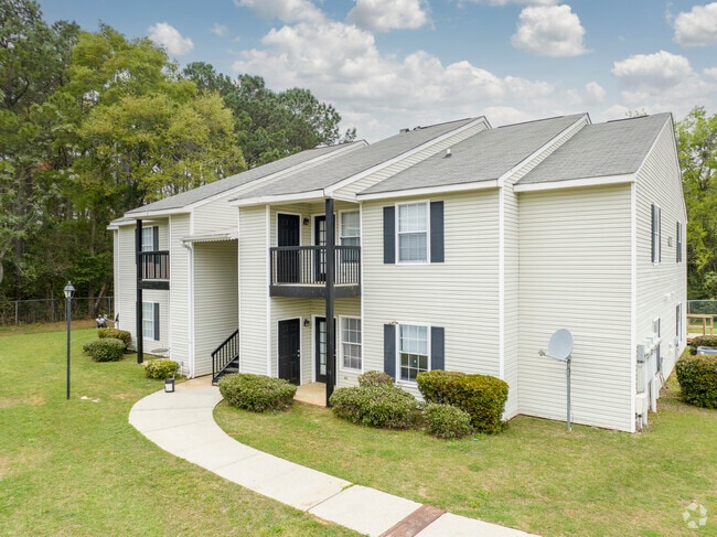
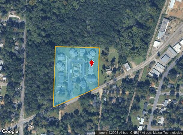
Property Record
560 Fortner St, Dothan, AL 36301
NEARBY LISTINGS FOR SALE OR LEASE
-
-
View all Dothan listings for sale on LoopNet.com
Property Detail
560 Fortner St
09-06-23-4-001-001-002
COM @ NE INT OF FORTNER ST & S EDGEWOOD IN SE1/4 OF SE1/4 OFSEC 23 T3N R26E TH NE ALG R/W 353.98' TO POB TH N 675.24' E493' S
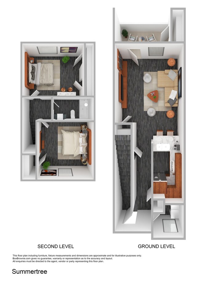
Apartment
Houston
X
Alabama
01069C0209G
6.30 AC
2025
Dothan/Enterprise
2025
Other Market Areas
040600
Dothan, AL
7,450 SF
DEMOGRAPHICS near 560 Fortner St
1 Mile
3 Mile
5 Mile
2024 Total Population
7,364
40,884
69,024
2029 Population
7,494
41,652
70,229
Pop Growth 2024-2029
+ 1.77%
+ 1.88%
+ 1.75%
Average Age
39
40
40
2024 Total Households
3,102
17,313
29,094
HH Growth 2024-2029
+ 1.77%
+ 1.88%
+ 1.75%
Median Household Inc
$28,557
$38,104
$45,546
Avg Household Size
2.30
2.30
2.30
2024 Avg HH Vehicles
1.00
2.00
2.00
Median Home Value
$102,749
$140,927
$159,549
Median Year Built
1961
1973
1980
Nearby Places
Map Layers
Map Styles
 Street
 Aerial
- Restaurants
- Banks
- Shops
- Fitness
- Groceries
PUBLIC TRANSPORTATION
AIRPORT
Dothan Regional
DRIVE
WALK
Distance
Dothan Regional
19 min
10.0 mi
Freight Ports
Port of Panama City
DRIVE
WALK
Distance
Port of Panama City
113 min
85.7 mi
Nearby Properties
Address
Land Use
TOTAL SIZE
Lot Size
Zoning
Address
Land Use
TOTAL SIZE
Lot Size
Zoning
9,150 SF
Address
Land Use
TOTAL SIZE
Lot Size
Zoning
192,165 SF
2 AC
Address
Land Use
TOTAL SIZE
Lot Size
Zoning
7,931 SF
9.10 AC
Address
Land Use
TOTAL SIZE
Lot Size
Zoning
187,423 SF
22.30 AC
Address
Land Use
TOTAL SIZE
Lot Size
Zoning
68,981 SF
1.97 AC
Address
Land Use
TOTAL SIZE
Lot Size
Zoning
136,564 SF
18.99 AC
Address
Land Use
TOTAL SIZE
Lot Size
Zoning
10,086 SF
16.80 AC
Address
Land Use
TOTAL SIZE
Lot Size
Zoning
88,725 SF
17 AC
Address
Land Use
TOTAL SIZE
Lot Size
Zoning
79,961 SF
12.40 AC
Address
Land Use
TOTAL SIZE
Lot Size
Zoning
34,399 SF
17.70 AC
Address
Land Use
TOTAL SIZE
Lot Size
Zoning
173,138 SF
8.50 AC
Address
Land Use
TOTAL SIZE
Lot Size
Zoning
11,422 SF
38 AC
Address
Land Use
TOTAL SIZE
Lot Size
Zoning
149,097 SF
15.20 AC
Address
Land Use
TOTAL SIZE
Lot Size
Zoning
9,112 SF
10.50 AC
Address
Land Use
TOTAL SIZE
Lot Size
Zoning
0.53 AC
Address
Land Use
TOTAL SIZE
Lot Size
Zoning
145,107 SF
14.30 AC
Address
Land Use
TOTAL SIZE
Lot Size
Zoning
14,624 SF
9.05 AC
Address
Land Use
TOTAL SIZE
Lot Size
Zoning
23,275 SF
60 AC
Address
Land Use
TOTAL SIZE
Lot Size
Zoning
110,042 SF
8.82 AC
Address
Land Use
TOTAL SIZE
Lot Size
Zoning
46,876 SF
12.66 AC
Address
Land Use
TOTAL SIZE
Lot Size
Zoning
201,923 SF
33.52 AC
Address
Land Use
TOTAL SIZE
Lot Size
Zoning
134,342 SF
15.65 AC
Address
Land Use
TOTAL SIZE
Lot Size
Zoning
244,027 SF
Address
Land Use
TOTAL SIZE
Lot Size
Zoning
1,764 SF
8.10 AC
Address
Land Use
TOTAL SIZE
Lot Size
Zoning
10,054 SF
9.20 AC
Address
Land Use
TOTAL SIZE
Lot Size
Zoning
175,728 SF
10.11 AC
Address
Land Use
TOTAL SIZE
Lot Size
Zoning
10,688 SF
7.80 AC
Address
Land Use
TOTAL SIZE
Lot Size
Zoning
71,457 SF
3.90 AC
Address
Land Use
TOTAL SIZE
Lot Size
Zoning
39,223 SF
12.03 AC
Address
Land Use
TOTAL SIZE
Lot Size
Zoning
65,972 SF
3.84 AC
The World's #1 Commercial Real Estate Marketplace
Connect with us
© 2025 CoStar Group
The information above has been obtained from sources believed reliable. While we do not doubt its accuracy we have not verified it and make no guarantee, warranty or representation about it. It is your responsibility to independently confirm its accuracy and completeness. Any projections, opinions, assumptions, or estimates used are for example only and do not represent the current or future performance of the property. The value of this transaction to you depends on tax and other factors which should be evaluated by your tax, financial, and legal advisors. You and your advisors should conduct a careful, independent investigation of the property to determine to your satisfaction the suitability of the property for your needs.