Property Record
560 Ne 14Th St, Ocala, FL 34470
Current Lease Availabilities
NEARBY LISTINGS FOR SALE OR LEASE
Property Detail
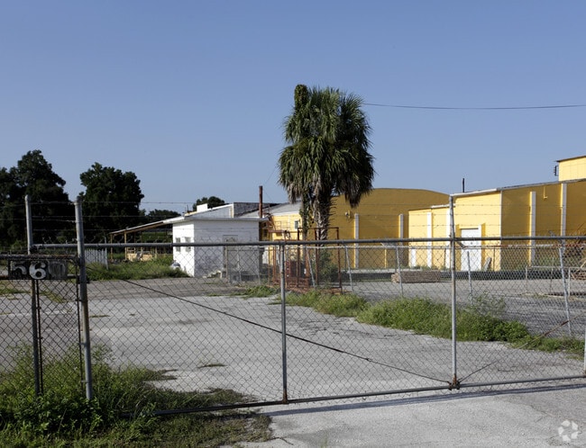
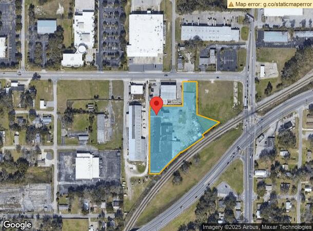
560 Ne 14Th St
Ocala, FL
Citrus Central Sub
2637-004-000
SEC 08 TWP 15 RGE 22 PLAT BOOK T PAGE 014 CITRUS CENTRAL SUB LOT 4
Warehouse
Marion
X
Florida
12083C0509E
4
2024
3.29 AC
2024
Downtown Ocala
001900
Ocala
68,747 SF
DEMOGRAPHICS near 560 Ne 14Th St
1 Mile
3 Mile
5 Mile
2024 Total Population
4,991
48,505
96,701
2029 Population
5,609
54,650
108,953
Pop Growth 2024-2029
+ 12.38%
+ 12.67%
+ 12.67%
Average Age
37
40
41
2024 Total Households
1,967
19,957
39,632
HH Growth 2024-2029
+ 12.51%
+ 12.66%
+ 12.72%
Median Household Inc
$34,910
$43,039
$52,365
Avg Household Size
2.40
2.30
2.30
2024 Avg HH Vehicles
2.00
2.00
2.00
Median Home Value
$144,109
$160,424
$194,985
Median Year Built
1965
1977
1982
Nearby Places
- Restaurants
- Banks
- Shops
- Fitness
- Groceries
Nearby Properties
Address
Land Use
TOTAL SIZE
Lot Size
Zoning
Address
Land Use
TOTAL SIZE
Lot Size
Zoning
207,950 SF
14.08 AC
INST
Address
Land Use
TOTAL SIZE
Lot Size
Zoning
704,765 SF
71.04 AC
GU
Address
Land Use
TOTAL SIZE
Lot Size
Zoning
326,425 SF
11.66 AC
INST
Address
Land Use
TOTAL SIZE
Lot Size
Zoning
189,286 SF
35.42 AC
PD08
Address
Land Use
TOTAL SIZE
Lot Size
Zoning
195,992 SF
5.72 AC
FBC
Address
Land Use
TOTAL SIZE
Lot Size
Zoning
458,983 SF
35.14 AC
M1
Address
Land Use
TOTAL SIZE
Lot Size
Zoning
444,381 SF
60 AC
M1
Address
Land Use
TOTAL SIZE
Lot Size
Zoning
350,895 SF
27.85 AC
M1
Address
Land Use
TOTAL SIZE
Lot Size
Zoning
92,049 SF
15.75 AC
R3
Address
Land Use
TOTAL SIZE
Lot Size
Zoning
88,462 SF
31.76 AC
INST
Address
Land Use
TOTAL SIZE
Lot Size
Zoning
604,920 SF
42.92 AC
M1
Address
Land Use
TOTAL SIZE
Lot Size
Zoning
482,618 SF
34.54 AC
M2
Address
Land Use
TOTAL SIZE
Lot Size
Zoning
116,035 SF
38.20 AC
GU
Address
Land Use
TOTAL SIZE
Lot Size
Zoning
66,600 SF
21.50 AC
B4
Address
Land Use
TOTAL SIZE
Lot Size
Zoning
101,892 SF
16.81 AC
INST
Address
Land Use
TOTAL SIZE
Lot Size
Zoning
180,334 SF
24.29 AC
INST
Address
Land Use
TOTAL SIZE
Lot Size
Zoning
111,395 SF
13 AC
B2
Address
Land Use
TOTAL SIZE
Lot Size
Zoning
30,334 SF
29.72 AC
GU
Address
Land Use
TOTAL SIZE
Lot Size
Zoning
78,280 SF
12.54 AC
R3
Address
Land Use
TOTAL SIZE
Lot Size
Zoning
69,607 SF
6.74 AC
INST
Address
Land Use
TOTAL SIZE
Lot Size
Zoning
40,150 SF
11.31 AC
SC
Address
Land Use
TOTAL SIZE
Lot Size
Zoning
114,655 SF
10.74 AC
B4
Address
Land Use
TOTAL SIZE
Lot Size
Zoning
29,068 SF
22.30 AC
PD
Address
Land Use
TOTAL SIZE
Lot Size
Zoning
112,663 SF
32.72 AC
INST
Address
Land Use
TOTAL SIZE
Lot Size
Zoning
19,117 SF
0.98 AC
FBC
Address
Land Use
TOTAL SIZE
Lot Size
Zoning
95,964 SF
15.51 AC
M1
Address
Land Use
TOTAL SIZE
Lot Size
Zoning
134,827 SF
14.83 AC
SC
Address
Land Use
TOTAL SIZE
Lot Size
Zoning
132,244 SF
11.60 AC
SC
Address
Land Use
TOTAL SIZE
Lot Size
Zoning
26,801 SF
5.66 AC
FBC
Address
Land Use
TOTAL SIZE
Lot Size
Zoning
121,462 SF
10.92 AC
B2
The World's #1 Commercial Real Estate Marketplace
Connect with us
© 2025 CoStar Group
The information above has been obtained from sources believed reliable. While we do not doubt its accuracy we have not verified it and make no guarantee, warranty or representation about it. It is your responsibility to independently confirm its accuracy and completeness. Any projections, opinions, assumptions, or estimates used are for example only and do not represent the current or future performance of the property. The value of this transaction to you depends on tax and other factors which should be evaluated by your tax, financial, and legal advisors. You and your advisors should conduct a careful, independent investigation of the property to determine to your satisfaction the suitability of the property for your needs.