Property Record
560 Old Baptist Rd, North Kingstown, RI 02852

NEARBY LISTINGS FOR SALE OR LEASE
Property Detail
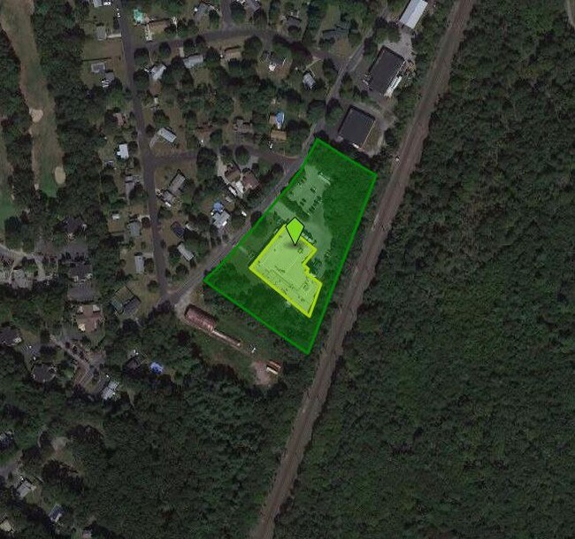
560 Old Baptist Rd
Industrialgeneral
Washington
X
Rhode Island
44003C0251G
4.27 AC
2025
Washington County
2025
Providence
050102
Providence-Warwick, RI-MA
35,265 SF
NKIN-000132-000005
DEMOGRAPHICS near 560 Old Baptist Rd
1 Mile
3 Mile
5 Mile
2024 Total Population
1,104
20,281
42,638
2029 Population
1,119
20,252
42,637
Pop Growth 2024-2029
+ 1.36%
(0.14%)
0.00%
Average Age
43
43
43
2024 Total Households
446
8,146
17,095
HH Growth 2024-2029
+ 1.12%
(0.48%)
(0.27%)
Median Household Inc
$101,225
$94,302
$106,591
Avg Household Size
2.40
2.40
2.40
2024 Avg HH Vehicles
2.00
2.00
2.00
Median Home Value
$421,000
$448,984
$468,355
Median Year Built
1984
1972
1972
Nearby Places
Map Layers
Map Styles
 Street
 Aerial
- Restaurants
- Banks
- Shops
- Fitness
- Groceries
PUBLIC TRANSPORTATION
COMMUTER RAIL
Wickford Junction (Providence/Stoughton Line - MBTA)
DRIVE
WALK
Distance
Wickford Junction (Providence/Stoughton Line - MBTA)
5 min
1.9 mi
AIRPORT
Rhode Island Tf Green International
DRIVE
WALK
Distance
Rhode Island Tf Green International
23 min
12.7 mi
Freight Ports
Port of Davisville, RI
DRIVE
WALK
Distance
Port of Davisville, RI
12 min
5.3 mi
Nearby Properties
Address
Land Use
TOTAL SIZE
Lot Size
Zoning
Address
Land Use
TOTAL SIZE
Lot Size
Zoning
122,785 SF
43.80 AC
QBPD
Address
Land Use
TOTAL SIZE
Lot Size
Zoning
39.16 AC
QBPD
Address
Land Use
TOTAL SIZE
Lot Size
Zoning
83.30 AC
F1
Address
Land Use
TOTAL SIZE
Lot Size
Zoning
20.43 AC
MUPD
Address
Land Use
TOTAL SIZE
Lot Size
Zoning
466,871 SF
17.96 AC
QBPD
Address
Land Use
TOTAL SIZE
Lot Size
Zoning
8.10 AC
PR
Address
Land Use
TOTAL SIZE
Lot Size
Zoning
161,263 SF
61.75 AC
R30
Address
Land Use
TOTAL SIZE
Lot Size
Zoning
196,759 SF
33.67 AC
QBPD
Address
Land Use
TOTAL SIZE
Lot Size
Zoning
4,288 SF
33.30 AC
PVD
Address
Land Use
TOTAL SIZE
Lot Size
Zoning
3,417 SF
7.13 AC
PR
Address
Land Use
TOTAL SIZE
Lot Size
Zoning
8.73 AC
PR
Address
Land Use
TOTAL SIZE
Lot Size
Zoning
63.69 AC
LI
Address
Land Use
TOTAL SIZE
Lot Size
Zoning
141,701 SF
12 AC
WJ
Address
Land Use
TOTAL SIZE
Lot Size
Zoning
137,323 SF
22.84 AC
PR
Address
Land Use
TOTAL SIZE
Lot Size
Zoning
97,308 SF
9.36 AC
P
Address
Land Use
TOTAL SIZE
Lot Size
Zoning
13.28 AC
GB
Address
Land Use
TOTAL SIZE
Lot Size
Zoning
125,393 SF
15.33 AC
GB
Address
Land Use
TOTAL SIZE
Lot Size
Zoning
83.12 AC
MLIO
Address
Land Use
TOTAL SIZE
Lot Size
Zoning
92,700 SF
9.90 AC
QBPD
Address
Land Use
TOTAL SIZE
Lot Size
Zoning
8.92 AC
PR
Address
Land Use
TOTAL SIZE
Lot Size
Zoning
25.10 AC
QBPD
Address
Land Use
TOTAL SIZE
Lot Size
Zoning
12.68 AC
PR
Address
Land Use
TOTAL SIZE
Lot Size
Zoning
237,726 SF
3.36 AC
WJ
Address
Land Use
TOTAL SIZE
Lot Size
Zoning
15.50 AC
PVD
Address
Land Use
TOTAL SIZE
Lot Size
Zoning
9.35 AC
PR
Address
Land Use
TOTAL SIZE
Lot Size
Zoning
8.85 AC
PR
Address
Land Use
TOTAL SIZE
Lot Size
Zoning
25.97 AC
QBPD
Address
Land Use
TOTAL SIZE
Lot Size
Zoning
15.90 AC
QBPD
Address
Land Use
TOTAL SIZE
Lot Size
Zoning
110,435 SF
11.84 AC
QBPD
Address
Land Use
TOTAL SIZE
Lot Size
Zoning
42,533 SF
12.60 AC
GB
The World's #1 Commercial Real Estate Marketplace
Connect with us
© 2025 CoStar Group
The information above has been obtained from sources believed reliable. While we do not doubt its accuracy we have not verified it and make no guarantee, warranty or representation about it. It is your responsibility to independently confirm its accuracy and completeness. Any projections, opinions, assumptions, or estimates used are for example only and do not represent the current or future performance of the property. The value of this transaction to you depends on tax and other factors which should be evaluated by your tax, financial, and legal advisors. You and your advisors should conduct a careful, independent investigation of the property to determine to your satisfaction the suitability of the property for your needs.