Property Record
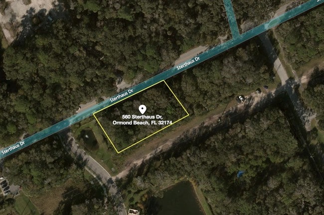
560 Sterthaus Dr, Ormond Beach, FL 32174


This Property Is For Sale
Property Detail
560 Sterthaus Dr
Deltona-Daytona Beach-Ormond Beach, FL
E 230 FT OF W 1825 FT OF N 1/2 OF LOT C SUB GRANT LOT 9 1/2 ORMOND EXC ST INC PER OR 4235 PG 2845-2846
4241-01-06-0063
VOLUSIA
Commercialacreage
Florida
13B1
c,9
AE The base floodplain where base flood elevations are provided. AE Zones are now used on new format FIRMs instead of A1-A30 Zones.
0.61 AC
2025
Ormond Beach
2026
Deltona/Daytona Beach
080807
NEARBY LISTINGS FOR SALE OR LEASE
DEMOGRAPHICS near 560 Sterthaus Dr
1 mile
3 mile
5 mile
2025 Total Population
6,737
52,727
105,008
2030 Population
7,212
56,759
113,809
Pop Growth 2025-2030
+ 7.05%
+ 7.65%
+ 8.38%
Average Age
47
48
47
2025 Total Households
3,135
23,825
47,238
HH Growth 2025-2030
+ 7.02%
+ 7.69%
+ 8.52%
Median Household Inc
$43,670
$57,793
$59,758
Avg Household Size
2.00
2.10
2.10
2025 Avg HH Vehicles
2.00
2.00
2.00
Median Home Value
$334,572
$334,950
$343,562
Median Year Built
1982
1980
1979
Nearby Places
Map Layers
Map Styles
 Street
 Aerial
Transit
 Traffic
 Biking
Places
Listings with unknown addresses are not visible on the map
- Restaurants
- Banks
- Shops
- Fitness
- Groceries
PUBLIC TRANSPORTATION
AIRPORT
Daytona Beach International
Drive
Walk
Distance
Daytona Beach International
21 min
11.8 mi
Orlando Sanford International
Drive
Walk
Distance
Orlando Sanford International
65 min
47.8 mi
Nearby Properties
Address
Land Use
TOTAL SIZE
Lot Size
Zoning
Address
Land Use
TOTAL SIZE
Lot Size
Zoning
12,394 SF
139.59 AC
Address
Land Use
TOTAL SIZE
Lot Size
Zoning
470,843 SF
1.78 AC
RC
Address
Land Use
TOTAL SIZE
Lot Size
Zoning
10,637 SF
0.15 AC
R2
Address
Land Use
TOTAL SIZE
Lot Size
Zoning
359,180 SF
29.73 AC
01A2
Address
Land Use
TOTAL SIZE
Lot Size
Zoning
13,846 SF
126.83 AC
13T1
Address
Land Use
TOTAL SIZE
Lot Size
Zoning
16.50 AC
Address
Land Use
TOTAL SIZE
Lot Size
Zoning
Address
Land Use
TOTAL SIZE
Lot Size
Zoning
Address
Land Use
TOTAL SIZE
Lot Size
Zoning
5,426 SF
6.28 AC
09R9
Address
Land Use
TOTAL SIZE
Lot Size
Zoning
168,456 SF
15.74 AC
Address
Land Use
TOTAL SIZE
Lot Size
Zoning
4,182 SF
0.16 AC
MH1
Address
Land Use
TOTAL SIZE
Lot Size
Zoning
144,576 SF
11.19 AC
13R6
Address
Land Use
TOTAL SIZE
Lot Size
Zoning
149,872 SF
20 AC
09R6
Address
Land Use
TOTAL SIZE
Lot Size
Zoning
162,450 SF
1.42 AC
13B9
Address
Land Use
TOTAL SIZE
Lot Size
Zoning
5,350 SF
36.42 AC
13T1
Address
Land Use
TOTAL SIZE
Lot Size
Zoning
152,621 SF
18.26 AC
C
Address
Land Use
TOTAL SIZE
Lot Size
Zoning
219,381 SF
25.44 AC
13B8
Address
Land Use
TOTAL SIZE
Lot Size
Zoning
179,868 SF
0.33 AC
Address
Land Use
TOTAL SIZE
Lot Size
Zoning
61,570 SF
23.04 AC
Address
Land Use
TOTAL SIZE
Lot Size
Zoning
148,966 SF
5.54 AC
13B10
Address
Land Use
TOTAL SIZE
Lot Size
Zoning
Address
Land Use
TOTAL SIZE
Lot Size
Zoning
135,886 SF
1.18 AC
Address
Land Use
TOTAL SIZE
Lot Size
Zoning
119,331 SF
9.09 AC
Address
Land Use
TOTAL SIZE
Lot Size
Zoning
96,309 SF
29.04 AC
Address
Land Use
TOTAL SIZE
Lot Size
Zoning
87,633 SF
568.97 AC
RR
Address
Land Use
TOTAL SIZE
Lot Size
Zoning
173,757 SF
11.64 AC
Address
Land Use
TOTAL SIZE
Lot Size
Zoning
94,926 SF
3.85 AC
Address
Land Use
TOTAL SIZE
Lot Size
Zoning
156,482 SF
27.91 AC
13SE
Address
Land Use
TOTAL SIZE
Lot Size
Zoning
68,131 SF
5.53 AC
Address
Land Use
TOTAL SIZE
Lot Size
Zoning
102,345 SF
2.74 AC
The World's #1 Commercial Real Estate Marketplace
Connect with us
© 2026 CoStar Group
The information above has been obtained from sources believed reliable. While we do not doubt its accuracy we have not verified it and make no guarantee, warranty or representation about it. It is your responsibility to independently confirm its accuracy and completeness. Any projections, opinions, assumptions, or estimates used are for example only and do not represent the current or future performance of the property. The value of this transaction to you depends on tax and other factors which should be evaluated by your tax, financial, and legal advisors. You and your advisors should conduct a careful, independent investigation of the property to determine to your satisfaction the suitability of the property for your needs.