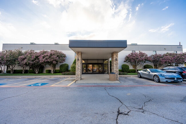
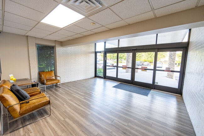
Property Record
560 W Main St, Lewisville, TX 75057

Property Detail
560 W Main St
Dallas-Fort Worth-Arlington, TX
NORTH TEXAS MEDICAL CENTER ADDN LOT 1 ACRES .9641
R16915
Denton
Commercialnec
Texas
B and X Area of moderate flood hazard, usually the area between the limits of the 100-year and 500-year floods.
1
2024
0.96 AC
2025
Lewisville
021618
Dallas/Ft Worth
25,520 SF
NEARBY LISTINGS FOR SALE OR LEASE
DEMOGRAPHICS near 560 W Main St
1 mile
3 mile
5 mile
2024 Total Population
13,718
106,400
215,290
2029 Population
15,459
118,511
238,823
Pop Growth 2024-2029
+ 12.69%
+ 11.38%
+ 10.93%
Average Age
37
38
39
2024 Total Households
4,440
39,365
80,113
HH Growth 2024-2029
+ 13.20%
+ 11.64%
+ 11.25%
Median Household Inc
$71,210
$87,625
$102,599
Avg Household Size
2.90
2.60
2.60
2024 Avg HH Vehicles
2.00
2.00
2.00
Median Home Value
$299,869
$357,671
$435,116
Median Year Built
1981
1991
1995
Nearby Places
Map Layers
Map Styles
 Street
 Aerial
Transit
 Traffic
 Biking
Places
Listings with unknown addresses are not visible on the map
- Restaurants
- Banks
- Shops
- Fitness
- Groceries
PUBLIC TRANSPORTATION
COMMUTER RAIL
Drive
Walk
Distance
4 min
1.6 mi
Drive
Walk
Distance
5 min
3.0 mi
AIRPORT
Dallas-Fort Worth International
Drive
Walk
Distance
Dallas-Fort Worth International
18 min
12.5 mi
Dallas Love Field
Drive
Walk
Distance
Dallas Love Field
30 min
21.5 mi
SALE & LEASE HISTORY
LISTING DATE
SALE/LEASE

Sep 24, 2016
For Lease
Sep 20, 2024
For Lease
Oct 26, 2023
For Lease
Nearby Properties
Address
Land Use
TOTAL SIZE
Lot Size
Zoning
Address
Land Use
TOTAL SIZE
Lot Size
Zoning
334,685 SF
38.12 AC
Address
Land Use
TOTAL SIZE
Lot Size
Zoning
599,705 SF
10.38 AC
Address
Land Use
TOTAL SIZE
Lot Size
Zoning
394,048 SF
16.36 AC
Address
Land Use
TOTAL SIZE
Lot Size
Zoning
323,048 SF
14.78 AC
Address
Land Use
TOTAL SIZE
Lot Size
Zoning
382,330 SF
21.43 AC
3B
Address
Land Use
TOTAL SIZE
Lot Size
Zoning
412,389 SF
16.69 AC
3B
Address
Land Use
TOTAL SIZE
Lot Size
Zoning
189,200 SF
5.08 AC
Address
Land Use
TOTAL SIZE
Lot Size
Zoning
269,300 SF
60.39 AC
Address
Land Use
TOTAL SIZE
Lot Size
Zoning
340,081 SF
18.06 AC
6
Address
Land Use
TOTAL SIZE
Lot Size
Zoning
411,223 SF
24.07 AC
3B
Address
Land Use
TOTAL SIZE
Lot Size
Zoning
380,316 SF
26.10 AC
Address
Land Use
TOTAL SIZE
Lot Size
Zoning
295,098 SF
10.65 AC
Address
Land Use
TOTAL SIZE
Lot Size
Zoning
266,959 SF
3.83 AC
Address
Land Use
TOTAL SIZE
Lot Size
Zoning
297,636 SF
9.43 AC
Address
Land Use
TOTAL SIZE
Lot Size
Zoning
310,788 SF
15.05 AC
Address
Land Use
TOTAL SIZE
Lot Size
Zoning
295,668 SF
13.03 AC
Address
Land Use
TOTAL SIZE
Lot Size
Zoning
659,218 SF
34.29 AC
Address
Land Use
TOTAL SIZE
Lot Size
Zoning
312,926 SF
10.07 AC
Address
Land Use
TOTAL SIZE
Lot Size
Zoning
345,310 SF
11.71 AC
Address
Land Use
TOTAL SIZE
Lot Size
Zoning
599,800 SF
31.44 AC
Address
Land Use
TOTAL SIZE
Lot Size
Zoning
288,735 SF
15.50 AC
3B
Address
Land Use
TOTAL SIZE
Lot Size
Zoning
344,932 SF
18.28 AC
3G
Address
Land Use
TOTAL SIZE
Lot Size
Zoning
212,454 SF
13 AC
6B
Address
Land Use
TOTAL SIZE
Lot Size
Zoning
572,808 SF
25.26 AC
Address
Land Use
TOTAL SIZE
Lot Size
Zoning
244,310 SF
6.24 AC
Address
Land Use
TOTAL SIZE
Lot Size
Zoning
440,000 SF
3.67 AC
Address
Land Use
TOTAL SIZE
Lot Size
Zoning
99,272 SF
16.60 AC
Address
Land Use
TOTAL SIZE
Lot Size
Zoning
182,602 SF
24.76 AC
Address
Land Use
TOTAL SIZE
Lot Size
Zoning
241,095 SF
13.02 AC
Address
Land Use
TOTAL SIZE
Lot Size
Zoning
199,121 SF
9.90 AC
3B
The World's #1 Commercial Real Estate Marketplace
Connect with us
© 2026 CoStar Group
The information above has been obtained from sources believed reliable. While we do not doubt its accuracy we have not verified it and make no guarantee, warranty or representation about it. It is your responsibility to independently confirm its accuracy and completeness. Any projections, opinions, assumptions, or estimates used are for example only and do not represent the current or future performance of the property. The value of this transaction to you depends on tax and other factors which should be evaluated by your tax, financial, and legal advisors. You and your advisors should conduct a careful, independent investigation of the property to determine to your satisfaction the suitability of the property for your needs.