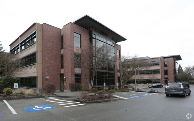
Property Record
5600 148Th Ave Ne, Redmond, WA 98052


NEARBY LISTINGS FOR SALE OR LEASE
Property Detail
5600 148Th Ave Ne
Seattle-Tacoma-Bellevue, WA
East Side Gardens Add
218250-0010
King
Notresolvable
Washington
X
15.81 AC
53033C0367G
520 Corridor
631,038 SF
Seattle/Puget Sound
DEMOGRAPHICS near 5600 148Th Ave Ne
1 Mile
3 Mile
5 Mile
2024 Total Population
14,790
126,004
272,943
2029 Population
14,865
127,847
276,797
Pop Growth 2024-2029
+ 0.51%
+ 1.46%
+ 1.41%
Average Age
36
37
38
2024 Total Households
5,797
52,229
112,803
HH Growth 2024-2029
+ 0.40%
+ 1.55%
+ 1.52%
Median Household Inc
$159,342
$146,127
$149,594
Avg Household Size
2.50
2.30
2.30
2024 Avg HH Vehicles
2.00
2.00
2.00
Median Home Value
$1,021,079
$1,010,436
$1,030,867
Median Year Built
1979
1987
1988
Nearby Places
Map Layers
Map Styles
 Street
 Aerial
- Restaurants
- Banks
- Shops
- Fitness
- Groceries
PUBLIC TRANSPORTATION
AIRPORT
Seattle Paine Field International
DRIVE
WALK
Distance
Seattle Paine Field International
34 min
21.8 mi
Seattle-Tacoma International
DRIVE
WALK
Distance
Seattle-Tacoma International
34 min
22.7 mi
Nearby Properties
Address
Land Use
TOTAL SIZE
Lot Size
Zoning
Address
Land Use
TOTAL SIZE
Lot Size
Zoning
482,658 SF
5.78 AC
BR-CR
Address
Land Use
TOTAL SIZE
Lot Size
Zoning
146,798 SF
19.63 AC
OBAT
Address
Land Use
TOTAL SIZE
Lot Size
Zoning
353,024 SF
3.19 AC
OV
Address
Land Use
TOTAL SIZE
Lot Size
Zoning
424,532 SF
30.49 AC
OUMF
Address
Land Use
TOTAL SIZE
Lot Size
Zoning
10,500 SF
2.33 AC
BR-RC-2
Address
Land Use
TOTAL SIZE
Lot Size
Zoning
274,912 SF
3.25 AC
BR-RC-3
Address
Land Use
TOTAL SIZE
Lot Size
Zoning
355,212 SF
19.10 AC
R-30
Address
Land Use
TOTAL SIZE
Lot Size
Zoning
457,543 SF
1.83 AC
OV
Address
Land Use
TOTAL SIZE
Lot Size
Zoning
342,000 SF
24.18 AC
OUMF
Address
Land Use
TOTAL SIZE
Lot Size
Zoning
364,208 SF
16.94 AC
NMF
Address
Land Use
TOTAL SIZE
Lot Size
Zoning
324,656 SF
15.40 AC
R-30
Address
Land Use
TOTAL SIZE
Lot Size
Zoning
231,088 SF
2.10 AC
TWNC
Address
Land Use
TOTAL SIZE
Lot Size
Zoning
270,158 SF
3.03 AC
TSQ
Address
Land Use
TOTAL SIZE
Lot Size
Zoning
135,130 SF
18.59 AC
BR-OR-2
Address
Land Use
TOTAL SIZE
Lot Size
Zoning
279,488 SF
20.82 AC
NMF
Address
Land Use
TOTAL SIZE
Lot Size
Zoning
209,322 SF
1.45 AC
OV
Address
Land Use
TOTAL SIZE
Lot Size
Zoning
282,532 SF
16.57 AC
NMF
Address
Land Use
TOTAL SIZE
Lot Size
Zoning
230,400 SF
1.26 AC
OV
Address
Land Use
TOTAL SIZE
Lot Size
Zoning
209,400 SF
1.80 AC
TSQ
Address
Land Use
TOTAL SIZE
Lot Size
Zoning
65,000 SF
13.57 AC
EH
Address
Land Use
TOTAL SIZE
Lot Size
Zoning
298,849 SF
3.99 AC
OBAT
Address
Land Use
TOTAL SIZE
Lot Size
Zoning
300,628 SF
4.43 AC
OBAT
Address
Land Use
TOTAL SIZE
Lot Size
Zoning
240 SF
471.44 AC
R1
Address
Land Use
TOTAL SIZE
Lot Size
Zoning
82,451 SF
15.02 AC
BP
Address
Land Use
TOTAL SIZE
Lot Size
Zoning
10,192 SF
16.47 AC
BR-OR-2
Address
Land Use
TOTAL SIZE
Lot Size
Zoning
393,897 SF
10.05 AC
OBAT
Address
Land Use
TOTAL SIZE
Lot Size
Zoning
229,460 SF
1.53 AC
OV
Address
Land Use
TOTAL SIZE
Lot Size
Zoning
125,996 SF
7.57 AC
TWNC
Address
Land Use
TOTAL SIZE
Lot Size
Zoning
230,061 SF
1.60 AC
OV
Address
Land Use
TOTAL SIZE
Lot Size
Zoning
136,191 SF
7.23 AC
TWNC
The World's #1 Commercial Real Estate Marketplace
Connect with us
© 2026 CoStar Group
The information above has been obtained from sources believed reliable. While we do not doubt its accuracy we have not verified it and make no guarantee, warranty or representation about it. It is your responsibility to independently confirm its accuracy and completeness. Any projections, opinions, assumptions, or estimates used are for example only and do not represent the current or future performance of the property. The value of this transaction to you depends on tax and other factors which should be evaluated by your tax, financial, and legal advisors. You and your advisors should conduct a careful, independent investigation of the property to determine to your satisfaction the suitability of the property for your needs.