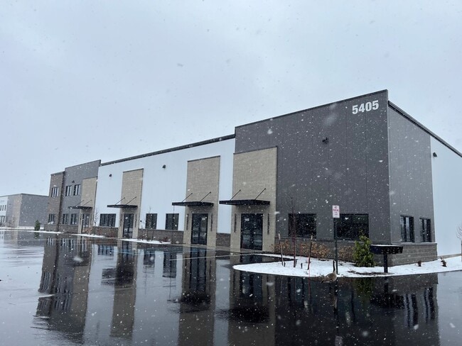
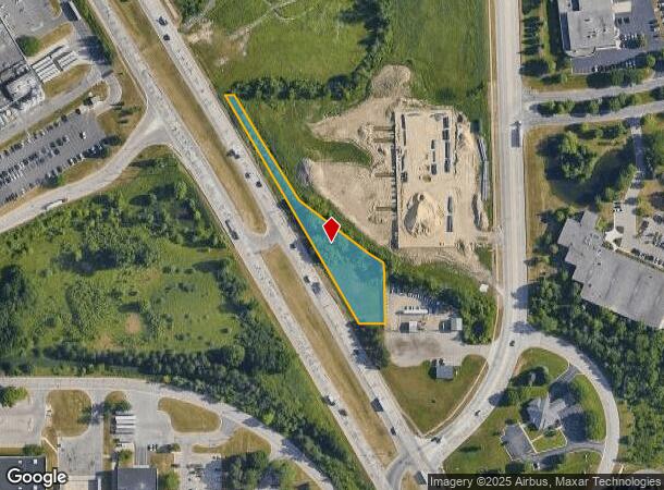
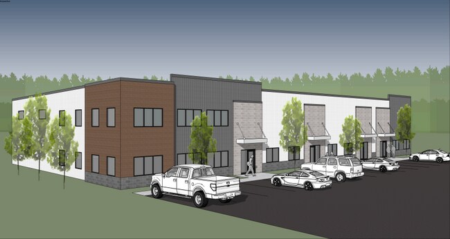
Property Record
5600 Broadmoor Ave Se, Grand Rapids, MI 49512
Current Lease Availabilities
NEARBY LISTINGS FOR SALE OR LEASE
Property Detail
5600 Broadmoor Ave Se
Grand Rapids-Wyoming, MI
411836200055 PART OF NE 1/4 COM AT NE COR OF SEC TH 90D 00M 00S W ALONG N SEC LINE 50.03 FT TH S 1D 51M 30S E ALONG W LINE OF
41-18-36-200-055
Kent
Industrialacreage
Michigan
2024
0.93 AC
2025
SE Grand Rapids/Cascade
012604
West Michigan
DEMOGRAPHICS near 5600 Broadmoor Ave Se
1 Mile
3 Mile
5 Mile
2024 Total Population
301
20,157
100,715
2029 Population
322
20,596
101,634
Pop Growth 2024-2029
+ 6.98%
+ 2.18%
+ 0.91%
Average Age
38
37
39
2024 Total Households
99
7,662
38,537
HH Growth 2024-2029
+ 7.07%
+ 2.34%
+ 0.92%
Median Household Inc
$131,944
$76,601
$73,624
Avg Household Size
2.90
2.50
2.50
2024 Avg HH Vehicles
2.00
2.00
2.00
Median Home Value
$422,727
$255,851
$267,470
Median Year Built
2004
1995
1986
Nearby Places
Map Layers
Map Styles
 Street
 Aerial
- Restaurants
- Banks
- Shops
- Fitness
- Groceries
PUBLIC TRANSPORTATION
AIRPORT
Gerald R Ford International
DRIVE
WALK
Distance
Gerald R Ford International
7 min
2.5 mi
Freight Ports
Port Milwaukee
DRIVE
WALK
Distance
Port Milwaukee
309 min
266.7 mi
Nearby Properties
Address
Land Use
TOTAL SIZE
Lot Size
Zoning
Address
Land Use
TOTAL SIZE
Lot Size
Zoning
719,632 SF
127.88 AC
PUD-PL UNI
Address
Land Use
TOTAL SIZE
Lot Size
Zoning
90.99 AC
Address
Land Use
TOTAL SIZE
Lot Size
Zoning
476,572 SF
51.60 AC
R4
Address
Land Use
TOTAL SIZE
Lot Size
Zoning
855,000 SF
PUD LSP-LG
Address
Land Use
TOTAL SIZE
Lot Size
Zoning
24.96 AC
Address
Land Use
TOTAL SIZE
Lot Size
Zoning
Address
Land Use
TOTAL SIZE
Lot Size
Zoning
438,644 SF
117.24 AC
PUD
Address
Land Use
TOTAL SIZE
Lot Size
Zoning
874,605 SF
87.68 AC
I-PUD
Address
Land Use
TOTAL SIZE
Lot Size
Zoning
47.13 AC
PUD
Address
Land Use
TOTAL SIZE
Lot Size
Zoning
155.84 AC
Address
Land Use
TOTAL SIZE
Lot Size
Zoning
223,592 SF
26.33 AC
PUD LSP-LG
Address
Land Use
TOTAL SIZE
Lot Size
Zoning
208.39 AC
I-PUD
Address
Land Use
TOTAL SIZE
Lot Size
Zoning
292,825 SF
15.01 AC
R-PUD-1
Address
Land Use
TOTAL SIZE
Lot Size
Zoning
685,902 SF
38.89 AC
I1
Address
Land Use
TOTAL SIZE
Lot Size
Zoning
266,630 SF
41.30 AC
I1-LIGHT I
Address
Land Use
TOTAL SIZE
Lot Size
Zoning
68.10 AC
Address
Land Use
TOTAL SIZE
Lot Size
Zoning
267,336 SF
13.99 AC
R-PUD-1
Address
Land Use
TOTAL SIZE
Lot Size
Zoning
210,096 SF
75.30 AC
PUD
Address
Land Use
TOTAL SIZE
Lot Size
Zoning
63.52 AC
Address
Land Use
TOTAL SIZE
Lot Size
Zoning
455,880 SF
24.91 AC
I1
Address
Land Use
TOTAL SIZE
Lot Size
Zoning
285,875 SF
37.86 AC
TI
Address
Land Use
TOTAL SIZE
Lot Size
Zoning
400,646 SF
23.78 AC
I1
Address
Land Use
TOTAL SIZE
Lot Size
Zoning
148.14 AC
Address
Land Use
TOTAL SIZE
Lot Size
Zoning
146.43 AC
Address
Land Use
TOTAL SIZE
Lot Size
Zoning
330,346 SF
49.71 AC
I1
Address
Land Use
TOTAL SIZE
Lot Size
Zoning
304,200 SF
R1
Address
Land Use
TOTAL SIZE
Lot Size
Zoning
196,764 SF
R1
Address
Land Use
TOTAL SIZE
Lot Size
Zoning
165,589 SF
Address
Land Use
TOTAL SIZE
Lot Size
Zoning
619,165 SF
37 AC
I1
Address
Land Use
TOTAL SIZE
Lot Size
Zoning
119.44 AC
I-PUD
The World's #1 Commercial Real Estate Marketplace
Connect with us
© 2025 CoStar Group
The information above has been obtained from sources believed reliable. While we do not doubt its accuracy we have not verified it and make no guarantee, warranty or representation about it. It is your responsibility to independently confirm its accuracy and completeness. Any projections, opinions, assumptions, or estimates used are for example only and do not represent the current or future performance of the property. The value of this transaction to you depends on tax and other factors which should be evaluated by your tax, financial, and legal advisors. You and your advisors should conduct a careful, independent investigation of the property to determine to your satisfaction the suitability of the property for your needs.