Property Record
5600 E Ih 20, Arlington, TX 76017
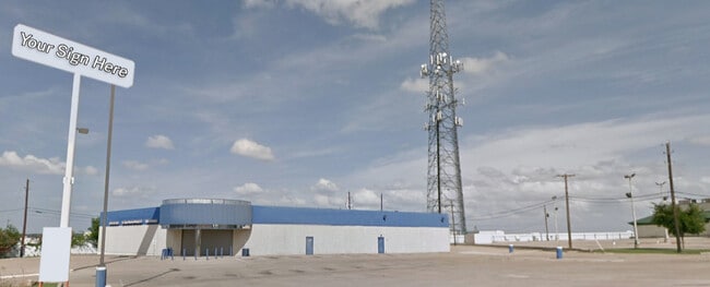

Property Detail
5600 E Ih 20
Dallas-Fort Worth-Arlington, TX
BROYLES ADDITION BLOCK 1 LOT 1 & PT CLOSED STREET
06496652
TARRANT
Commercialnec
Texas
B and X Area of moderate flood hazard, usually the area between the limits of the 100-year and 500-year floods.
1
2024
0.89 AC
2025
SE Outlying Tarrant
111530
Dallas/Ft Worth
10,583 SF
NEARBY LISTINGS FOR SALE OR LEASE
DEMOGRAPHICS near 5600 E Ih 20
1 mile
3 mile
5 mile
2025 Total Population
7,457
73,024
198,928
2030 Population
7,901
76,813
209,592
Pop Growth 2025-2030
+ 5.95%
+ 5.19%
+ 5.36%
Average Age
38
37
38
2025 Total Households
2,782
24,942
66,333
HH Growth 2025-2030
+ 6.18%
+ 5.35%
+ 5.48%
Median Household Inc
$50,491
$69,441
$69,110
Avg Household Size
2.60
2.90
2.90
2025 Avg HH Vehicles
2.00
2.00
2.00
Median Home Value
$140,666
$260,935
$266,517
Median Year Built
1992
1983
1981
Nearby Places
Map Layers
Map Styles
 Street
 Aerial
Transit
 Traffic
 Biking
Places
Listings with unknown addresses are not visible on the map
- Restaurants
- Banks
- Shops
- Fitness
- Groceries
PUBLIC TRANSPORTATION
COMMUTER RAIL
Texas And Pacific (T&P) (Trinity Railway Express - Dallas Area Rapid Transit (DART))
Drive
Walk
Distance
Texas And Pacific (T&P) (Trinity Railway Express - Dallas Area Rapid Transit (DART))
12 min
9.0 mi
Drive
Walk
Distance
13 min
9.0 mi
AIRPORT
Dallas-Fort Worth International
Drive
Walk
Distance
Dallas-Fort Worth International
36 min
26.7 mi
Dallas Love Field
Drive
Walk
Distance
Dallas Love Field
46 min
35.3 mi
Nearby Properties
Address
Land Use
TOTAL SIZE
Lot Size
Zoning
Address
Land Use
TOTAL SIZE
Lot Size
Zoning
605,489 SF
35.12 AC
Address
Land Use
TOTAL SIZE
Lot Size
Zoning
181,611 SF
24.44 AC
Address
Land Use
TOTAL SIZE
Lot Size
Zoning
487,507 SF
145.80 AC
Address
Land Use
TOTAL SIZE
Lot Size
Zoning
186,894 SF
10.85 AC
Address
Land Use
TOTAL SIZE
Lot Size
Zoning
222,500 SF
13.86 AC
Address
Land Use
TOTAL SIZE
Lot Size
Zoning
169,837 SF
9.44 AC
Address
Land Use
TOTAL SIZE
Lot Size
Zoning
180,556 SF
11.78 AC
Address
Land Use
TOTAL SIZE
Lot Size
Zoning
147,822 SF
9.45 AC
Address
Land Use
TOTAL SIZE
Lot Size
Zoning
301,302 SF
0.46 AC
Address
Land Use
TOTAL SIZE
Lot Size
Zoning
193,290 SF
10.56 AC
Address
Land Use
TOTAL SIZE
Lot Size
Zoning
239,360 SF
17.55 AC
Address
Land Use
TOTAL SIZE
Lot Size
Zoning
159,030 SF
10.32 AC
Address
Land Use
TOTAL SIZE
Lot Size
Zoning
142,110 SF
7.40 AC
Address
Land Use
TOTAL SIZE
Lot Size
Zoning
115,345 SF
107.70 AC
Address
Land Use
TOTAL SIZE
Lot Size
Zoning
119,741 SF
45 AC
Address
Land Use
TOTAL SIZE
Lot Size
Zoning
171,684 SF
8.12 AC
Address
Land Use
TOTAL SIZE
Lot Size
Zoning
4,886 SF
45.16 AC
Address
Land Use
TOTAL SIZE
Lot Size
Zoning
255,568 SF
14.79 AC
Address
Land Use
TOTAL SIZE
Lot Size
Zoning
498,850 SF
27.65 AC
Address
Land Use
TOTAL SIZE
Lot Size
Zoning
4,888 SF
31.18 AC
Address
Land Use
TOTAL SIZE
Lot Size
Zoning
2,058 SF
37.92 AC
Address
Land Use
TOTAL SIZE
Lot Size
Zoning
246,423 SF
18.84 AC
Address
Land Use
TOTAL SIZE
Lot Size
Zoning
189,323 SF
44.29 AC
Address
Land Use
TOTAL SIZE
Lot Size
Zoning
107,033 SF
12.52 AC
Address
Land Use
TOTAL SIZE
Lot Size
Zoning
238,977 SF
58.29 AC
Address
Land Use
TOTAL SIZE
Lot Size
Zoning
3,078 SF
28.32 AC
Address
Land Use
TOTAL SIZE
Lot Size
Zoning
259,627 SF
18.87 AC
Address
Land Use
TOTAL SIZE
Lot Size
Zoning
101,030 SF
10.11 AC
Address
Land Use
TOTAL SIZE
Lot Size
Zoning
262,200 SF
18.66 AC
Address
Land Use
TOTAL SIZE
Lot Size
Zoning
64,903 SF
2.64 AC
The World's #1 Commercial Real Estate Marketplace
Connect with us
© 2026 CoStar Group
The information above has been obtained from sources believed reliable. While we do not doubt its accuracy we have not verified it and make no guarantee, warranty or representation about it. It is your responsibility to independently confirm its accuracy and completeness. Any projections, opinions, assumptions, or estimates used are for example only and do not represent the current or future performance of the property. The value of this transaction to you depends on tax and other factors which should be evaluated by your tax, financial, and legal advisors. You and your advisors should conduct a careful, independent investigation of the property to determine to your satisfaction the suitability of the property for your needs.