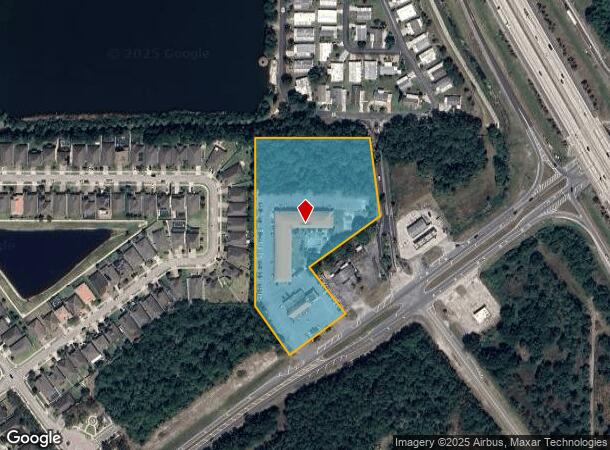
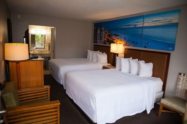
Property Record
5600 State Road 524, Cocoa, FL 32926
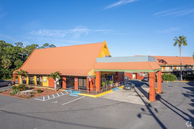
This Property Is For Sale
NEARBY LISTINGS FOR SALE OR LEASE
-
-
View all Cocoa listings for sale on LoopNet.com
Property Detail
5600 State Road 524
24-35-27-00-00007.0-0000.00
PART OF NE 1/4 OF NE 1/4 AS DES IN ORB 1357 PG 834
Hotel
Brevard
A
Florida
12009C0425G
5 AC
2024
Titusville/Cocoa Beach
2025
Orlando
071205
Palm Bay-Melbourne-Titusville, FL
49,460 SF
DEMOGRAPHICS near 5600 State Road 524
1 Mile
3 Mile
5 Mile
2024 Total Population
3,208
16,771
47,087
2029 Population
3,547
18,440
51,689
Pop Growth 2024-2029
+ 10.57%
+ 9.95%
+ 9.77%
Average Age
46
45
43
2024 Total Households
1,306
6,890
19,173
HH Growth 2024-2029
+ 10.41%
+ 9.72%
+ 9.55%
Median Household Inc
$94,317
$52,951
$49,065
Avg Household Size
2.40
2.40
2.40
2024 Avg HH Vehicles
2.00
2.00
2.00
Median Home Value
$237,242
$231,232
$228,223
Median Year Built
1999
1985
1981
Nearby Places
Map Layers
Map Styles
 Street
 Aerial
- Restaurants
- Banks
- Shops
- Fitness
- Groceries
PUBLIC TRANSPORTATION
AIRPORT
Melbourne Orlando International
DRIVE
WALK
Distance
Melbourne Orlando International
36 min
26.1 mi
Freight Ports
Port Canaveral
DRIVE
WALK
Distance
Port Canaveral
20 min
12.9 mi
Nearby Properties
Address
Land Use
TOTAL SIZE
Lot Size
Zoning
Address
Land Use
TOTAL SIZE
Lot Size
Zoning
658,069 SF
268.45 AC
RU17
Address
Land Use
TOTAL SIZE
Lot Size
Zoning
497,135 SF
34.13 AC
CW
Address
Land Use
TOTAL SIZE
Lot Size
Zoning
307,934 SF
13.66 AC
RU215
Address
Land Use
TOTAL SIZE
Lot Size
Zoning
264,679 SF
59.90 AC
RU17
Address
Land Use
TOTAL SIZE
Lot Size
Zoning
102,141 SF
47.88 AC
BU1
Address
Land Use
TOTAL SIZE
Lot Size
Zoning
212.10 AC
PUD
Address
Land Use
TOTAL SIZE
Lot Size
Zoning
101,945 SF
11.15 AC
CG
Address
Land Use
TOTAL SIZE
Lot Size
Zoning
141,592 SF
20.22 AC
CG
Address
Land Use
TOTAL SIZE
Lot Size
Zoning
96,878 SF
17.47 AC
CN
Address
Land Use
TOTAL SIZE
Lot Size
Zoning
49,208 SF
18.28 AC
Address
Land Use
TOTAL SIZE
Lot Size
Zoning
86,391 SF
12.02 AC
GU
Address
Land Use
TOTAL SIZE
Lot Size
Zoning
77,885 SF
11.54 AC
BU2
Address
Land Use
TOTAL SIZE
Lot Size
Zoning
65,316 SF
956.57 AC
GML(H)
Address
Land Use
TOTAL SIZE
Lot Size
Zoning
38,033 SF
10.72 AC
Address
Land Use
TOTAL SIZE
Lot Size
Zoning
66,210 SF
12.22 AC
M2
Address
Land Use
TOTAL SIZE
Lot Size
Zoning
62,439 SF
14.19 AC
TU-2
Address
Land Use
TOTAL SIZE
Lot Size
Zoning
76,142 SF
8.26 AC
BU-2
Address
Land Use
TOTAL SIZE
Lot Size
Zoning
78,343 SF
8.50 AC
CG
Address
Land Use
TOTAL SIZE
Lot Size
Zoning
33,221 SF
6.31 AC
Address
Land Use
TOTAL SIZE
Lot Size
Zoning
13,616 SF
12.92 AC
Address
Land Use
TOTAL SIZE
Lot Size
Zoning
69,352 SF
3.81 AC
BU-2
Address
Land Use
TOTAL SIZE
Lot Size
Zoning
23,864 SF
3.89 AC
BU-2
Address
Land Use
TOTAL SIZE
Lot Size
Zoning
66,216 SF
16.04 AC
AU
Address
Land Use
TOTAL SIZE
Lot Size
Zoning
63,760 SF
5.46 AC
BU2
Address
Land Use
TOTAL SIZE
Lot Size
Zoning
37,125 SF
6.40 AC
M2
Address
Land Use
TOTAL SIZE
Lot Size
Zoning
2,520 SF
69.41 AC
IU
Address
Land Use
TOTAL SIZE
Lot Size
Zoning
19.77 AC
Address
Land Use
TOTAL SIZE
Lot Size
Zoning
10,864 SF
12 AC
RVP
Address
Land Use
TOTAL SIZE
Lot Size
Zoning
23,617 SF
48.92 AC
GML
The World's #1 Commercial Real Estate Marketplace
Connect with us
© 2025 CoStar Group
The information above has been obtained from sources believed reliable. While we do not doubt its accuracy we have not verified it and make no guarantee, warranty or representation about it. It is your responsibility to independently confirm its accuracy and completeness. Any projections, opinions, assumptions, or estimates used are for example only and do not represent the current or future performance of the property. The value of this transaction to you depends on tax and other factors which should be evaluated by your tax, financial, and legal advisors. You and your advisors should conduct a careful, independent investigation of the property to determine to your satisfaction the suitability of the property for your needs.