Property Record
5601 High St, Augusta, MO 63332

Property Detail
5601 High St
St. Louis, MO-IL
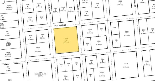
KNORNSCHILDS SUB BLK 21 LOTS 1 - 6
1-0033-4002-21-0001.0000000
Saint Charles
Commercialnec
Missouri
B and X Area of moderate flood hazard, usually the area between the limits of the 100-year and 500-year floods.
1
2024
0.82 AC
2025
Outer St Charles Cnty
312204
St. Louis
19,936 SF
NEARBY LISTINGS FOR SALE OR LEASE
-
-
View all Augusta listings for sale on LoopNet.com
DEMOGRAPHICS near 5601 High St
1 mile
3 mile
5 mile
2025 Total Population
496
956
3,912
2030 Population
527
1,008
4,056
Pop Growth 2025-2030
+ 6.25%
+ 5.44%
+ 3.68%
Average Age
49
48
46
2025 Total Households
201
384
1,515
HH Growth 2025-2030
+ 5.97%
+ 5.47%
+ 3.89%
Median Household Inc
$111,742
$112,909
$99,663
Avg Household Size
2.40
2.40
2.60
2025 Avg HH Vehicles
2.00
2.00
2.00
Median Home Value
$522,222
$507,576
$474,561
Median Year Built
1967
1987
1992
Nearby Places
Map Layers
Map Styles
 Street
 Aerial
Layers
 Traffic
 Biking
Places
Listings with unknown addresses are not visible on the map
- Restaurants
- Banks
- Shops
- Fitness
- Groceries
PUBLIC TRANSPORTATION
COMMUTER RAIL
Washington Amtrak Station (Lincoln Service Missouri River Runner - Amtrak, Missouri River Runner - Amtrak)
Drive
Walk
Distance
Washington Amtrak Station (Lincoln Service Missouri River Runner - Amtrak, Missouri River Runner - Amtrak)
21 min
8.7 mi
Freight Ports
Tulsa Port of Inola
Drive
Walk
Distance
Tulsa Port of Inola
403 min
354.9 mi
Nearby Properties
Address
Land Use
TOTAL SIZE
Lot Size
Zoning
Address
Land Use
TOTAL SIZE
Lot Size
Zoning
7,305 SF
472.60 AC
ANU
Address
Land Use
TOTAL SIZE
Lot Size
Zoning
7,380 SF
122.30 AC
Address
Land Use
TOTAL SIZE
Lot Size
Zoning
3,200 SF
67.30 AC
Address
Land Use
TOTAL SIZE
Lot Size
Zoning
408 SF
11.87 AC
Address
Land Use
TOTAL SIZE
Lot Size
Zoning
20,296 SF
19.95 AC
Address
Land Use
TOTAL SIZE
Lot Size
Zoning
60 AC
AA1
Address
Land Use
TOTAL SIZE
Lot Size
Zoning
2,968 SF
53.36 AC
Address
Land Use
TOTAL SIZE
Lot Size
Zoning
17,868 SF
10.07 AC
Address
Land Use
TOTAL SIZE
Lot Size
Zoning
13,420 SF
43.56 AC
Address
Land Use
TOTAL SIZE
Lot Size
Zoning
5,256 SF
45.39 AC
Address
Land Use
TOTAL SIZE
Lot Size
Zoning
2,869 SF
7.44 AC
AA1
Address
Land Use
TOTAL SIZE
Lot Size
Zoning
6,103 SF
1.01 AC
AA1
Address
Land Use
TOTAL SIZE
Lot Size
Zoning
2,940 SF
79.14 AC
Address
Land Use
TOTAL SIZE
Lot Size
Zoning
7.17 AC
AA1
Address
Land Use
TOTAL SIZE
Lot Size
Zoning
8,310 SF
31.29 AC
Address
Land Use
TOTAL SIZE
Lot Size
Zoning
63.50 AC
AA1
Address
Land Use
TOTAL SIZE
Lot Size
Zoning
6 AC
AA1
Address
Land Use
TOTAL SIZE
Lot Size
Zoning
7,948 SF
6.56 AC
Address
Land Use
TOTAL SIZE
Lot Size
Zoning
2.70 AC
AA1
Address
Land Use
TOTAL SIZE
Lot Size
Zoning
7,805 SF
10 AC
Address
Land Use
TOTAL SIZE
Lot Size
Zoning
4,888 SF
127.68 AC
Address
Land Use
TOTAL SIZE
Lot Size
Zoning
6,854 SF
10.49 AC
Address
Land Use
TOTAL SIZE
Lot Size
Zoning
1,432 SF
0.14 AC
AA1
Address
Land Use
TOTAL SIZE
Lot Size
Zoning
8,265 SF
44.90 AC
Address
Land Use
TOTAL SIZE
Lot Size
Zoning
4.33 AC
Address
Land Use
TOTAL SIZE
Lot Size
Zoning
5,720 SF
134.45 AC
Address
Land Use
TOTAL SIZE
Lot Size
Zoning
3,810 SF
0.22 AC
AF0
Address
Land Use
TOTAL SIZE
Lot Size
Zoning
4,178 SF
0.50 AC
AA1
Address
Land Use
TOTAL SIZE
Lot Size
Zoning
4,925 SF
0.41 AC
The World's #1 Commercial Real Estate Marketplace
Connect with us
© 2026 CoStar Group
The information above has been obtained from sources believed reliable. While we do not doubt its accuracy we have not verified it and make no guarantee, warranty or representation about it. It is your responsibility to independently confirm its accuracy and completeness. Any projections, opinions, assumptions, or estimates used are for example only and do not represent the current or future performance of the property. The value of this transaction to you depends on tax and other factors which should be evaluated by your tax, financial, and legal advisors. You and your advisors should conduct a careful, independent investigation of the property to determine to your satisfaction the suitability of the property for your needs.