Property Record
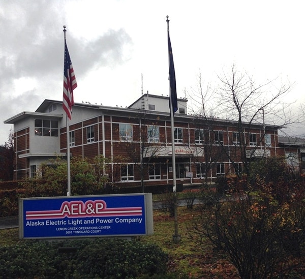
5601 Tonsgard Ct, Juneau, AK 99801

Property Detail
5601 Tonsgard Ct
5B120-106-0030
USS 204 POLE YARD LT 1
Utilities
Juneau
I
Alaska
B and X Area of moderate flood hazard, usually the area between the limits of the 100-year and 500-year floods.
1
2025
109.61 AC
2025
Alaska Regional
000400
Other Market Areas
39,064 SF
Juneau, AK
NEARBY LISTINGS FOR SALE OR LEASE
-
-
View all Juneau listings for sale on LoopNet.com
DEMOGRAPHICS near 5601 Tonsgard Ct
1 mile
3 mile
5 mile
2025 Total Population
4,130
5,885
24,254
2030 Population
4,088
5,810
24,071
Pop Growth 2025-2030
(1.02%)
(1.27%)
(0.75%)
Average Age
38
39
39
2025 Total Households
1,412
2,110
9,509
HH Growth 2025-2030
(1.06%)
(1.37%)
(0.78%)
Median Household Inc
$58,143
$71,527
$95,343
Avg Household Size
2.60
2.50
2.50
2025 Avg HH Vehicles
2.00
2.00
2.00
Median Home Value
$278,440
$417,187
$439,184
Median Year Built
1980
1982
1979
Nearby Places
Map Layers
Map Styles
 Street
 Aerial
Layers
 Traffic
 Biking
Places
Listings with unknown addresses are not visible on the map
- Restaurants
- Banks
- Shops
- Fitness
- Groceries
PUBLIC TRANSPORTATION
AIRPORT
Juneau International
Drive
Walk
Distance
Juneau International
20 min
5.3 mi
Freight Ports
Port of Anchorage
Drive
Walk
Distance
Port of Anchorage
1,519 min
848.2 mi
Nearby Properties
Address
Land Use
TOTAL SIZE
Lot Size
Zoning
Address
Land Use
TOTAL SIZE
Lot Size
Zoning
170,786 SF
54.65 AC
LC
Address
Land Use
TOTAL SIZE
Lot Size
Zoning
125,620 SF
32.11 AC
I
Address
Land Use
TOTAL SIZE
Lot Size
Zoning
122,278 SF
10.76 AC
GC
Address
Land Use
TOTAL SIZE
Lot Size
Zoning
76,696 SF
10 AC
I
Address
Land Use
TOTAL SIZE
Lot Size
Zoning
8.29 AC
D15
Address
Land Use
TOTAL SIZE
Lot Size
Zoning
52,799 SF
3 AC
GC
Address
Land Use
TOTAL SIZE
Lot Size
Zoning
55,080 SF
1.56 AC
GC
Address
Land Use
TOTAL SIZE
Lot Size
Zoning
8.02 AC
GC
Address
Land Use
TOTAL SIZE
Lot Size
Zoning
25,276 SF
16.32 AC
I
Address
Land Use
TOTAL SIZE
Lot Size
Zoning
49,011 SF
19.52 AC
WI
Address
Land Use
TOTAL SIZE
Lot Size
Zoning
33,340 SF
3.39 AC
I
Address
Land Use
TOTAL SIZE
Lot Size
Zoning
44,517 SF
1 AC
GC
Address
Land Use
TOTAL SIZE
Lot Size
Zoning
12.92 AC
I
Address
Land Use
TOTAL SIZE
Lot Size
Zoning
28,576 SF
10.04 AC
I
Address
Land Use
TOTAL SIZE
Lot Size
Zoning
37,480 SF
10.17 AC
GC
Address
Land Use
TOTAL SIZE
Lot Size
Zoning
36,019 SF
1.65 AC
I
Address
Land Use
TOTAL SIZE
Lot Size
Zoning
89.68 AC
I
Address
Land Use
TOTAL SIZE
Lot Size
Zoning
8,812 SF
5.41 AC
GC
Address
Land Use
TOTAL SIZE
Lot Size
Zoning
17,964 SF
9.06 AC
WI
Address
Land Use
TOTAL SIZE
Lot Size
Zoning
34,600 SF
6.25 AC
GC
Address
Land Use
TOTAL SIZE
Lot Size
Zoning
10,000 SF
1.23 AC
GC
Address
Land Use
TOTAL SIZE
Lot Size
Zoning
399 SF
6.03 AC
I
Address
Land Use
TOTAL SIZE
Lot Size
Zoning
14,700 SF
5.60 AC
I
Address
Land Use
TOTAL SIZE
Lot Size
Zoning
26,545 SF
2 AC
I
Address
Land Use
TOTAL SIZE
Lot Size
Zoning
16,985 SF
0.96 AC
GC
Address
Land Use
TOTAL SIZE
Lot Size
Zoning
5,440 SF
WI
Address
Land Use
TOTAL SIZE
Lot Size
Zoning
4.29 AC
GC
Address
Land Use
TOTAL SIZE
Lot Size
Zoning
28.56 AC
GC
Address
Land Use
TOTAL SIZE
Lot Size
Zoning
22,560 SF
1.23 AC
GC
The World's #1 Commercial Real Estate Marketplace
Connect with us
© 2026 CoStar Group
The information above has been obtained from sources believed reliable. While we do not doubt its accuracy we have not verified it and make no guarantee, warranty or representation about it. It is your responsibility to independently confirm its accuracy and completeness. Any projections, opinions, assumptions, or estimates used are for example only and do not represent the current or future performance of the property. The value of this transaction to you depends on tax and other factors which should be evaluated by your tax, financial, and legal advisors. You and your advisors should conduct a careful, independent investigation of the property to determine to your satisfaction the suitability of the property for your needs.