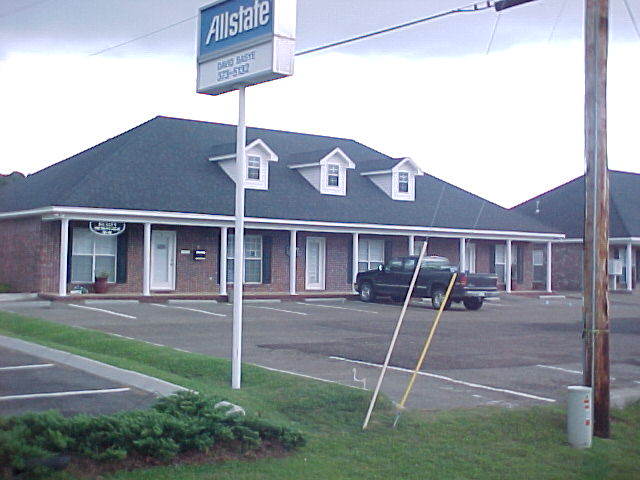
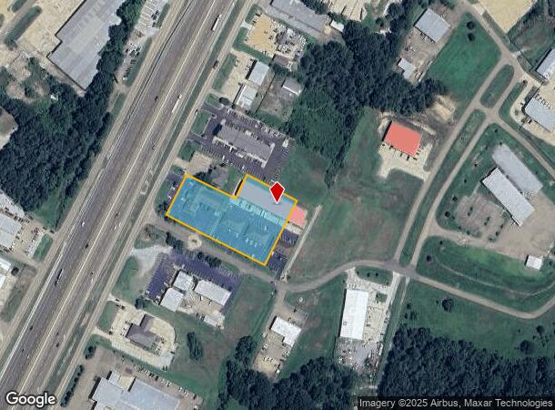
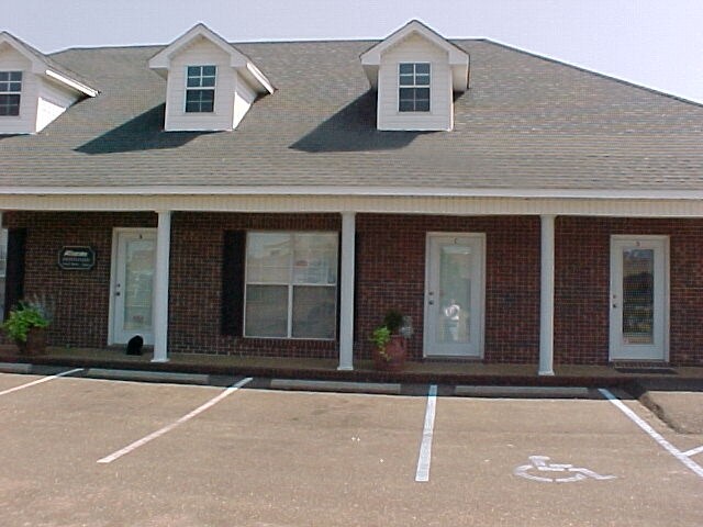
Property Record
120 Southpointe Dr, Byram, MS 39272
NEARBY LISTINGS FOR SALE OR LEASE
Property Detail
120 Southpointe Dr
4851-0200-066
BEG 170 FT NE INT W/L NE 1/4 SEC 13 & E/L I 55 NELY 200 FT SELY 200 FT NELY 100 FT SELY 200.02 FT SWLY 275 FT SELY 100 FT SWLY 25 FT NWLY 500.2 FT TO POB IN SW 1/4 NE 1/4 SEC 13 T4 R1W TOWN OF BYRAM
Commercialnec
Hinds
AE
Mississippi
28049C0435H
2.98 AC
2024
Outlying Hinds County
2025
Jackson
011103
Jackson, MS
27,491 SF
DEMOGRAPHICS near 120 Southpointe Dr
1 Mile
3 Mile
5 Mile
2024 Total Population
3,245
13,763
31,189
2029 Population
2,960
12,802
29,461
Pop Growth 2024-2029
(8.78%)
(6.98%)
(5.54%)
Average Age
36
38
38
2024 Total Households
1,384
5,411
12,061
HH Growth 2024-2029
(9.25%)
(7.23%)
(5.72%)
Median Household Inc
$55,090
$66,900
$55,835
Avg Household Size
2.30
2.50
2.50
2024 Avg HH Vehicles
2.00
2.00
2.00
Median Home Value
$153,324
$155,704
$141,435
Median Year Built
1996
1995
1987
Nearby Places
Map Layers
Map Styles
 Street
 Aerial
- Restaurants
- Banks
- Shops
- Fitness
- Groceries
PUBLIC TRANSPORTATION
AIRPORT
Jackson-Medgar Wiley Evers International
DRIVE
WALK
Distance
Jackson-Medgar Wiley Evers International
24 min
19.0 mi
SALE & LEASE HISTORY
LISTING DATE
SALE/LEASE

May 14, 2020
For Lease
Nearby Properties
Address
Land Use
TOTAL SIZE
Lot Size
Zoning
Address
Land Use
TOTAL SIZE
Lot Size
Zoning
110,876 SF
8.80 AC
Address
Land Use
TOTAL SIZE
Lot Size
Zoning
489,330 SF
27.90 AC
Address
Land Use
TOTAL SIZE
Lot Size
Zoning
232,136 SF
16.06 AC
Address
Land Use
TOTAL SIZE
Lot Size
Zoning
190,029 SF
24.47 AC
Address
Land Use
TOTAL SIZE
Lot Size
Zoning
31,980 SF
9.10 AC
Address
Land Use
TOTAL SIZE
Lot Size
Zoning
Address
Land Use
TOTAL SIZE
Lot Size
Zoning
229,741 SF
17.28 AC
Address
Land Use
TOTAL SIZE
Lot Size
Zoning
34,900 SF
6.60 AC
Address
Land Use
TOTAL SIZE
Lot Size
Zoning
224,684 SF
18 AC
Address
Land Use
TOTAL SIZE
Lot Size
Zoning
8.90 AC
Address
Land Use
TOTAL SIZE
Lot Size
Zoning
351,384 SF
16.69 AC
Address
Land Use
TOTAL SIZE
Lot Size
Zoning
136,190 SF
10.06 AC
Address
Land Use
TOTAL SIZE
Lot Size
Zoning
45.60 AC
Address
Land Use
TOTAL SIZE
Lot Size
Zoning
18,200 SF
1.66 AC
Address
Land Use
TOTAL SIZE
Lot Size
Zoning
134,417 SF
10 AC
Address
Land Use
TOTAL SIZE
Lot Size
Zoning
25,880 SF
5.47 AC
Address
Land Use
TOTAL SIZE
Lot Size
Zoning
Address
Land Use
TOTAL SIZE
Lot Size
Zoning
230,745 SF
18.40 AC
Address
Land Use
TOTAL SIZE
Lot Size
Zoning
Address
Land Use
TOTAL SIZE
Lot Size
Zoning
173,863 SF
30.67 AC
Address
Land Use
TOTAL SIZE
Lot Size
Zoning
Address
Land Use
TOTAL SIZE
Lot Size
Zoning
81,983 SF
7.20 AC
Address
Land Use
TOTAL SIZE
Lot Size
Zoning
222,160 SF
37.66 AC
Address
Land Use
TOTAL SIZE
Lot Size
Zoning
94,621 SF
23.37 AC
Address
Land Use
TOTAL SIZE
Lot Size
Zoning
29.50 AC
Address
Land Use
TOTAL SIZE
Lot Size
Zoning
Address
Land Use
TOTAL SIZE
Lot Size
Zoning
68,315 SF
6.36 AC
Address
Land Use
TOTAL SIZE
Lot Size
Zoning
12,500 SF
3.40 AC
Address
Land Use
TOTAL SIZE
Lot Size
Zoning
11,260 SF
1.86 AC
Address
Land Use
TOTAL SIZE
Lot Size
Zoning
37,542 SF
3.50 AC
The World's #1 Commercial Real Estate Marketplace
Connect with us
© 2025 CoStar Group
The information above has been obtained from sources believed reliable. While we do not doubt its accuracy we have not verified it and make no guarantee, warranty or representation about it. It is your responsibility to independently confirm its accuracy and completeness. Any projections, opinions, assumptions, or estimates used are for example only and do not represent the current or future performance of the property. The value of this transaction to you depends on tax and other factors which should be evaluated by your tax, financial, and legal advisors. You and your advisors should conduct a careful, independent investigation of the property to determine to your satisfaction the suitability of the property for your needs.