Property Record
5605 A1a S, Saint Augustine, FL 32080


NEARBY LISTINGS FOR SALE OR LEASE
-
-
View all Saint Augustine listings for sale on LoopNet.com
Property Detail
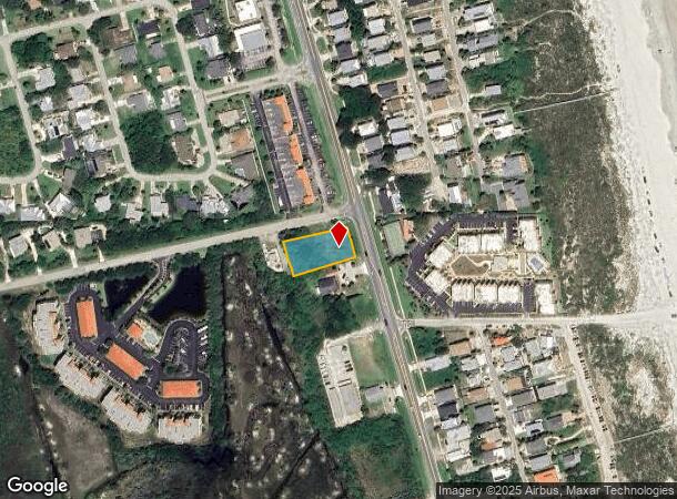
5605 A1a S
Jacksonville, FL
Butlers Beach Unit 1
179170-0000
6/22 BUTLERS BEACH UNIT NO 1 LOTS 10 THRU 15 BLK L & SLY 25FT OF VACATED RIVERSIDE BLVD LYING N IN OR2653/520 (RES #2006-35) OR4110/1352 & 5807/458(Q/C) & 6045/352
Residentialacreage
St. Johns
AE
Florida
12109C0392J
10-15
2023
0.47 AC
2025
St Johns County
021404
Jacksonville (Florida)
DEMOGRAPHICS near 5605 A1a S
1 Mile
3 Mile
5 Mile
2024 Total Population
3,629
15,929
44,876
2029 Population
4,955
21,655
60,278
Pop Growth 2024-2029
+ 36.54%
+ 35.95%
+ 34.32%
Average Age
55
56
52
2024 Total Households
1,741
7,999
20,954
HH Growth 2024-2029
+ 36.36%
+ 35.92%
+ 34.32%
Median Household Inc
$89,208
$81,517
$72,236
Avg Household Size
2.10
2.00
2.10
2024 Avg HH Vehicles
2.00
2.00
2.00
Median Home Value
$453,542
$426,160
$383,410
Median Year Built
1988
1989
1989
Nearby Places
Map Layers
Map Styles
 Street
 Aerial
- Restaurants
- Banks
- Shops
- Fitness
- Groceries
SALE & LEASE HISTORY
LISTING DATE
SALE/LEASE

Jun 01, 2017
For Sale
Jul 01, 2019
For Sale
Aug 29, 2023
For Sale
Nearby Properties
Address
Land Use
TOTAL SIZE
Lot Size
Zoning
Address
Land Use
TOTAL SIZE
Lot Size
Zoning
7,133 SF
18.57 AC
RS3
Address
Land Use
TOTAL SIZE
Lot Size
Zoning
8,556 SF
20.32 AC
CHT
Address
Land Use
TOTAL SIZE
Lot Size
Zoning
12,597 SF
26.99 AC
PUD
Address
Land Use
TOTAL SIZE
Lot Size
Zoning
104,688 SF
10.80 AC
Address
Land Use
TOTAL SIZE
Lot Size
Zoning
62,867 SF
48.30 AC
OR
Address
Land Use
TOTAL SIZE
Lot Size
Zoning
52,011 SF
11.51 AC
CG-B
Address
Land Use
TOTAL SIZE
Lot Size
Zoning
8,997 SF
7.13 AC
PUD
Address
Land Use
TOTAL SIZE
Lot Size
Zoning
26,624 SF
2.24 AC
PUD
Address
Land Use
TOTAL SIZE
Lot Size
Zoning
1,179.40 AC
OR
Address
Land Use
TOTAL SIZE
Lot Size
Zoning
38.17 AC
OR
Address
Land Use
TOTAL SIZE
Lot Size
Zoning
10,178 SF
1.44 AC
CHT/R3
Address
Land Use
TOTAL SIZE
Lot Size
Zoning
6,464 SF
0.80 AC
RS2
Address
Land Use
TOTAL SIZE
Lot Size
Zoning
1.85 AC
RG2
Address
Land Use
TOTAL SIZE
Lot Size
Zoning
Address
Land Use
TOTAL SIZE
Lot Size
Zoning
6,750 SF
0.84 AC
RS2
Address
Land Use
TOTAL SIZE
Lot Size
Zoning
24,779 SF
29.89 AC
OR
Address
Land Use
TOTAL SIZE
Lot Size
Zoning
12,705 SF
0.32 AC
CG
Address
Land Use
TOTAL SIZE
Lot Size
Zoning
2,339 SF
8.80 AC
CHT
Address
Land Use
TOTAL SIZE
Lot Size
Zoning
15.34 AC
PUD
Address
Land Use
TOTAL SIZE
Lot Size
Zoning
1,788 SF
2.17 AC
OR
Address
Land Use
TOTAL SIZE
Lot Size
Zoning
1,152 SF
293.60 AC
OR
Address
Land Use
TOTAL SIZE
Lot Size
Zoning
4,988 SF
0.79 AC
RS2
Address
Land Use
TOTAL SIZE
Lot Size
Zoning
10,712 SF
1.09 AC
BU-1A
Address
Land Use
TOTAL SIZE
Lot Size
Zoning
14,376 SF
1.67 AC
CG-B
Address
Land Use
TOTAL SIZE
Lot Size
Zoning
2,280 SF
9.28 AC
PUD
Address
Land Use
TOTAL SIZE
Lot Size
Zoning
10,540 SF
1.72 AC
PSD
Address
Land Use
TOTAL SIZE
Lot Size
Zoning
10,010 SF
1.10 AC
BU-1A
Address
Land Use
TOTAL SIZE
Lot Size
Zoning
4,104 SF
0.79 AC
RS2
Address
Land Use
TOTAL SIZE
Lot Size
Zoning
4,908 SF
0.60 AC
RS3
Address
Land Use
TOTAL SIZE
Lot Size
Zoning
241.36 AC
OR
The World's #1 Commercial Real Estate Marketplace
Connect with us
© 2026 CoStar Group
The information above has been obtained from sources believed reliable. While we do not doubt its accuracy we have not verified it and make no guarantee, warranty or representation about it. It is your responsibility to independently confirm its accuracy and completeness. Any projections, opinions, assumptions, or estimates used are for example only and do not represent the current or future performance of the property. The value of this transaction to you depends on tax and other factors which should be evaluated by your tax, financial, and legal advisors. You and your advisors should conduct a careful, independent investigation of the property to determine to your satisfaction the suitability of the property for your needs.