Property Record
5605 N Chester Ext, Bakersfield, CA 93308

NEARBY LISTINGS FOR SALE OR LEASE
-
-
View all Bakersfield listings for sale on LoopNet.com
Property Detail
5605 N Chester Ext
Bakersfield, CA
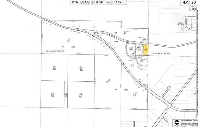
Parcel Map No 12132
481-120-20-00-0
PARCEL MAP 12132 , LOT 1
Lightindustrial
Kern
X
California
06029C1825F
1
2024
2.82 AC
2025
North Bakersfield
005103
Bakersfield
2,190 SF
DEMOGRAPHICS near 5605 N Chester Ext
1 Mile
3 Mile
5 Mile
2024 Total Population
2,751
26,282
80,409
2029 Population
2,738
26,362
80,651
Pop Growth 2024-2029
(0.47%)
+ 0.30%
+ 0.30%
Average Age
40
35
36
2024 Total Households
1,064
9,420
28,194
HH Growth 2024-2029
(0.56%)
+ 0.23%
+ 0.27%
Median Household Inc
$50,943
$45,412
$47,262
Avg Household Size
2.60
2.70
2.80
2024 Avg HH Vehicles
2.00
2.00
2.00
Median Home Value
$227,404
$228,695
$287,640
Median Year Built
1975
1971
1975
Nearby Places
Map Layers
Map Styles
 Street
 Aerial
- Restaurants
- Banks
- Shops
- Fitness
- Groceries
PUBLIC TRANSPORTATION
COMMUTER RAIL
DRIVE
WALK
Distance
15 min
7.0 mi
AIRPORT
Meadows Field
DRIVE
WALK
Distance
Meadows Field
16 min
6.2 mi
Nearby Properties
Address
Land Use
TOTAL SIZE
Lot Size
Zoning
Address
Land Use
TOTAL SIZE
Lot Size
Zoning
2,645,250 SF
64.24 AC
M-2 PD H
Address
Land Use
TOTAL SIZE
Lot Size
Zoning
16.04 AC
NR
Address
Land Use
TOTAL SIZE
Lot Size
Zoning
30,326 SF
19 AC
M3
Address
Land Use
TOTAL SIZE
Lot Size
Zoning
Address
Land Use
TOTAL SIZE
Lot Size
Zoning
2,129 SF
11.42 AC
M-2
Address
Land Use
TOTAL SIZE
Lot Size
Zoning
151,797 SF
4.42 AC
R3
Address
Land Use
TOTAL SIZE
Lot Size
Zoning
8 AC
M-3
Address
Land Use
TOTAL SIZE
Lot Size
Zoning
54,960 SF
15.83 AC
M-2
Address
Land Use
TOTAL SIZE
Lot Size
Zoning
8.58 AC
M-3
Address
Land Use
TOTAL SIZE
Lot Size
Zoning
12,000 SF
11.90 AC
M-2 PD
Address
Land Use
TOTAL SIZE
Lot Size
Zoning
3,934 SF
8.58 AC
M-3
Address
Land Use
TOTAL SIZE
Lot Size
Zoning
226,463 SF
11.01 AC
R3
Address
Land Use
TOTAL SIZE
Lot Size
Zoning
7,196 SF
2.24 AC
Address
Land Use
TOTAL SIZE
Lot Size
Zoning
62,536 SF
2.11 AC
M2
Address
Land Use
TOTAL SIZE
Lot Size
Zoning
22,572 SF
44.92 AC
M-2 PD
Address
Land Use
TOTAL SIZE
Lot Size
Zoning
Address
Land Use
TOTAL SIZE
Lot Size
Zoning
163,159 SF
1.59 AC
C2
Address
Land Use
TOTAL SIZE
Lot Size
Zoning
43,088 SF
2.07 AC
M2
Address
Land Use
TOTAL SIZE
Lot Size
Zoning
49,911 SF
2.20 AC
M-2
Address
Land Use
TOTAL SIZE
Lot Size
Zoning
4.94 AC
Address
Land Use
TOTAL SIZE
Lot Size
Zoning
36,642 SF
1.72 AC
M-2
Address
Land Use
TOTAL SIZE
Lot Size
Zoning
49,953 SF
3.99 AC
M-2-AA
Address
Land Use
TOTAL SIZE
Lot Size
Zoning
24,600 SF
3.79 AC
M-2-AA
Address
Land Use
TOTAL SIZE
Lot Size
Zoning
1.47 AC
M2
Address
Land Use
TOTAL SIZE
Lot Size
Zoning
41,038 SF
6.56 AC
C-2 PD
Address
Land Use
TOTAL SIZE
Lot Size
Zoning
40,221 SF
6.03 AC
M2
Address
Land Use
TOTAL SIZE
Lot Size
Zoning
50,869 SF
2 AC
R-3
Address
Land Use
TOTAL SIZE
Lot Size
Zoning
138,000 SF
15.55 AC
C2
The World's #1 Commercial Real Estate Marketplace
Connect with us
© 2025 CoStar Group
The information above has been obtained from sources believed reliable. While we do not doubt its accuracy we have not verified it and make no guarantee, warranty or representation about it. It is your responsibility to independently confirm its accuracy and completeness. Any projections, opinions, assumptions, or estimates used are for example only and do not represent the current or future performance of the property. The value of this transaction to you depends on tax and other factors which should be evaluated by your tax, financial, and legal advisors. You and your advisors should conduct a careful, independent investigation of the property to determine to your satisfaction the suitability of the property for your needs.