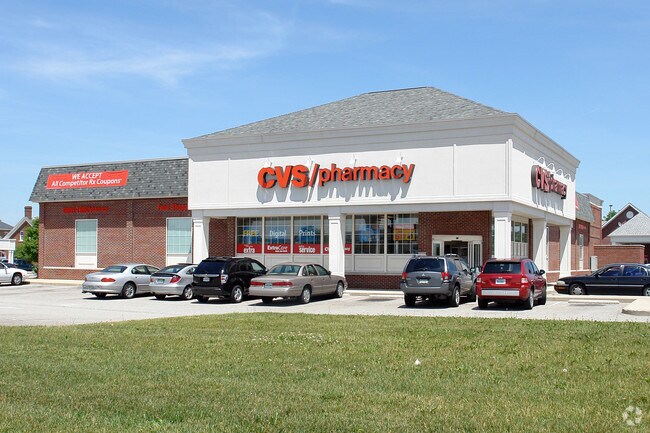
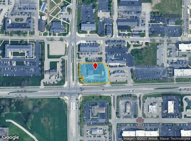
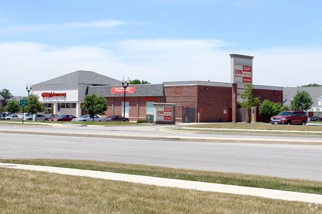
Property Record
5605 N Post Rd, Indianapolis, IN 46216
NEARBY LISTINGS FOR SALE OR LEASE
Property Detail
5605 N Post Rd
49-08-05-117-006.000-407
PT SW1/4 SW1/4 S5 T16 R5 BEG 64.68 N & 100.32 NEOF SW COR NW 63.51 E 34.78 N 30.08 SW 38.55N 122.73 E 18.81 NE 52.78 NE 146.57 SE82.64 S IRR 142.67 SW 239.19 TO BEG 1.194AC
Storebuilding
Marion
X
Indiana
18097C0160F
1.19 AC
2023
North Shadeland
2024
Indianapolis
390602
Indianapolis-Carmel-Anderson, IN
10,742 SF
DEMOGRAPHICS near 5605 N Post Rd
1 Mile
3 Mile
5 Mile
2024 Total Population
8,060
77,869
182,662
2029 Population
8,075
77,144
180,917
Pop Growth 2024-2029
+ 0.19%
(0.93%)
(0.96%)
Average Age
37
36
38
2024 Total Households
3,347
29,934
72,125
HH Growth 2024-2029
+ 0.57%
(0.92%)
(1.01%)
Median Household Inc
$45,405
$50,562
$58,069
Avg Household Size
2.30
2.50
2.50
2024 Avg HH Vehicles
2.00
2.00
2.00
Median Home Value
$79,321
$162,512
$185,925
Median Year Built
1993
1975
1976
Nearby Places
Map Layers
Map Styles
 Street
 Aerial
- Restaurants
- Banks
- Shops
- Fitness
- Groceries
PUBLIC TRANSPORTATION
AIRPORT
Indianapolis International
DRIVE
WALK
Distance
Indianapolis International
45 min
25.3 mi
Nearby Properties
Address
Land Use
TOTAL SIZE
Lot Size
Zoning
Address
Land Use
TOTAL SIZE
Lot Size
Zoning
11,154 SF
21.99 AC
Address
Land Use
TOTAL SIZE
Lot Size
Zoning
532,932 SF
61.88 AC
ZO03
Address
Land Use
TOTAL SIZE
Lot Size
Zoning
2,556 SF
35.56 AC
ZO01
Address
Land Use
TOTAL SIZE
Lot Size
Zoning
4,217 SF
7.37 AC
ZO01
Address
Land Use
TOTAL SIZE
Lot Size
Zoning
129,608 SF
54.85 AC
ZO01
Address
Land Use
TOTAL SIZE
Lot Size
Zoning
679,214 SF
16.70 AC
ZO01
Address
Land Use
TOTAL SIZE
Lot Size
Zoning
4,588 SF
24.33 AC
ZO01
Address
Land Use
TOTAL SIZE
Lot Size
Zoning
13,087 SF
57.88 AC
Address
Land Use
TOTAL SIZE
Lot Size
Zoning
136,336 SF
8.74 AC
ZO01
Address
Land Use
TOTAL SIZE
Lot Size
Zoning
6,770 SF
38.91 AC
Address
Land Use
TOTAL SIZE
Lot Size
Zoning
293,952 SF
12.88 AC
ZO01
Address
Land Use
TOTAL SIZE
Lot Size
Zoning
2,527 SF
23.16 AC
Address
Land Use
TOTAL SIZE
Lot Size
Zoning
65,095 SF
4.06 AC
ZO01
Address
Land Use
TOTAL SIZE
Lot Size
Zoning
1,066 SF
24.93 AC
Address
Land Use
TOTAL SIZE
Lot Size
Zoning
118,126 SF
6.31 AC
ZO01
Address
Land Use
TOTAL SIZE
Lot Size
Zoning
150,929 SF
28.61 AC
ZO01
Address
Land Use
TOTAL SIZE
Lot Size
Zoning
167,808 SF
14.95 AC
ZO01
Address
Land Use
TOTAL SIZE
Lot Size
Zoning
109,200 SF
4.63 AC
ZO01
Address
Land Use
TOTAL SIZE
Lot Size
Zoning
1,865 SF
22.15 AC
ZO01
Address
Land Use
TOTAL SIZE
Lot Size
Zoning
329,180 SF
20.88 AC
Address
Land Use
TOTAL SIZE
Lot Size
Zoning
203,720 SF
21.44 AC
Address
Land Use
TOTAL SIZE
Lot Size
Zoning
1,490 SF
14.21 AC
ZO01
Address
Land Use
TOTAL SIZE
Lot Size
Zoning
16,160 SF
25.93 AC
ZO01
Address
Land Use
TOTAL SIZE
Lot Size
Zoning
278,338 SF
14.80 AC
Address
Land Use
TOTAL SIZE
Lot Size
Zoning
4,878 SF
25.65 AC
Address
Land Use
TOTAL SIZE
Lot Size
Zoning
206,080 SF
12.97 AC
ZO01
Address
Land Use
TOTAL SIZE
Lot Size
Zoning
175,046 SF
15.77 AC
ZO01
Address
Land Use
TOTAL SIZE
Lot Size
Zoning
640 SF
26.44 AC
Address
Land Use
TOTAL SIZE
Lot Size
Zoning
1,594 SF
6.47 AC
ZO01
Address
Land Use
TOTAL SIZE
Lot Size
Zoning
3,004 SF
13.79 AC
The World's #1 Commercial Real Estate Marketplace
Connect with us
© 2025 CoStar Group
The information above has been obtained from sources believed reliable. While we do not doubt its accuracy we have not verified it and make no guarantee, warranty or representation about it. It is your responsibility to independently confirm its accuracy and completeness. Any projections, opinions, assumptions, or estimates used are for example only and do not represent the current or future performance of the property. The value of this transaction to you depends on tax and other factors which should be evaluated by your tax, financial, and legal advisors. You and your advisors should conduct a careful, independent investigation of the property to determine to your satisfaction the suitability of the property for your needs.