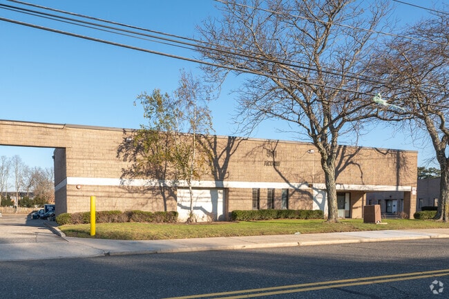
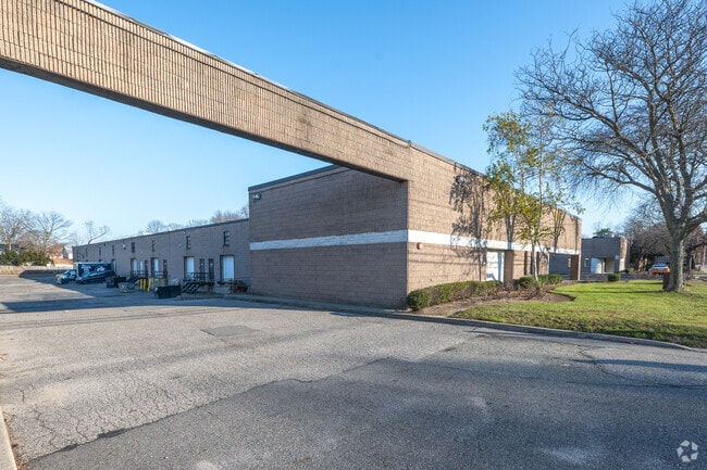
Property Record
561 Acorn St, Deer Park, NY 11729


Current Lease Availabilities
NEARBY LISTINGS FOR SALE OR LEASE
Property Detail
561 Acorn St
Nassau County-Suffolk County, NY
Map Deer Park Terrace Section 2
0100-060-00-01-00-033-009
N-VARIOUS E-HERMAN AV S-ACORN ST W-VAR & ELM ST
Industrialgeneral
Suffolk
X
New York
36103C0640H
33
2024
3.10 AC
2024
Deer Park
122705
Long Island (New York)
51,050 SF
DEMOGRAPHICS near 561 Acorn St
1 Mile
3 Mile
5 Mile
2024 Total Population
16,965
97,764
244,828
2029 Population
16,640
95,678
238,890
Pop Growth 2024-2029
(1.92%)
(2.13%)
(2.43%)
Average Age
40
40
40
2024 Total Households
5,162
29,796
76,248
HH Growth 2024-2029
(2.15%)
(2.36%)
(2.61%)
Median Household Inc
$120,331
$119,615
$121,700
Avg Household Size
3.20
3.10
3.10
2024 Avg HH Vehicles
2.00
2.00
2.00
Median Home Value
$468,955
$462,836
$481,545
Median Year Built
1962
1964
1963
Nearby Places
Map Layers
Map Styles
 Street
 Aerial
- Restaurants
- Banks
- Shops
- Fitness
- Groceries
PUBLIC TRANSPORTATION
COMMUTER RAIL
Wyandanch Station (Ronkonkoma Branch - Long Island Rail Road)
DRIVE
WALK
Distance
Wyandanch Station (Ronkonkoma Branch - Long Island Rail Road)
4 min
17 min
0.9 mi
Deer Park Station (Ronkonkoma Branch - Long Island Rail Road)
DRIVE
WALK
Distance
Deer Park Station (Ronkonkoma Branch - Long Island Rail Road)
8 min
3.2 mi
AIRPORT
Long Island MacArthur
DRIVE
WALK
Distance
Long Island MacArthur
27 min
17.3 mi
John F Kennedy International
DRIVE
WALK
Distance
John F Kennedy International
44 min
32.3 mi
LaGuardia
DRIVE
WALK
Distance
LaGuardia
52 min
35.0 mi
Freight Ports
NY - Red Hook Container Terminal
DRIVE
WALK
Distance
NY - Red Hook Container Terminal
63 min
43.1 mi
Nearby Properties
Address
Land Use
TOTAL SIZE
Lot Size
Zoning
Address
Land Use
TOTAL SIZE
Lot Size
Zoning
16.23 AC
A
Address
Land Use
TOTAL SIZE
Lot Size
Zoning
18.37 AC
IND1
Address
Land Use
TOTAL SIZE
Lot Size
Zoning
20.13 AC
Address
Land Use
TOTAL SIZE
Lot Size
Zoning
777,483 SF
80.70 AC
GA
Address
Land Use
TOTAL SIZE
Lot Size
Zoning
13.30 AC
A
Address
Land Use
TOTAL SIZE
Lot Size
Zoning
756 SF
0.36 AC
B1
Address
Land Use
TOTAL SIZE
Lot Size
Zoning
9.20 AC
IND1
Address
Land Use
TOTAL SIZE
Lot Size
Zoning
10.95 AC
IND1
Address
Land Use
TOTAL SIZE
Lot Size
Zoning
3.31 AC
R40
Address
Land Use
TOTAL SIZE
Lot Size
Zoning
9.79 AC
IND1
Address
Land Use
TOTAL SIZE
Lot Size
Zoning
42.07 AC
IND2
Address
Land Use
TOTAL SIZE
Lot Size
Zoning
11.20 AC
IND2
Address
Land Use
TOTAL SIZE
Lot Size
Zoning
2,388 SF
0.36 AC
B1
Address
Land Use
TOTAL SIZE
Lot Size
Zoning
400 AC
A
Address
Land Use
TOTAL SIZE
Lot Size
Zoning
3.61 AC
IND1
Address
Land Use
TOTAL SIZE
Lot Size
Zoning
3.62 AC
IND1
Address
Land Use
TOTAL SIZE
Lot Size
Zoning
1,680 SF
0.15 AC
B1
Address
Land Use
TOTAL SIZE
Lot Size
Zoning
3.86 AC
IND1
Address
Land Use
TOTAL SIZE
Lot Size
Zoning
8.45 AC
IND1
Address
Land Use
TOTAL SIZE
Lot Size
Zoning
5.95 AC
C
Address
Land Use
TOTAL SIZE
Lot Size
Zoning
0.55 AC
VILLA
Address
Land Use
TOTAL SIZE
Lot Size
Zoning
10.25 AC
Address
Land Use
TOTAL SIZE
Lot Size
Zoning
16.90 AC
EA
Address
Land Use
TOTAL SIZE
Lot Size
Zoning
2.35 AC
IND1
Address
Land Use
TOTAL SIZE
Lot Size
Zoning
11.10 AC
SC
Address
Land Use
TOTAL SIZE
Lot Size
Zoning
114.70 AC
A
Address
Land Use
TOTAL SIZE
Lot Size
Zoning
0.26 AC
R20
Address
Land Use
TOTAL SIZE
Lot Size
Zoning
52.20 AC
R40
Address
Land Use
TOTAL SIZE
Lot Size
Zoning
3.22 AC
IND1
Address
Land Use
TOTAL SIZE
Lot Size
Zoning
16.81 AC
The World's #1 Commercial Real Estate Marketplace
Connect with us
© 2026 CoStar Group
The information above has been obtained from sources believed reliable. While we do not doubt its accuracy we have not verified it and make no guarantee, warranty or representation about it. It is your responsibility to independently confirm its accuracy and completeness. Any projections, opinions, assumptions, or estimates used are for example only and do not represent the current or future performance of the property. The value of this transaction to you depends on tax and other factors which should be evaluated by your tax, financial, and legal advisors. You and your advisors should conduct a careful, independent investigation of the property to determine to your satisfaction the suitability of the property for your needs.