Property Record
519 Agnes Dr, Tontitown, AR 72762
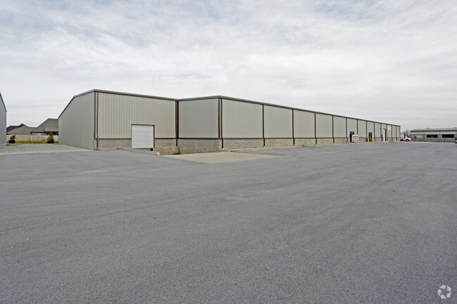

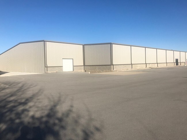
Property Detail
519 Agnes Dr
830-37611-002
PT FRL SW1/4 4.732 AC FURTHER DESCRIBED IN 2021-44192 AS: A PART OFTHE FRACTIONAL SW/4 OF SECTION 6, TOWNSHIP 17 NORTH, RANGE
Commercialnec
WASHINGTON
B and X Area of moderate flood hazard, usually the area between the limits of the 100-year and 500-year floods.
Arkansas
2025
4.73 AC
2025
Outlying Washington Cnty
010501
Fayetteville/Springdale/Rogers
45,960 SF
Fayetteville-Springdale-Rogers, AR
NEARBY LISTINGS FOR SALE OR LEASE
-
-
View all Tontitown listings for lease on LoopNet.com
DEMOGRAPHICS near 519 Agnes Dr
1 mile
3 mile
5 mile
2025 Total Population
3,272
18,119
60,684
2030 Population
3,543
19,666
65,027
Pop Growth 2025-2030
+ 8.28%
+ 8.54%
+ 7.16%
Average Age
37
39
38
2025 Total Households
1,226
6,776
21,756
HH Growth 2025-2030
+ 8.48%
+ 8.83%
+ 7.37%
Median Household Inc
$85,568
$87,035
$80,851
Avg Household Size
2.70
2.60
2.70
2025 Avg HH Vehicles
2.00
2.00
2.00
Median Home Value
$411,561
$411,689
$336,213
Median Year Built
2009
2005
1997
Nearby Places
Map Layers
Map Styles
 Street
 Aerial
Layers
 Traffic
 Biking
Places
Listings with unknown addresses are not visible on the map
- Restaurants
- Banks
- Shops
- Fitness
- Groceries
PUBLIC TRANSPORTATION
AIRPORT
Northwest Arkansas Ntl
Drive
Walk
Distance
Northwest Arkansas Ntl
28 min
11.2 mi
Freight Ports
Tulsa Port of Inola
Drive
Walk
Distance
Tulsa Port of Inola
95 min
81.9 mi
SALE & LEASE HISTORY
LISTING DATE
SALE/LEASE

Feb 10, 2017
For Lease
Nearby Properties
Address
Land Use
TOTAL SIZE
Lot Size
Zoning
Address
Land Use
TOTAL SIZE
Lot Size
Zoning
132,060 SF
8 AC
Address
Land Use
TOTAL SIZE
Lot Size
Zoning
54,448 SF
19.43 AC
Address
Land Use
TOTAL SIZE
Lot Size
Zoning
75,774 SF
16.49 AC
Address
Land Use
TOTAL SIZE
Lot Size
Zoning
181,734 SF
21.02 AC
Address
Land Use
TOTAL SIZE
Lot Size
Zoning
15,347 SF
6.27 AC
Address
Land Use
TOTAL SIZE
Lot Size
Zoning
437,349 SF
40.29 AC
Address
Land Use
TOTAL SIZE
Lot Size
Zoning
106,141 SF
2.82 AC
Address
Land Use
TOTAL SIZE
Lot Size
Zoning
81,000 SF
7.01 AC
Address
Land Use
TOTAL SIZE
Lot Size
Zoning
78,374 SF
8.79 AC
Address
Land Use
TOTAL SIZE
Lot Size
Zoning
112,817 SF
9.57 AC
Address
Land Use
TOTAL SIZE
Lot Size
Zoning
196,657 SF
18.82 AC
Address
Land Use
TOTAL SIZE
Lot Size
Zoning
176,204 SF
7.57 AC
Address
Land Use
TOTAL SIZE
Lot Size
Zoning
193,140 SF
21.31 AC
Address
Land Use
TOTAL SIZE
Lot Size
Zoning
89,280 SF
12.22 AC
Address
Land Use
TOTAL SIZE
Lot Size
Zoning
32,124 SF
6.58 AC
Address
Land Use
TOTAL SIZE
Lot Size
Zoning
140,755 SF
14.15 AC
Address
Land Use
TOTAL SIZE
Lot Size
Zoning
229,158 SF
21.23 AC
C2
Address
Land Use
TOTAL SIZE
Lot Size
Zoning
167,040 SF
19.98 AC
Address
Land Use
TOTAL SIZE
Lot Size
Zoning
21,208 SF
1.89 AC
C2
Address
Land Use
TOTAL SIZE
Lot Size
Zoning
85,874 SF
2.76 AC
Address
Land Use
TOTAL SIZE
Lot Size
Zoning
16,760 SF
2.96 AC
Address
Land Use
TOTAL SIZE
Lot Size
Zoning
100,690 SF
3.79 AC
C2
Address
Land Use
TOTAL SIZE
Lot Size
Zoning
51,336 SF
4.19 AC
Address
Land Use
TOTAL SIZE
Lot Size
Zoning
72,866 SF
7.14 AC
Address
Land Use
TOTAL SIZE
Lot Size
Zoning
Address
Land Use
TOTAL SIZE
Lot Size
Zoning
39,336 SF
5.03 AC
Address
Land Use
TOTAL SIZE
Lot Size
Zoning
47,780 SF
5.15 AC
PUD
Address
Land Use
TOTAL SIZE
Lot Size
Zoning
30,076 SF
4.69 AC
Address
Land Use
TOTAL SIZE
Lot Size
Zoning
108,702 SF
5.36 AC
Address
Land Use
TOTAL SIZE
Lot Size
Zoning
165,271 SF
9.94 AC
The World's #1 Commercial Real Estate Marketplace
Connect with us
© 2026 CoStar Group
The information above has been obtained from sources believed reliable. While we do not doubt its accuracy we have not verified it and make no guarantee, warranty or representation about it. It is your responsibility to independently confirm its accuracy and completeness. Any projections, opinions, assumptions, or estimates used are for example only and do not represent the current or future performance of the property. The value of this transaction to you depends on tax and other factors which should be evaluated by your tax, financial, and legal advisors. You and your advisors should conduct a careful, independent investigation of the property to determine to your satisfaction the suitability of the property for your needs.