Property Record
561 Durham Rd, Newtown, PA 18940
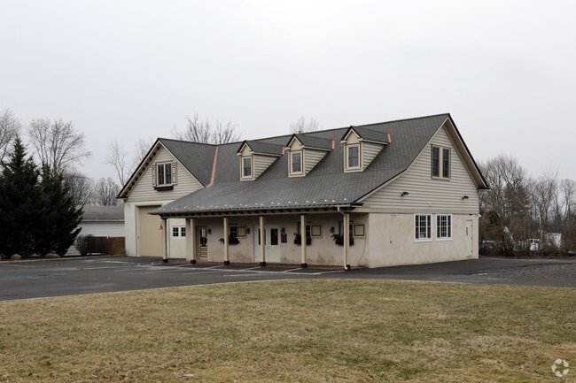


Property Detail
561 Durham Rd
Philadelphia-Camden-Wilmington, PA-NJ-DE-MD
LOT W S DOYLESTOWN RD 196 FT N PENNS PARK RD 160X322
53-012-037
Bucks
Commercialnec
Pennsylvania
VR4
w
2024
1.18 AC
2025
Lower Bucks County
105100
Philadelphia
1,980 SF
NEARBY LISTINGS FOR SALE OR LEASE
-
-
View all Newtown listings for lease on LoopNet.com
DEMOGRAPHICS near 561 Durham Rd
1 mile
3 mile
5 mile
2025 Total Population
1,391
15,422
64,645
2030 Population
1,360
15,340
64,747
Pop Growth 2025-2030
(2.23%)
(0.53%)
+ 0.16%
Average Age
43
44
45
2025 Total Households
472
5,530
23,864
HH Growth 2025-2030
(2.54%)
(0.60%)
+ 0.05%
Median Household Inc
$169,642
$171,669
$151,158
Avg Household Size
3.00
2.80
2.70
2025 Avg HH Vehicles
2.00
2.00
2.00
Median Home Value
$789,958
$718,406
$678,973
Median Year Built
1976
1986
1984
Nearby Places
Map Layers
Map Styles
 Street
 Aerial
Layers
 Traffic
 Biking
Places
Listings with unknown addresses are not visible on the map
- Restaurants
- Banks
- Shops
- Fitness
- Groceries
PUBLIC TRANSPORTATION
COMMUTER RAIL
Warminster (R2 - Southeastern Pennsylvania Transportation Authority Regional Rail (SEPTA Regional Rail))
Drive
Walk
Distance
Warminster (R2 - Southeastern Pennsylvania Transportation Authority Regional Rail (SEPTA Regional Rail))
18 min
9.3 mi
Langhorne (R3 - Southeastern Pennsylvania Transportation Authority Regional Rail (SEPTA Regional Rail))
Drive
Walk
Distance
Langhorne (R3 - Southeastern Pennsylvania Transportation Authority Regional Rail (SEPTA Regional Rail))
16 min
9.4 mi
AIRPORT
Trenton Mercer
Drive
Walk
Distance
Trenton Mercer
23 min
11.1 mi
Philadelphia International
Drive
Walk
Distance
Philadelphia International
64 min
37.6 mi
Lehigh Valley International
Drive
Walk
Distance
Lehigh Valley International
72 min
42.8 mi
SALE & LEASE HISTORY
LISTING DATE
SALE/LEASE

Sep 25, 2016
For Lease
Nov 21, 2024
For Lease
Nearby Properties
Address
Land Use
TOTAL SIZE
Lot Size
Zoning
Address
Land Use
TOTAL SIZE
Lot Size
Zoning
800 SF
147.62 AC
QA
Address
Land Use
TOTAL SIZE
Lot Size
Zoning
53,644 SF
8.91 AC
R1
Address
Land Use
TOTAL SIZE
Lot Size
Zoning
19,410 SF
7.53 AC
IP
Address
Land Use
TOTAL SIZE
Lot Size
Zoning
42,588 SF
42.73 AC
AG
Address
Land Use
TOTAL SIZE
Lot Size
Zoning
22,023 SF
5.70 AC
VC2
Address
Land Use
TOTAL SIZE
Lot Size
Zoning
Address
Land Use
TOTAL SIZE
Lot Size
Zoning
18,480 SF
34.34 AC
CM
Address
Land Use
TOTAL SIZE
Lot Size
Zoning
43.44 AC
CM
Address
Land Use
TOTAL SIZE
Lot Size
Zoning
4,300 SF
38.79 AC
CM
Address
Land Use
TOTAL SIZE
Lot Size
Zoning
0.33 AC
CM
Address
Land Use
TOTAL SIZE
Lot Size
Zoning
55,750 SF
4.06 AC
R1
Address
Land Use
TOTAL SIZE
Lot Size
Zoning
6,849 SF
8.46 AC
CM
Address
Land Use
TOTAL SIZE
Lot Size
Zoning
9,944 SF
2.82 AC
VC2
Address
Land Use
TOTAL SIZE
Lot Size
Zoning
6.95 AC
CR1
Address
Land Use
TOTAL SIZE
Lot Size
Zoning
14,515 SF
1.12 AC
MS
Address
Land Use
TOTAL SIZE
Lot Size
Zoning
34,126 SF
47.69 AC
VR1
Address
Land Use
TOTAL SIZE
Lot Size
Zoning
44,574 SF
9.87 AC
CR1
Address
Land Use
TOTAL SIZE
Lot Size
Zoning
58.62 AC
R2
Address
Land Use
TOTAL SIZE
Lot Size
Zoning
9,488 SF
1.50 AC
VR4
Address
Land Use
TOTAL SIZE
Lot Size
Zoning
7,988 SF
1.55 AC
R2
Address
Land Use
TOTAL SIZE
Lot Size
Zoning
23,590 SF
8.24 AC
VC1
Address
Land Use
TOTAL SIZE
Lot Size
Zoning
2,012 SF
48.73 AC
QA
Address
Land Use
TOTAL SIZE
Lot Size
Zoning
2,508 SF
1.16 AC
PS
Address
Land Use
TOTAL SIZE
Lot Size
Zoning
3,682 SF
33.60 AC
CM
Address
Land Use
TOTAL SIZE
Lot Size
Zoning
28,728 SF
49.41 AC
AG
Address
Land Use
TOTAL SIZE
Lot Size
Zoning
27,287 SF
1.22 AC
VC2
Address
Land Use
TOTAL SIZE
Lot Size
Zoning
13,280 SF
6.22 AC
AR
Address
Land Use
TOTAL SIZE
Lot Size
Zoning
7,350 SF
4.60 AC
VC
Address
Land Use
TOTAL SIZE
Lot Size
Zoning
17,540 SF
1.50 AC
VR1
Address
Land Use
TOTAL SIZE
Lot Size
Zoning
78.96 AC
R2
The World's #1 Commercial Real Estate Marketplace
Connect with us
© 2026 CoStar Group
The information above has been obtained from sources believed reliable. While we do not doubt its accuracy we have not verified it and make no guarantee, warranty or representation about it. It is your responsibility to independently confirm its accuracy and completeness. Any projections, opinions, assumptions, or estimates used are for example only and do not represent the current or future performance of the property. The value of this transaction to you depends on tax and other factors which should be evaluated by your tax, financial, and legal advisors. You and your advisors should conduct a careful, independent investigation of the property to determine to your satisfaction the suitability of the property for your needs.