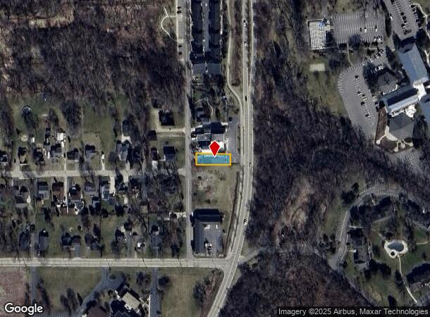
Property Record
561 Valley View Dr, Fontana, WI 53125


NEARBY LISTINGS FOR SALE OR LEASE
Property Detail
561 Valley View Dr
Whitewater-Elkhorn, WI
Assessors Plat No. 1(C.L. Douglass Sub.)
STFV00199A
LOT 5 BLK 3 ASSESSORS PLAT NO. 1 C.L. DOUGLASS ADD, EXC. N 20 FT, TOGETHER WITH EASEMENT OVER S 10' OF N 20' SD LOT 5, WHICH S 10' IS NOW & SHALL BE IN FUTURE A 10' PRIVATE ROAD FOR USE OF PROPERTY OWNERS ON EACH SIDE OF SD RD, VILLAGE OF FONTANA ON
Commercialnec
Walworth
X
Wisconsin
55127C0312D
5
2024
0.15 AC
2024
Walworth West
001608
Milwaukee/Madison
DEMOGRAPHICS near 561 Valley View Dr
1 Mile
3 Mile
5 Mile
2024 Total Population
3,570
11,078
20,373
2029 Population
3,736
11,662
21,597
Pop Growth 2024-2029
+ 4.65%
+ 5.27%
+ 6.01%
Average Age
37
43
45
2024 Total Households
1,241
4,381
8,390
HH Growth 2024-2029
+ 8.38%
+ 6.21%
+ 6.45%
Median Household Inc
$90,441
$73,553
$74,286
Avg Household Size
2.20
2.30
2.30
2024 Avg HH Vehicles
2.00
2.00
2.00
Median Home Value
$386,864
$335,679
$311,762
Median Year Built
1975
1977
1978
Nearby Places
Map Layers
Map Styles
 Street
 Aerial
- Restaurants
- Banks
- Shops
- Fitness
- Groceries
PUBLIC TRANSPORTATION
COMMUTER RAIL
Harvard Station (Union Pacific Northwest Line - Northeast Illinois Regional Commuter Railroad (Metra))
DRIVE
WALK
Distance
Harvard Station (Union Pacific Northwest Line - Northeast Illinois Regional Commuter Railroad (Metra))
16 min
9.9 mi
Freight Ports
Port Milwaukee
DRIVE
WALK
Distance
Port Milwaukee
67 min
54.2 mi
Nearby Properties
Address
Land Use
TOTAL SIZE
Lot Size
Zoning
Address
Land Use
TOTAL SIZE
Lot Size
Zoning
175.60 AC
M1
Address
Land Use
TOTAL SIZE
Lot Size
Zoning
35.02 AC
Address
Land Use
TOTAL SIZE
Lot Size
Zoning
278.83 AC
Address
Land Use
TOTAL SIZE
Lot Size
Zoning
16.19 AC
Address
Land Use
TOTAL SIZE
Lot Size
Zoning
1.60 AC
Address
Land Use
TOTAL SIZE
Lot Size
Zoning
2.22 AC
Address
Land Use
TOTAL SIZE
Lot Size
Zoning
Address
Land Use
TOTAL SIZE
Lot Size
Zoning
3.71 AC
Address
Land Use
TOTAL SIZE
Lot Size
Zoning
4.21 AC
Address
Land Use
TOTAL SIZE
Lot Size
Zoning
5.05 AC
Address
Land Use
TOTAL SIZE
Lot Size
Zoning
4.89 AC
Address
Land Use
TOTAL SIZE
Lot Size
Zoning
161.01 AC
Address
Land Use
TOTAL SIZE
Lot Size
Zoning
13.01 AC
Address
Land Use
TOTAL SIZE
Lot Size
Zoning
33.99 AC
Address
Land Use
TOTAL SIZE
Lot Size
Zoning
0.42 AC
Address
Land Use
TOTAL SIZE
Lot Size
Zoning
7.06 AC
Address
Land Use
TOTAL SIZE
Lot Size
Zoning
0.42 AC
Address
Land Use
TOTAL SIZE
Lot Size
Zoning
Address
Land Use
TOTAL SIZE
Lot Size
Zoning
23.02 AC
Address
Land Use
TOTAL SIZE
Lot Size
Zoning
Address
Land Use
TOTAL SIZE
Lot Size
Zoning
3.80 AC
Address
Land Use
TOTAL SIZE
Lot Size
Zoning
0.56 AC
Address
Land Use
TOTAL SIZE
Lot Size
Zoning
13.67 AC
Address
Land Use
TOTAL SIZE
Lot Size
Zoning
5.51 AC
Address
Land Use
TOTAL SIZE
Lot Size
Zoning
6.85 AC
M1
Address
Land Use
TOTAL SIZE
Lot Size
Zoning
0.26 AC
Address
Land Use
TOTAL SIZE
Lot Size
Zoning
2.88 AC
Address
Land Use
TOTAL SIZE
Lot Size
Zoning
0.26 AC
Address
Land Use
TOTAL SIZE
Lot Size
Zoning
Address
Land Use
TOTAL SIZE
Lot Size
Zoning
1.75 AC
The World's #1 Commercial Real Estate Marketplace
Connect with us
© 2025 CoStar Group
The information above has been obtained from sources believed reliable. While we do not doubt its accuracy we have not verified it and make no guarantee, warranty or representation about it. It is your responsibility to independently confirm its accuracy and completeness. Any projections, opinions, assumptions, or estimates used are for example only and do not represent the current or future performance of the property. The value of this transaction to you depends on tax and other factors which should be evaluated by your tax, financial, and legal advisors. You and your advisors should conduct a careful, independent investigation of the property to determine to your satisfaction the suitability of the property for your needs.