Property Record
5610 Eagle Point Rd Ne, Menomonie, WI 54751
NEARBY LISTINGS FOR SALE OR LEASE
-
-
View all Menomonie listings for sale on LoopNet.com
Property Detail
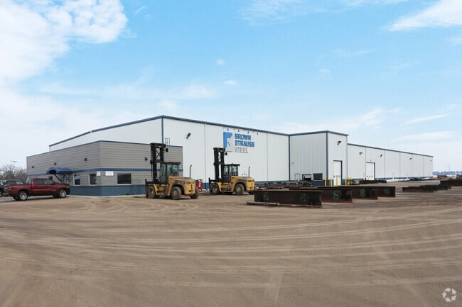
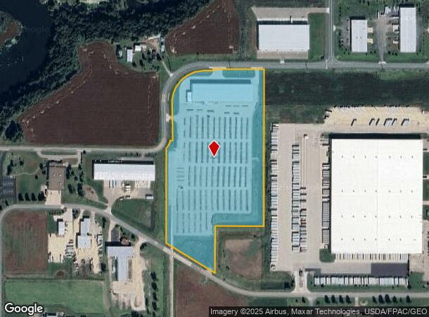
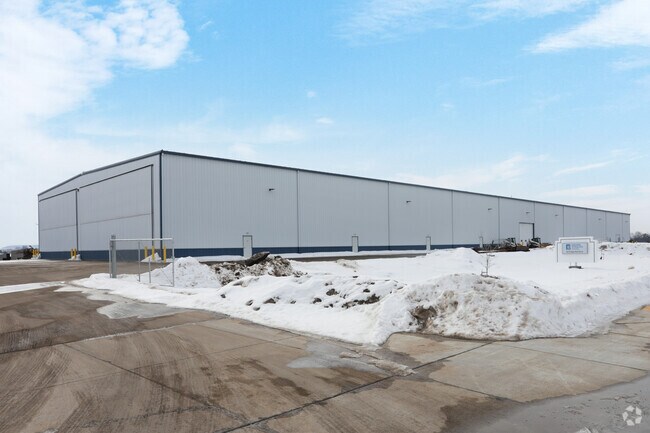
5610 Eagle Point Rd Ne
Menomonie, WI
PT. NW NE AND PT. SW NE NOW KNOWN AS LOT 1 CSM 4522 VOLUME 22 PAGE 122 OF SURVEYS RECORDED AS DOCUMENT NUMBER 634959
1725122812171200003
Dunn
Commercialnec
Wisconsin
X
1
55033C0317C
23.03 AC
2024
Eau Claire/Menomonie
2024
Other Market Areas
970500
DEMOGRAPHICS near 5610 Eagle Point Rd Ne
1 Mile
3 Mile
5 Mile
2024 Total Population
13
4,656
21,787
2029 Population
13
4,764
22,483
Pop Growth 2024-2029
0.00%
+ 2.32%
+ 3.19%
Average Age
37
42
36
2024 Total Households
6
1,923
8,157
HH Growth 2024-2029
0.00%
+ 2.44%
+ 3.60%
Median Household Inc
$67,500
$66,745
$58,483
Avg Household Size
1.80
2.30
2.20
2024 Avg HH Vehicles
2.00
2.00
2.00
Median Home Value
$150,000
$220,293
$199,934
Median Year Built
1994
1989
1981
Nearby Places
Map Layers
Map Styles
 Street
 Aerial
- Restaurants
- Banks
- Shops
- Fitness
- Groceries
Nearby Properties
Address
Land Use
TOTAL SIZE
Lot Size
Zoning
Address
Land Use
TOTAL SIZE
Lot Size
Zoning
124.80 AC
I1
Address
Land Use
TOTAL SIZE
Lot Size
Zoning
50.09 AC
I3
Address
Land Use
TOTAL SIZE
Lot Size
Zoning
70.28 AC
I3
Address
Land Use
TOTAL SIZE
Lot Size
Zoning
20.75 AC
I1
Address
Land Use
TOTAL SIZE
Lot Size
Zoning
22.74 AC
I3
Address
Land Use
TOTAL SIZE
Lot Size
Zoning
30.01 AC
I1
Address
Land Use
TOTAL SIZE
Lot Size
Zoning
6.17 AC
T1
Address
Land Use
TOTAL SIZE
Lot Size
Zoning
16.09 AC
Address
Land Use
TOTAL SIZE
Lot Size
Zoning
21.37 AC
I1
Address
Land Use
TOTAL SIZE
Lot Size
Zoning
16 AC
A3
Address
Land Use
TOTAL SIZE
Lot Size
Zoning
Address
Land Use
TOTAL SIZE
Lot Size
Zoning
4.55 AC
B2
Address
Land Use
TOTAL SIZE
Lot Size
Zoning
11.61 AC
PUD
Address
Land Use
TOTAL SIZE
Lot Size
Zoning
2.24 AC
PUD
Address
Land Use
TOTAL SIZE
Lot Size
Zoning
40 AC
T1
Address
Land Use
TOTAL SIZE
Lot Size
Zoning
7.13 AC
Address
Land Use
TOTAL SIZE
Lot Size
Zoning
9.21 AC
I2
Address
Land Use
TOTAL SIZE
Lot Size
Zoning
6.61 AC
Address
Land Use
TOTAL SIZE
Lot Size
Zoning
10 AC
I1
Address
Land Use
TOTAL SIZE
Lot Size
Zoning
36.91 AC
A3
Address
Land Use
TOTAL SIZE
Lot Size
Zoning
9.13 AC
T1
Address
Land Use
TOTAL SIZE
Lot Size
Zoning
1.60 AC
PUD
Address
Land Use
TOTAL SIZE
Lot Size
Zoning
Address
Land Use
TOTAL SIZE
Lot Size
Zoning
9.13 AC
T1
Address
Land Use
TOTAL SIZE
Lot Size
Zoning
4.51 AC
Address
Land Use
TOTAL SIZE
Lot Size
Zoning
5.54 AC
Address
Land Use
TOTAL SIZE
Lot Size
Zoning
11.26 AC
I1
Address
Land Use
TOTAL SIZE
Lot Size
Zoning
0.01 AC
T1
The World's #1 Commercial Real Estate Marketplace
Connect with us
© 2026 CoStar Group
The information above has been obtained from sources believed reliable. While we do not doubt its accuracy we have not verified it and make no guarantee, warranty or representation about it. It is your responsibility to independently confirm its accuracy and completeness. Any projections, opinions, assumptions, or estimates used are for example only and do not represent the current or future performance of the property. The value of this transaction to you depends on tax and other factors which should be evaluated by your tax, financial, and legal advisors. You and your advisors should conduct a careful, independent investigation of the property to determine to your satisfaction the suitability of the property for your needs.