Property Record
5610 Zip Dr, Fort Myers, FL 33905


NEARBY LISTINGS FOR SALE OR LEASE
Property Detail
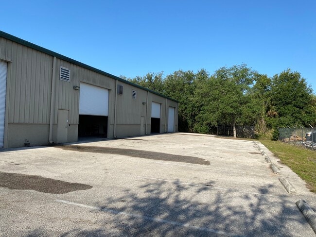
5610 Zip Dr
Cape Coral-Fort Myers, FL
Billy Creek & B F Industrial
10-44-25-10-00000.1460
BILLY CREEK COMMERCE CENTER UNIT 5 PB 64 PGS 23 + 24 LOT 146 + N 1/2 OF LOT 147
Warehouse
Lee
AE
Florida
12071C0291G
146,1
2024
1.48 AC
2025
City of Ft Myers
000504
Southwest Florida
22,987 SF
DEMOGRAPHICS near 5610 Zip Dr
1 Mile
3 Mile
5 Mile
2024 Total Population
7,374
34,521
104,725
2029 Population
8,711
40,902
124,867
Pop Growth 2024-2029
+ 18.13%
+ 18.48%
+ 19.23%
Average Age
36
38
42
2024 Total Households
2,308
11,626
42,246
HH Growth 2024-2029
+ 17.81%
+ 18.48%
+ 19.23%
Median Household Inc
$42,205
$43,933
$50,315
Avg Household Size
2.80
2.60
2.30
2024 Avg HH Vehicles
1.00
2.00
2.00
Median Home Value
$109,681
$144,798
$223,956
Median Year Built
1977
1982
1993
Nearby Places
Map Layers
Map Styles
 Street
 Aerial
- Restaurants
- Banks
- Shops
- Fitness
- Groceries
PUBLIC TRANSPORTATION
AIRPORT
Southwest Florida International
DRIVE
WALK
Distance
Southwest Florida International
20 min
12.1 mi
Punta Gorda
DRIVE
WALK
Distance
Punta Gorda
33 min
24.7 mi
SALE & LEASE HISTORY
LISTING DATE
SALE/LEASE

May 21, 2021
For Lease
Mar 05, 2021
For Sale
Feb 08, 2021
For Lease
Nearby Properties
Address
Land Use
TOTAL SIZE
Lot Size
Zoning
Address
Land Use
TOTAL SIZE
Lot Size
Zoning
77.79 AC
PUD
Address
Land Use
TOTAL SIZE
Lot Size
Zoning
438,839 SF
66.95 AC
MU
Address
Land Use
TOTAL SIZE
Lot Size
Zoning
362,391 SF
12.80 AC
SDA
Address
Land Use
TOTAL SIZE
Lot Size
Zoning
475,045 SF
30.22 AC
PUD
Address
Land Use
TOTAL SIZE
Lot Size
Zoning
723,322 SF
1.73 AC
PUD
Address
Land Use
TOTAL SIZE
Lot Size
Zoning
286,629 SF
13.01 AC
SDA
Address
Land Use
TOTAL SIZE
Lot Size
Zoning
111.70 AC
C1
Address
Land Use
TOTAL SIZE
Lot Size
Zoning
580,121 SF
61.83 AC
IL
Address
Land Use
TOTAL SIZE
Lot Size
Zoning
324,346 SF
20 AC
C1
Address
Land Use
TOTAL SIZE
Lot Size
Zoning
376,949 SF
49.70 AC
RM16
Address
Land Use
TOTAL SIZE
Lot Size
Zoning
6.99 AC
C-1
Address
Land Use
TOTAL SIZE
Lot Size
Zoning
319,765 SF
47.40 AC
RS7
Address
Land Use
TOTAL SIZE
Lot Size
Zoning
6.38 AC
SDA
Address
Land Use
TOTAL SIZE
Lot Size
Zoning
67.46 AC
C1
Address
Land Use
TOTAL SIZE
Lot Size
Zoning
154,653 SF
11.77 AC
SDA
Address
Land Use
TOTAL SIZE
Lot Size
Zoning
230,967 SF
8.31 AC
SDA
Address
Land Use
TOTAL SIZE
Lot Size
Zoning
106,300 SF
14.71 AC
TFC2
Address
Land Use
TOTAL SIZE
Lot Size
Zoning
231,360 SF
17.08 AC
PUD
Address
Land Use
TOTAL SIZE
Lot Size
Zoning
11,062 SF
47.11 AC
Address
Land Use
TOTAL SIZE
Lot Size
Zoning
291,613 SF
40.32 AC
RPD
Address
Land Use
TOTAL SIZE
Lot Size
Zoning
103,525 SF
236.09 AC
IL
Address
Land Use
TOTAL SIZE
Lot Size
Zoning
127,637 SF
6.50 AC
SDA
Address
Land Use
TOTAL SIZE
Lot Size
Zoning
137,687 SF
18.25 AC
RS7
Address
Land Use
TOTAL SIZE
Lot Size
Zoning
8,811 SF
11.79 AC
PUD
Address
Land Use
TOTAL SIZE
Lot Size
Zoning
78,179 SF
34.82 AC
PUD
Address
Land Use
TOTAL SIZE
Lot Size
Zoning
199,728 SF
19.76 AC
CC
Address
Land Use
TOTAL SIZE
Lot Size
Zoning
5.88 AC
CG
Address
Land Use
TOTAL SIZE
Lot Size
Zoning
29.75 AC
CI
Address
Land Use
TOTAL SIZE
Lot Size
Zoning
548,993 SF
54.61 AC
RM16
Address
Land Use
TOTAL SIZE
Lot Size
Zoning
60,633 SF
5.95 AC
SDA
The World's #1 Commercial Real Estate Marketplace
Connect with us
© 2026 CoStar Group
The information above has been obtained from sources believed reliable. While we do not doubt its accuracy we have not verified it and make no guarantee, warranty or representation about it. It is your responsibility to independently confirm its accuracy and completeness. Any projections, opinions, assumptions, or estimates used are for example only and do not represent the current or future performance of the property. The value of this transaction to you depends on tax and other factors which should be evaluated by your tax, financial, and legal advisors. You and your advisors should conduct a careful, independent investigation of the property to determine to your satisfaction the suitability of the property for your needs.