Property Record
5611 Shirley Park Dr, Bessemer, AL 35022


NEARBY LISTINGS FOR SALE OR LEASE
-
-
View all Bessemer listings for sale on LoopNet.com
Property Detail
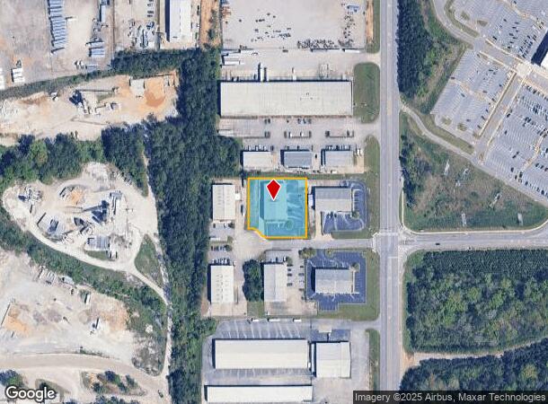
5611 Shirley Park Dr
Birmingham-Hoover, AL
Shirley Industrail Park
37-00-24-1-000-002.012
LOT 2 SHIRLEY INDUSTRIAL PARK 38/64
Warehouse
Jefferson
X
Alabama
01073C0519H
2
2023
1.09 AC
2024
Bessemer
014104
Birmingham
9,600 SF
DEMOGRAPHICS near 5611 Shirley Park Dr
1 Mile
3 Mile
5 Mile
2024 Total Population
28
14,998
44,069
2029 Population
27
14,644
43,247
Pop Growth 2024-2029
(3.57%)
(2.36%)
(1.87%)
Average Age
39
40
40
2024 Total Households
12
5,991
17,545
HH Growth 2024-2029
(8.33%)
(2.54%)
(1.99%)
Median Household Inc
$24,999
$48,180
$50,055
Avg Household Size
2.30
2.40
2.40
2024 Avg HH Vehicles
1.00
2.00
2.00
Median Home Value
$99,999
$165,030
$163,716
Median Year Built
1969
1974
1973
Nearby Places
Map Layers
Map Styles
 Street
 Aerial
- Restaurants
- Banks
- Shops
- Fitness
- Groceries
PUBLIC TRANSPORTATION
AIRPORT
Birmingham-Shuttlesworth International
DRIVE
WALK
Distance
Birmingham-Shuttlesworth International
31 min
23.9 mi
Nearby Properties
Address
Land Use
TOTAL SIZE
Lot Size
Zoning
Address
Land Use
TOTAL SIZE
Lot Size
Zoning
857,420 SF
34.50 AC
I3
Address
Land Use
TOTAL SIZE
Lot Size
Zoning
184,428 SF
9.70 AC
01
Address
Land Use
TOTAL SIZE
Lot Size
Zoning
311,900 SF
30.20 AC
Address
Land Use
TOTAL SIZE
Lot Size
Zoning
526,350 SF
24.62 AC
I2
Address
Land Use
TOTAL SIZE
Lot Size
Zoning
47,705 SF
0.69 AC
01
Address
Land Use
TOTAL SIZE
Lot Size
Zoning
195,461 SF
15.03 AC
C3-R
Address
Land Use
TOTAL SIZE
Lot Size
Zoning
200,227 SF
25.10 AC
C-4
Address
Land Use
TOTAL SIZE
Lot Size
Zoning
175,224 SF
9.70 AC
R2
Address
Land Use
TOTAL SIZE
Lot Size
Zoning
38,868 SF
10.90 AC
C-4
Address
Land Use
TOTAL SIZE
Lot Size
Zoning
100,050 SF
14 AC
C-4
Address
Land Use
TOTAL SIZE
Lot Size
Zoning
122,720 SF
6.77 AC
O1-R
Address
Land Use
TOTAL SIZE
Lot Size
Zoning
137,641 SF
26.80 AC
R4
Address
Land Use
TOTAL SIZE
Lot Size
Zoning
132,116 SF
9.15 AC
R3
Address
Land Use
TOTAL SIZE
Lot Size
Zoning
132,683 SF
16 AC
R-4
Address
Land Use
TOTAL SIZE
Lot Size
Zoning
63.30 AC
I3
Address
Land Use
TOTAL SIZE
Lot Size
Zoning
2.50 AC
C4
Address
Land Use
TOTAL SIZE
Lot Size
Zoning
25,182 SF
1.76 AC
C4
Address
Land Use
TOTAL SIZE
Lot Size
Zoning
38,376 SF
4.87 AC
C3
Address
Land Use
TOTAL SIZE
Lot Size
Zoning
47,284 SF
11.30 AC
0-1/
Address
Land Use
TOTAL SIZE
Lot Size
Zoning
23,264 SF
4.06 AC
C4
Address
Land Use
TOTAL SIZE
Lot Size
Zoning
45,959 SF
6.72 AC
C-4
Address
Land Use
TOTAL SIZE
Lot Size
Zoning
110,500 SF
11 AC
I-2
Address
Land Use
TOTAL SIZE
Lot Size
Zoning
27,383 SF
7 AC
C4
Address
Land Use
TOTAL SIZE
Lot Size
Zoning
3.29 AC
O1
Address
Land Use
TOTAL SIZE
Lot Size
Zoning
81,846 SF
77.30 AC
I3
Address
Land Use
TOTAL SIZE
Lot Size
Zoning
28,722 SF
2.90 AC
A-1
Address
Land Use
TOTAL SIZE
Lot Size
Zoning
67,065 SF
15 AC
A1
Address
Land Use
TOTAL SIZE
Lot Size
Zoning
21,928 SF
5 AC
C4
Address
Land Use
TOTAL SIZE
Lot Size
Zoning
57,716 SF
5.50 AC
R4
Address
Land Use
TOTAL SIZE
Lot Size
Zoning
26,685 SF
1.71 AC
I3
The World's #1 Commercial Real Estate Marketplace
Connect with us
© 2025 CoStar Group
The information above has been obtained from sources believed reliable. While we do not doubt its accuracy we have not verified it and make no guarantee, warranty or representation about it. It is your responsibility to independently confirm its accuracy and completeness. Any projections, opinions, assumptions, or estimates used are for example only and do not represent the current or future performance of the property. The value of this transaction to you depends on tax and other factors which should be evaluated by your tax, financial, and legal advisors. You and your advisors should conduct a careful, independent investigation of the property to determine to your satisfaction the suitability of the property for your needs.