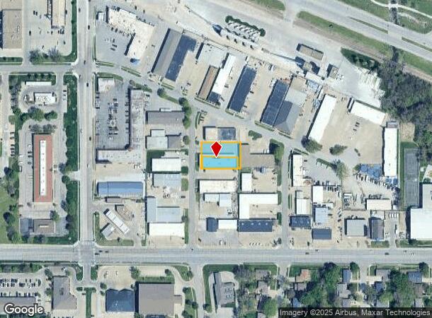
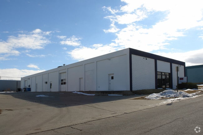
Property Record
5612 S 49Th St, Lincoln, NE 68516
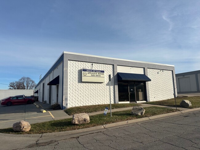
This Property Is For Sale
NEARBY LISTINGS FOR SALE OR LEASE
Property Detail
5612 S 49Th St
Lincoln, NE
Rent-Worth
16-08-408-002-000
SOUTH 49TH CONDOMINIUM, BASE ACCOUNT: LOCATED ON RENTWORTH BLOCK 3 LOT 2
Commercialacreage
Lancaster
AE
Nebraska
31109C0319F
2
0
0.42 AC
2025
Far South
003704
Lincoln
DEMOGRAPHICS near 5612 S 49Th St
1 Mile
3 Mile
5 Mile
2024 Total Population
12,247
93,066
182,960
2029 Population
12,569
96,074
189,690
Pop Growth 2024-2029
+ 2.63%
+ 3.23%
+ 3.68%
Average Age
40
41
39
2024 Total Households
5,111
38,732
77,015
HH Growth 2024-2029
+ 2.68%
+ 3.29%
+ 3.83%
Median Household Inc
$72,515
$83,434
$67,737
Avg Household Size
2.40
2.30
2.30
2024 Avg HH Vehicles
2.00
2.00
2.00
Median Home Value
$243,134
$270,889
$256,091
Median Year Built
1979
1985
1977
Nearby Places
Map Layers
Map Styles
 Street
 Aerial
- Restaurants
- Banks
- Shops
- Fitness
- Groceries
PUBLIC TRANSPORTATION
COMMUTER RAIL
DRIVE
WALK
Distance
14 min
6.4 mi
AIRPORT
Lincoln
DRIVE
WALK
Distance
Lincoln
20 min
11.4 mi
Nearby Properties
Address
Land Use
TOTAL SIZE
Lot Size
Zoning
Address
Land Use
TOTAL SIZE
Lot Size
Zoning
604,749 SF
20.55 AC
R2
Address
Land Use
TOTAL SIZE
Lot Size
Zoning
329,069 SF
30 AC
R6
Address
Land Use
TOTAL SIZE
Lot Size
Zoning
48,378 SF
9.53 AC
R5
Address
Land Use
TOTAL SIZE
Lot Size
Zoning
213,738 SF
14.97 AC
B5
Address
Land Use
TOTAL SIZE
Lot Size
Zoning
61,818 SF
12.38 AC
B5
Address
Land Use
TOTAL SIZE
Lot Size
Zoning
185,015 SF
38.72 AC
AGR
Address
Land Use
TOTAL SIZE
Lot Size
Zoning
17,070 SF
8.95 AC
R3
Address
Land Use
TOTAL SIZE
Lot Size
Zoning
188,540 SF
4.57 AC
Address
Land Use
TOTAL SIZE
Lot Size
Zoning
126,172 SF
5.46 AC
B2
Address
Land Use
TOTAL SIZE
Lot Size
Zoning
234,103 SF
13.56 AC
R2
Address
Land Use
TOTAL SIZE
Lot Size
Zoning
172,989 SF
6.16 AC
Address
Land Use
TOTAL SIZE
Lot Size
Zoning
44,957 SF
7.93 AC
R4
Address
Land Use
TOTAL SIZE
Lot Size
Zoning
131,316 SF
26.31 AC
R3
Address
Land Use
TOTAL SIZE
Lot Size
Zoning
142,179 SF
9.68 AC
R3
Address
Land Use
TOTAL SIZE
Lot Size
Zoning
90,362 SF
2.53 AC
B3
Address
Land Use
TOTAL SIZE
Lot Size
Zoning
57,434 SF
15.62 AC
R4
Address
Land Use
TOTAL SIZE
Lot Size
Zoning
148,760 SF
4.99 AC
R4
Address
Land Use
TOTAL SIZE
Lot Size
Zoning
32,854 SF
22.09 AC
NULL
Address
Land Use
TOTAL SIZE
Lot Size
Zoning
32,443 SF
7.20 AC
NULL
Address
Land Use
TOTAL SIZE
Lot Size
Zoning
81,149 SF
6.46 AC
R5
Address
Land Use
TOTAL SIZE
Lot Size
Zoning
33,983 SF
23.08 AC
R4
Address
Land Use
TOTAL SIZE
Lot Size
Zoning
22,324 SF
16.59 AC
NULL
Address
Land Use
TOTAL SIZE
Lot Size
Zoning
14,637 SF
18.90 AC
NULL
Address
Land Use
TOTAL SIZE
Lot Size
Zoning
68,664 SF
7 AC
NULL
Address
Land Use
TOTAL SIZE
Lot Size
Zoning
16,284 SF
8.77 AC
NULL
Address
Land Use
TOTAL SIZE
Lot Size
Zoning
39,968 SF
13.41 AC
NULL
Address
Land Use
TOTAL SIZE
Lot Size
Zoning
67,029 SF
17.26 AC
R3
Address
Land Use
TOTAL SIZE
Lot Size
Zoning
131,049 SF
78.38 AC
P
Address
Land Use
TOTAL SIZE
Lot Size
Zoning
86,718 SF
7.16 AC
NULL
Address
Land Use
TOTAL SIZE
Lot Size
Zoning
63,298 SF
10.15 AC
R1
The World's #1 Commercial Real Estate Marketplace
Connect with us
© 2025 CoStar Group
The information above has been obtained from sources believed reliable. While we do not doubt its accuracy we have not verified it and make no guarantee, warranty or representation about it. It is your responsibility to independently confirm its accuracy and completeness. Any projections, opinions, assumptions, or estimates used are for example only and do not represent the current or future performance of the property. The value of this transaction to you depends on tax and other factors which should be evaluated by your tax, financial, and legal advisors. You and your advisors should conduct a careful, independent investigation of the property to determine to your satisfaction the suitability of the property for your needs.