Property Record
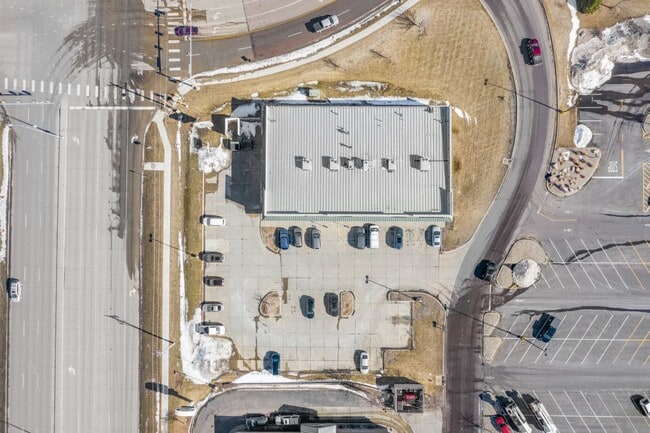
5615 E Arrowhead Pkwy, Sioux Falls, SD 57110


Property Detail
5615 E Arrowhead Pkwy
74979
OUTLOT 1 (EX LOT H1) DAWLEY 2ND ADDN TO CITY OF SIOUX FALLS
Stripcommercialcenter
MINNEHAHA
B and X Area of moderate flood hazard, usually the area between the limits of the 100-year and 500-year floods.
South Dakota
2025
1.23 AC
2025
Sioux Falls
000407
Other Market Areas
10,218 SF
Sioux Falls, SD-MN
NEARBY LISTINGS FOR SALE OR LEASE
DEMOGRAPHICS near 5615 E Arrowhead Pkwy
1 mile
3 mile
5 mile
2025 Total Population
9,634
61,090
126,644
2030 Population
10,199
64,454
134,559
Pop Growth 2025-2030
+ 5.86%
+ 5.51%
+ 6.25%
Average Age
37
37
39
2025 Total Households
3,691
23,821
51,220
HH Growth 2025-2030
+ 6.29%
+ 5.80%
+ 6.73%
Median Household Inc
$69,356
$72,282
$71,243
Avg Household Size
2.50
2.50
2.40
2025 Avg HH Vehicles
2.00
2.00
2.00
Median Home Value
$335,403
$317,954
$308,433
Median Year Built
2003
1995
1990
Nearby Places
Map Layers
Map Styles
 Street
 Aerial
Layers
 Traffic
 Biking
Places
Listings with unknown addresses are not visible on the map
- Restaurants
- Banks
- Shops
- Fitness
- Groceries
PUBLIC TRANSPORTATION
AIRPORT
Joe Foss Field
Drive
Walk
Distance
Joe Foss Field
28 min
8.1 mi
Freight Ports
Port Milwaukee
Drive
Walk
Distance
Port Milwaukee
545 min
501.3 mi
SALE & LEASE HISTORY
LISTING DATE
SALE/LEASE

Oct 29, 2024
For Lease
May 02, 2023
For Lease
May 02, 2017
For Lease
Aug 12, 2021
For Lease
Nearby Properties
Address
Land Use
TOTAL SIZE
Lot Size
Zoning
Address
Land Use
TOTAL SIZE
Lot Size
Zoning
3,217 SF
10.40 AC
NO;SPECIAL
Address
Land Use
TOTAL SIZE
Lot Size
Zoning
94,624 SF
12.31 AC
Address
Land Use
TOTAL SIZE
Lot Size
Zoning
153,249 SF
15.39 AC
Address
Land Use
TOTAL SIZE
Lot Size
Zoning
4,136 SF
18.95 AC
Address
Land Use
TOTAL SIZE
Lot Size
Zoning
4,358 SF
14.79 AC
Address
Land Use
TOTAL SIZE
Lot Size
Zoning
3,306 SF
17.41 AC
Address
Land Use
TOTAL SIZE
Lot Size
Zoning
284,136 SF
15.02 AC
Address
Land Use
TOTAL SIZE
Lot Size
Zoning
11,800 SF
11.78 AC
Address
Land Use
TOTAL SIZE
Lot Size
Zoning
2,406 SF
13.76 AC
Address
Land Use
TOTAL SIZE
Lot Size
Zoning
212,076 SF
41.01 AC
FP;FP
Address
Land Use
TOTAL SIZE
Lot Size
Zoning
17,117 SF
6.51 AC
PD;PLANNED
Address
Land Use
TOTAL SIZE
Lot Size
Zoning
92,195 SF
8 AC
Address
Land Use
TOTAL SIZE
Lot Size
Zoning
87,328 SF
6.92 AC
Address
Land Use
TOTAL SIZE
Lot Size
Zoning
5.85 AC
Address
Land Use
TOTAL SIZE
Lot Size
Zoning
86,019 SF
3.60 AC
NO;SPECIAL
Address
Land Use
TOTAL SIZE
Lot Size
Zoning
89,935 SF
4.81 AC
Address
Land Use
TOTAL SIZE
Lot Size
Zoning
62,856 SF
11.26 AC
Address
Land Use
TOTAL SIZE
Lot Size
Zoning
212,260 SF
20.37 AC
Address
Land Use
TOTAL SIZE
Lot Size
Zoning
83,394 SF
4.46 AC
Address
Land Use
TOTAL SIZE
Lot Size
Zoning
198,644 SF
18.65 AC
Address
Land Use
TOTAL SIZE
Lot Size
Zoning
81,404 SF
0.54 AC
S;INSTITUT
Address
Land Use
TOTAL SIZE
Lot Size
Zoning
125,520 SF
5.61 AC
Address
Land Use
TOTAL SIZE
Lot Size
Zoning
58,932 SF
4.93 AC
Address
Land Use
TOTAL SIZE
Lot Size
Zoning
134,519 SF
12 AC
Address
Land Use
TOTAL SIZE
Lot Size
Zoning
1,860 SF
86.79 AC
Address
Land Use
TOTAL SIZE
Lot Size
Zoning
1,760 SF
7.25 AC
RA;APARTME
Address
Land Use
TOTAL SIZE
Lot Size
Zoning
47,617 SF
7.74 AC
Address
Land Use
TOTAL SIZE
Lot Size
Zoning
57,503 SF
6.67 AC
Address
Land Use
TOTAL SIZE
Lot Size
Zoning
134,538 SF
4.75 AC
I2;GENERAL
Address
Land Use
TOTAL SIZE
Lot Size
Zoning
38,172 SF
5.77 AC
The World's #1 Commercial Real Estate Marketplace
Connect with us
© 2026 CoStar Group
The information above has been obtained from sources believed reliable. While we do not doubt its accuracy we have not verified it and make no guarantee, warranty or representation about it. It is your responsibility to independently confirm its accuracy and completeness. Any projections, opinions, assumptions, or estimates used are for example only and do not represent the current or future performance of the property. The value of this transaction to you depends on tax and other factors which should be evaluated by your tax, financial, and legal advisors. You and your advisors should conduct a careful, independent investigation of the property to determine to your satisfaction the suitability of the property for your needs.