Property Record
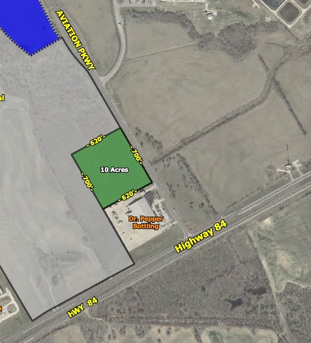
5619 E Highway 84, Waco, TX 76705

Property Detail
5619 E Highway 84
28-057000-053802-6
TOMAS DE LA VEGA ACRES 190.852
Commercialnec
MCLENNAN
R
Texas
B and X Area of moderate flood hazard, usually the area between the limits of the 100-year and 500-year floods.
190.85 AC
0
Waco
2025
Other Market Areas
001600
Waco, TX
1,368 SF
NEARBY LISTINGS FOR SALE OR LEASE
-
-
SWC Interstate Highway 35E & East Crestview Drive
Lacy-Lakeview, TX 76705
$1,846,944
5.30 AC Lots
Land
-
-
-
View all Waco listings for sale on LoopNet.com
DEMOGRAPHICS near 5619 E Highway 84
1 mile
3 mile
5 mile
2025 Total Population
114
15,705
32,521
2030 Population
119
16,365
33,825
Pop Growth 2025-2030
+ 4.39%
+ 4.20%
+ 4.01%
Average Age
38
36
37
2025 Total Households
42
5,621
11,524
HH Growth 2025-2030
+ 4.76%
+ 4.38%
+ 4.15%
Median Household Inc
$57,999
$54,003
$52,885
Avg Household Size
2.70
2.60
2.60
2025 Avg HH Vehicles
1.00
2.00
2.00
Median Home Value
$141,666
$165,470
$181,549
Median Year Built
1982
1979
1979
Nearby Places
Map Layers
Map Styles
 Street
 Aerial
Transit
 Traffic
 Biking
Places
Listings with unknown addresses are not visible on the map
- Restaurants
- Banks
- Shops
- Fitness
- Groceries
PUBLIC TRANSPORTATION
AIRPORT
Waco Regional
Drive
Walk
Distance
Waco Regional
25 min
12.6 mi
Freight Ports
Port of Houston
Drive
Walk
Distance
Port of Houston
217 min
188.0 mi
SALE & LEASE HISTORY
LISTING DATE
SALE/LEASE

Sep 24, 2016
For Sale
Nearby Properties
Address
Land Use
TOTAL SIZE
Lot Size
Zoning
Address
Land Use
TOTAL SIZE
Lot Size
Zoning
821,607 SF
48.98 AC
Address
Land Use
TOTAL SIZE
Lot Size
Zoning
Address
Land Use
TOTAL SIZE
Lot Size
Zoning
215,433 SF
33.17 AC
R
Address
Land Use
TOTAL SIZE
Lot Size
Zoning
Address
Land Use
TOTAL SIZE
Lot Size
Zoning
Address
Land Use
TOTAL SIZE
Lot Size
Zoning
Address
Land Use
TOTAL SIZE
Lot Size
Zoning
30.89 AC
R1
Address
Land Use
TOTAL SIZE
Lot Size
Zoning
33,442 SF
2.80 AC
Address
Land Use
TOTAL SIZE
Lot Size
Zoning
127,979 SF
5.72 AC
R
Address
Land Use
TOTAL SIZE
Lot Size
Zoning
186,588 SF
10.28 AC
C1
Address
Land Use
TOTAL SIZE
Lot Size
Zoning
Address
Land Use
TOTAL SIZE
Lot Size
Zoning
266,294 SF
23.53 AC
Address
Land Use
TOTAL SIZE
Lot Size
Zoning
8.86 AC
R1
Address
Land Use
TOTAL SIZE
Lot Size
Zoning
87,206 SF
2.80 AC
Address
Land Use
TOTAL SIZE
Lot Size
Zoning
Address
Land Use
TOTAL SIZE
Lot Size
Zoning
229,166 SF
14.18 AC
C
Address
Land Use
TOTAL SIZE
Lot Size
Zoning
Address
Land Use
TOTAL SIZE
Lot Size
Zoning
125,412 SF
8.37 AC
R
Address
Land Use
TOTAL SIZE
Lot Size
Zoning
99,796 SF
11.13 AC
R
Address
Land Use
TOTAL SIZE
Lot Size
Zoning
102,480 SF
9.36 AC
R4
Address
Land Use
TOTAL SIZE
Lot Size
Zoning
Address
Land Use
TOTAL SIZE
Lot Size
Zoning
75,523 SF
17.78 AC
R1
Address
Land Use
TOTAL SIZE
Lot Size
Zoning
99,124 SF
5 AC
B2
Address
Land Use
TOTAL SIZE
Lot Size
Zoning
Address
Land Use
TOTAL SIZE
Lot Size
Zoning
47.44 AC
Address
Land Use
TOTAL SIZE
Lot Size
Zoning
94,428 SF
6.20 AC
B1
Address
Land Use
TOTAL SIZE
Lot Size
Zoning
50,814 SF
12.44 AC
B2
Address
Land Use
TOTAL SIZE
Lot Size
Zoning
48,612 SF
5.20 AC
R-2
Address
Land Use
TOTAL SIZE
Lot Size
Zoning
104,971 SF
11.55 AC
B2
Address
Land Use
TOTAL SIZE
Lot Size
Zoning
5,230 SF
2.21 AC
The World's #1 Commercial Real Estate Marketplace
Connect with us
© 2026 CoStar Group
The information above has been obtained from sources believed reliable. While we do not doubt its accuracy we have not verified it and make no guarantee, warranty or representation about it. It is your responsibility to independently confirm its accuracy and completeness. Any projections, opinions, assumptions, or estimates used are for example only and do not represent the current or future performance of the property. The value of this transaction to you depends on tax and other factors which should be evaluated by your tax, financial, and legal advisors. You and your advisors should conduct a careful, independent investigation of the property to determine to your satisfaction the suitability of the property for your needs.