Property Record
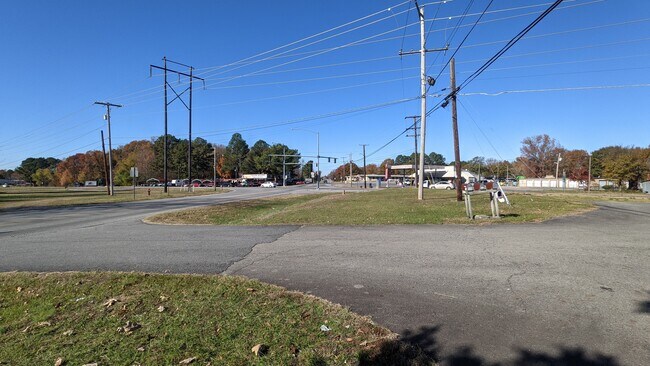
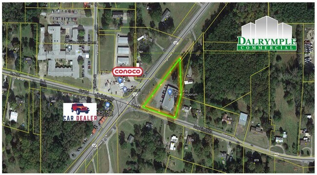
562 Highway 367 N, Judsonia, AR 72081

Property Detail
562 Highway 367 N
001-03545-000
PT NE NE LYING N OF HWY 67-B LS OUTSALE
Storebuilding
White
B and X Area of moderate flood hazard, usually the area between the limits of the 100-year and 500-year floods.
Arkansas
2025
1.19 AC
2025
Arkansas North Area
070502
Other Market Areas
9,100 SF
Searcy, AR
NEARBY LISTINGS FOR SALE OR LEASE
DEMOGRAPHICS near 562 Highway 367 N
1 mile
3 mile
5 mile
2025 Total Population
786
8,780
21,715
2030 Population
804
8,992
22,320
Pop Growth 2025-2030
+ 2.29%
+ 2.41%
+ 2.79%
Average Age
41
43
38
2025 Total Households
301
3,654
8,441
HH Growth 2025-2030
+ 2.66%
+ 2.52%
+ 3.01%
Median Household Inc
$54,523
$42,269
$40,189
Avg Household Size
2.50
2.30
2.30
2025 Avg HH Vehicles
2.00
2.00
2.00
Median Home Value
$115,909
$166,038
$168,342
Median Year Built
1983
1984
1985
Nearby Places
Map Layers
Map Styles
 Street
 Aerial
Layers
 Traffic
 Biking
Places
Listings with unknown addresses are not visible on the map
- Restaurants
- Banks
- Shops
- Fitness
- Groceries
SALE & LEASE HISTORY
LISTING DATE
SALE/LEASE

Dec 28, 2021
For Sale
Nearby Properties
Address
Land Use
TOTAL SIZE
Lot Size
Zoning
Address
Land Use
TOTAL SIZE
Lot Size
Zoning
3,780 SF
29.27 AC
Address
Land Use
TOTAL SIZE
Lot Size
Zoning
56,820 SF
8.50 AC
Address
Land Use
TOTAL SIZE
Lot Size
Zoning
110,398 SF
10.39 AC
Address
Land Use
TOTAL SIZE
Lot Size
Zoning
81,577 SF
4.33 AC
Address
Land Use
TOTAL SIZE
Lot Size
Zoning
16,573 SF
0.98 AC
Address
Land Use
TOTAL SIZE
Lot Size
Zoning
79,336 SF
12.78 AC
Address
Land Use
TOTAL SIZE
Lot Size
Zoning
25,248 SF
4.70 AC
Address
Land Use
TOTAL SIZE
Lot Size
Zoning
9,000 SF
1 AC
Address
Land Use
TOTAL SIZE
Lot Size
Zoning
42,746 SF
5.56 AC
Address
Land Use
TOTAL SIZE
Lot Size
Zoning
91,577 SF
7.06 AC
Address
Land Use
TOTAL SIZE
Lot Size
Zoning
15,483 SF
4 AC
Address
Land Use
TOTAL SIZE
Lot Size
Zoning
44,430 SF
4.50 AC
Address
Land Use
TOTAL SIZE
Lot Size
Zoning
17,937 SF
2.57 AC
Address
Land Use
TOTAL SIZE
Lot Size
Zoning
76,756 SF
9.20 AC
Address
Land Use
TOTAL SIZE
Lot Size
Zoning
51,747 SF
3 AC
Address
Land Use
TOTAL SIZE
Lot Size
Zoning
47,312 SF
2.15 AC
Address
Land Use
TOTAL SIZE
Lot Size
Zoning
74,751 SF
3.10 AC
Address
Land Use
TOTAL SIZE
Lot Size
Zoning
79,092 SF
5.50 AC
Address
Land Use
TOTAL SIZE
Lot Size
Zoning
58,843 SF
4.25 AC
Address
Land Use
TOTAL SIZE
Lot Size
Zoning
53,645 SF
11.80 AC
Address
Land Use
TOTAL SIZE
Lot Size
Zoning
46,132 SF
2.36 AC
Address
Land Use
TOTAL SIZE
Lot Size
Zoning
20,440 SF
32.01 AC
Address
Land Use
TOTAL SIZE
Lot Size
Zoning
121,234 SF
125.90 AC
Address
Land Use
TOTAL SIZE
Lot Size
Zoning
40,258 SF
4.60 AC
Address
Land Use
TOTAL SIZE
Lot Size
Zoning
5,688 SF
0.69 AC
Address
Land Use
TOTAL SIZE
Lot Size
Zoning
20,773 SF
4.23 AC
Address
Land Use
TOTAL SIZE
Lot Size
Zoning
32,999 SF
1.25 AC
Address
Land Use
TOTAL SIZE
Lot Size
Zoning
58,544 SF
3.78 AC
Address
Land Use
TOTAL SIZE
Lot Size
Zoning
28,894 SF
3.60 AC
Address
Land Use
TOTAL SIZE
Lot Size
Zoning
36,861 SF
1.38 AC
The World's #1 Commercial Real Estate Marketplace
Connect with us
© 2026 CoStar Group
The information above has been obtained from sources believed reliable. While we do not doubt its accuracy we have not verified it and make no guarantee, warranty or representation about it. It is your responsibility to independently confirm its accuracy and completeness. Any projections, opinions, assumptions, or estimates used are for example only and do not represent the current or future performance of the property. The value of this transaction to you depends on tax and other factors which should be evaluated by your tax, financial, and legal advisors. You and your advisors should conduct a careful, independent investigation of the property to determine to your satisfaction the suitability of the property for your needs.