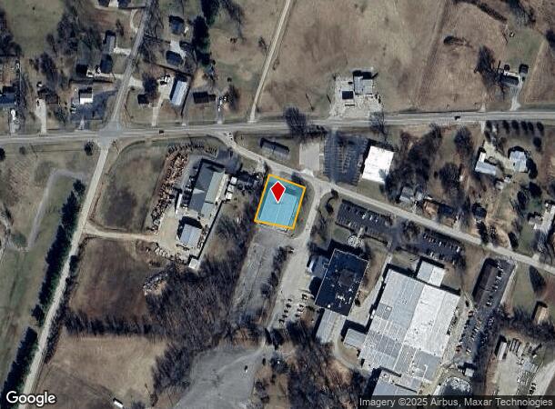
Property Record
5620 Old Highway 54, Philpot, KY 42366
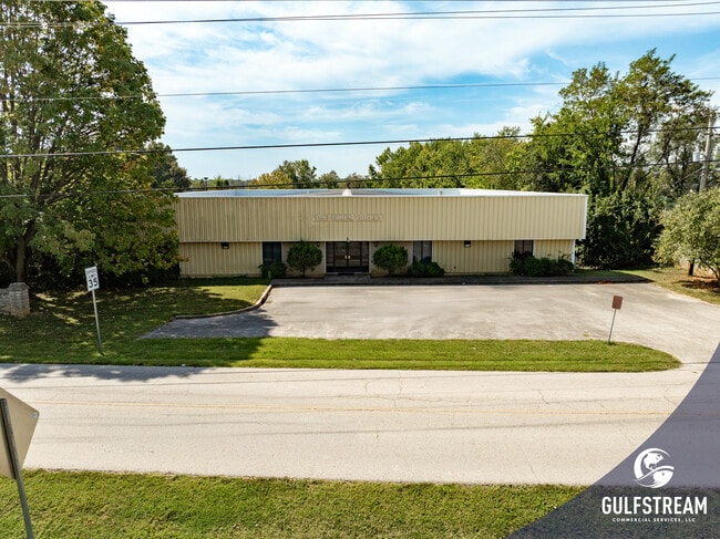
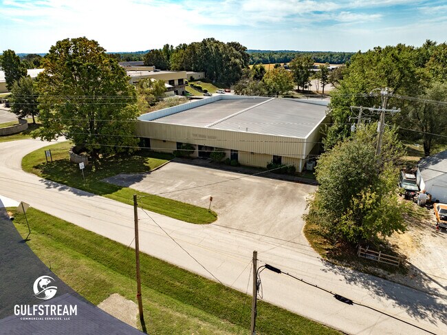
This Property Is For Sale
Current Lease Availabilities
NEARBY LISTINGS FOR SALE OR LEASE
Property Detail
5620 Old Highway 54
089-00-00-014-00-000
89-145620 OLD HWY 54.47 ACRE
Commercialnec
Daviess
X
Kentucky
21059C0285E
0.47 AC
2025
Kentucky West Area
2025
Other Market Areas
001602
Owensboro, KY
12,000 SF
DEMOGRAPHICS near 5620 Old Highway 54
1 Mile
3 Mile
5 Mile
2024 Total Population
773
9,344
32,940
2029 Population
784
9,477
33,557
Pop Growth 2024-2029
+ 1.42%
+ 1.42%
+ 1.87%
Average Age
41
41
40
2024 Total Households
282
3,552
12,662
HH Growth 2024-2029
+ 1.77%
+ 1.49%
+ 1.94%
Median Household Inc
$85,742
$91,181
$73,155
Avg Household Size
2.70
2.60
2.50
2024 Avg HH Vehicles
2.00
2.00
2.00
Median Home Value
$257,926
$272,142
$243,374
Median Year Built
1981
1992
1986
Nearby Places
Map Layers
Map Styles
 Street
 Aerial
- Restaurants
- Banks
- Shops
- Fitness
- Groceries
PUBLIC TRANSPORTATION
AIRPORT
Evansville Regional
DRIVE
WALK
Distance
Evansville Regional
67 min
46.3 mi
Nearby Properties
Address
Land Use
TOTAL SIZE
Lot Size
Zoning
Address
Land Use
TOTAL SIZE
Lot Size
Zoning
4,361 SF
17.09 AC
Address
Land Use
TOTAL SIZE
Lot Size
Zoning
16,373 SF
20.90 AC
Address
Land Use
TOTAL SIZE
Lot Size
Zoning
46,646 SF
3.53 AC
Address
Land Use
TOTAL SIZE
Lot Size
Zoning
57,072 SF
6.28 AC
Address
Land Use
TOTAL SIZE
Lot Size
Zoning
161,940 SF
17.95 AC
Address
Land Use
TOTAL SIZE
Lot Size
Zoning
52,751 SF
22.59 AC
Address
Land Use
TOTAL SIZE
Lot Size
Zoning
31,202 SF
6.83 AC
Address
Land Use
TOTAL SIZE
Lot Size
Zoning
16,817 SF
3.43 AC
Address
Land Use
TOTAL SIZE
Lot Size
Zoning
9,783 SF
73.13 AC
Address
Land Use
TOTAL SIZE
Lot Size
Zoning
1,731 SF
1.10 AC
Address
Land Use
TOTAL SIZE
Lot Size
Zoning
10,431 SF
1.90 AC
Address
Land Use
TOTAL SIZE
Lot Size
Zoning
6,536 SF
8.34 AC
Address
Land Use
TOTAL SIZE
Lot Size
Zoning
4,541 SF
1.99 AC
Address
Land Use
TOTAL SIZE
Lot Size
Zoning
46,646 SF
2.61 AC
Address
Land Use
TOTAL SIZE
Lot Size
Zoning
57,883 SF
76.98 AC
Address
Land Use
TOTAL SIZE
Lot Size
Zoning
16,200 SF
1.88 AC
Address
Land Use
TOTAL SIZE
Lot Size
Zoning
2,250 SF
2.11 AC
Address
Land Use
TOTAL SIZE
Lot Size
Zoning
Address
Land Use
TOTAL SIZE
Lot Size
Zoning
Address
Land Use
TOTAL SIZE
Lot Size
Zoning
Address
Land Use
TOTAL SIZE
Lot Size
Zoning
1,247 SF
1.88 AC
Address
Land Use
TOTAL SIZE
Lot Size
Zoning
21,755 SF
1.61 AC
Address
Land Use
TOTAL SIZE
Lot Size
Zoning
9,146 SF
0.96 AC
Address
Land Use
TOTAL SIZE
Lot Size
Zoning
3,061 SF
1 AC
Address
Land Use
TOTAL SIZE
Lot Size
Zoning
3,300 SF
0.85 AC
Address
Land Use
TOTAL SIZE
Lot Size
Zoning
70,500 SF
4.34 AC
Address
Land Use
TOTAL SIZE
Lot Size
Zoning
4,268 SF
10.50 AC
Address
Land Use
TOTAL SIZE
Lot Size
Zoning
12,342 SF
0.29 AC
Address
Land Use
TOTAL SIZE
Lot Size
Zoning
7.60 AC
Address
Land Use
TOTAL SIZE
Lot Size
Zoning
5,368 SF
3.64 AC
The World's #1 Commercial Real Estate Marketplace
Connect with us
© 2025 CoStar Group
The information above has been obtained from sources believed reliable. While we do not doubt its accuracy we have not verified it and make no guarantee, warranty or representation about it. It is your responsibility to independently confirm its accuracy and completeness. Any projections, opinions, assumptions, or estimates used are for example only and do not represent the current or future performance of the property. The value of this transaction to you depends on tax and other factors which should be evaluated by your tax, financial, and legal advisors. You and your advisors should conduct a careful, independent investigation of the property to determine to your satisfaction the suitability of the property for your needs.