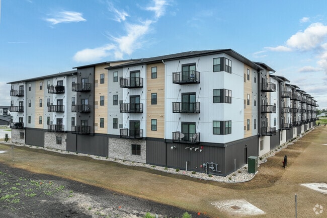
Property Record
5624 Tillstone Dr S, Fargo, ND 58104


NEARBY LISTINGS FOR SALE OR LEASE
Property Detail
5624 Tillstone Dr S
Other Market Areas
District Of Fargo Fourth Addition
Fargo, ND-MN
LOT: 3 BLOCK: 2 ADDITION: THE DISTRICT OF FARGO 4TH ADDITION ADDITIONAL: THE DISTRICT OF FARGO 4TH ADDN LT 3 BLK 2 **5-24-22
01-8810-00700-000
Cass
Commercialacreage
North Dakota
2024
3
2024
Fargo
040509
DEMOGRAPHICS near 5624 Tillstone Dr S
1 Mile
3 Mile
5 Mile
2024 Total Population
4,749
53,456
129,647
2029 Population
5,183
57,542
138,944
Pop Growth 2024-2029
+ 9.14%
+ 7.64%
+ 7.17%
Average Age
34
35
35
2024 Total Households
1,992
21,796
54,697
HH Growth 2024-2029
+ 9.89%
+ 8.11%
+ 7.56%
Median Household Inc
$76,239
$79,426
$72,026
Avg Household Size
2.40
2.40
2.30
2024 Avg HH Vehicles
2.00
2.00
2.00
Median Home Value
$333,544
$311,959
$286,816
Median Year Built
2010
2007
2001
Nearby Places
Map Layers
Map Styles
 Street
 Aerial
- Restaurants
- Banks
- Shops
- Fitness
- Groceries
PUBLIC TRANSPORTATION
COMMUTER RAIL
Fargo Amtrak Station (Empire Builder - Amtrak)
DRIVE
WALK
Distance
Fargo Amtrak Station (Empire Builder - Amtrak)
16 min
9.2 mi
AIRPORT
Hector International
DRIVE
WALK
Distance
Hector International
19 min
11.5 mi
Freight Ports
Port Milwaukee
DRIVE
WALK
Distance
Port Milwaukee
633 min
577.0 mi
Nearby Properties
Address
Land Use
TOTAL SIZE
Lot Size
Zoning
Address
Land Use
TOTAL SIZE
Lot Size
Zoning
161,184 SF
10.51 AC
GC
Address
Land Use
TOTAL SIZE
Lot Size
Zoning
55.68 AC
Address
Land Use
TOTAL SIZE
Lot Size
Zoning
Address
Land Use
TOTAL SIZE
Lot Size
Zoning
Address
Land Use
TOTAL SIZE
Lot Size
Zoning
7.66 AC
Address
Land Use
TOTAL SIZE
Lot Size
Zoning
Address
Land Use
TOTAL SIZE
Lot Size
Zoning
Address
Land Use
TOTAL SIZE
Lot Size
Zoning
Address
Land Use
TOTAL SIZE
Lot Size
Zoning
64,653 SF
2.20 AC
MR3
Address
Land Use
TOTAL SIZE
Lot Size
Zoning
Address
Land Use
TOTAL SIZE
Lot Size
Zoning
9,279 SF
8.33 AC
MR1
Address
Land Use
TOTAL SIZE
Lot Size
Zoning
30,240 SF
1.54 AC
MR2
Address
Land Use
TOTAL SIZE
Lot Size
Zoning
Address
Land Use
TOTAL SIZE
Lot Size
Zoning
217,776 SF
31.82 AC
GC
Address
Land Use
TOTAL SIZE
Lot Size
Zoning
Address
Land Use
TOTAL SIZE
Lot Size
Zoning
73,907 SF
3.41 AC
MR3
Address
Land Use
TOTAL SIZE
Lot Size
Zoning
152,918 SF
5.38 AC
Address
Land Use
TOTAL SIZE
Lot Size
Zoning
122,201 SF
8.92 AC
GO
Address
Land Use
TOTAL SIZE
Lot Size
Zoning
191,151 SF
22.98 AC
LC
Address
Land Use
TOTAL SIZE
Lot Size
Zoning
54,927 SF
8.45 AC
Address
Land Use
TOTAL SIZE
Lot Size
Zoning
123,777 SF
1.90 AC
Address
Land Use
TOTAL SIZE
Lot Size
Zoning
387,326 SF
16.51 AC
GC
Address
Land Use
TOTAL SIZE
Lot Size
Zoning
Address
Land Use
TOTAL SIZE
Lot Size
Zoning
88,956 SF
10.56 AC
GO
Address
Land Use
TOTAL SIZE
Lot Size
Zoning
160,913 SF
11.46 AC
GC
Address
Land Use
TOTAL SIZE
Lot Size
Zoning
Address
Land Use
TOTAL SIZE
Lot Size
Zoning
7.18 AC
Address
Land Use
TOTAL SIZE
Lot Size
Zoning
42,476 SF
2.07 AC
MR1
Address
Land Use
TOTAL SIZE
Lot Size
Zoning
3.72 AC
Address
Land Use
TOTAL SIZE
Lot Size
Zoning
7.56 AC
The World's #1 Commercial Real Estate Marketplace
Connect with us
© 2026 CoStar Group
The information above has been obtained from sources believed reliable. While we do not doubt its accuracy we have not verified it and make no guarantee, warranty or representation about it. It is your responsibility to independently confirm its accuracy and completeness. Any projections, opinions, assumptions, or estimates used are for example only and do not represent the current or future performance of the property. The value of this transaction to you depends on tax and other factors which should be evaluated by your tax, financial, and legal advisors. You and your advisors should conduct a careful, independent investigation of the property to determine to your satisfaction the suitability of the property for your needs.