Property Record
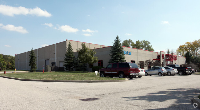
5625 Decatur Blvd, Indianapolis, IN 46241


NEARBY LISTINGS FOR SALE OR LEASE
Property Detail
5625 Decatur Blvd
49-13-03-103-002.000-200
PT SE1/4 S3 T14 R2 526.77 S OF NE COR P.O.B. S418.74 W568.82 NW90.37 NW179.39 W188.15 N355 E1015 TO BEG 9.30AC
Lightindustrial
Marion
X
Indiana
18097C0220F
9.30 AC
2023
Airport
2024
Indianapolis
390802
Indianapolis-Carmel-Greenwood, IN
24,873 SF
DEMOGRAPHICS near 5625 Decatur Blvd
1 Mile
3 Mile
5 Mile
2024 Total Population
2,865
24,050
77,529
2029 Population
2,800
23,654
78,477
Pop Growth 2024-2029
(2.27%)
(1.65%)
+ 1.22%
Average Age
35
35
36
2024 Total Households
1,045
8,553
28,314
HH Growth 2024-2029
(2.39%)
(1.71%)
+ 1.42%
Median Household Inc
$76,625
$71,269
$67,002
Avg Household Size
2.70
2.70
2.70
2024 Avg HH Vehicles
2.00
2.00
2.00
Median Home Value
$177,834
$168,656
$164,576
Median Year Built
1998
1992
1990
Nearby Places
Map Layers
Map Styles
 Street
 Aerial
- Restaurants
- Banks
- Shops
- Fitness
- Groceries
PUBLIC TRANSPORTATION
COMMUTER RAIL
DRIVE
WALK
Distance
18 min
9.7 mi
AIRPORT
Indianapolis International
DRIVE
WALK
Distance
Indianapolis International
14 min
5.4 mi
SALE & LEASE HISTORY
LISTING DATE
SALE/LEASE

Mar 30, 2021
For Lease
Jun 17, 2021
For Sale
Apr 01, 2021
For Lease
Nearby Properties
Address
Land Use
TOTAL SIZE
Lot Size
Zoning
Address
Land Use
TOTAL SIZE
Lot Size
Zoning
911,062 SF
54.40 AC
ZO01
Address
Land Use
TOTAL SIZE
Lot Size
Zoning
41.50 AC
Address
Land Use
TOTAL SIZE
Lot Size
Zoning
822,500 SF
45.66 AC
Address
Land Use
TOTAL SIZE
Lot Size
Zoning
770,712 SF
56.53 AC
Address
Land Use
TOTAL SIZE
Lot Size
Zoning
747,256 SF
41.32 AC
Address
Land Use
TOTAL SIZE
Lot Size
Zoning
665,724 SF
47.25 AC
ZO01
Address
Land Use
TOTAL SIZE
Lot Size
Zoning
798,160 SF
44.46 AC
ZO01
Address
Land Use
TOTAL SIZE
Lot Size
Zoning
997,763 SF
65.80 AC
ZO01
Address
Land Use
TOTAL SIZE
Lot Size
Zoning
292,315 SF
28.97 AC
Address
Land Use
TOTAL SIZE
Lot Size
Zoning
695,702 SF
39.68 AC
ZO03
Address
Land Use
TOTAL SIZE
Lot Size
Zoning
462,275 SF
25.83 AC
ZO01
Address
Land Use
TOTAL SIZE
Lot Size
Zoning
7,028 SF
25.48 AC
ZO01
Address
Land Use
TOTAL SIZE
Lot Size
Zoning
434,240 SF
26.25 AC
ZO01
Address
Land Use
TOTAL SIZE
Lot Size
Zoning
442,201 SF
21.48 AC
Address
Land Use
TOTAL SIZE
Lot Size
Zoning
297,040 SF
22.26 AC
Address
Land Use
TOTAL SIZE
Lot Size
Zoning
383,727 SF
25.26 AC
Address
Land Use
TOTAL SIZE
Lot Size
Zoning
423,757 SF
28.71 AC
Address
Land Use
TOTAL SIZE
Lot Size
Zoning
465,480 SF
34.07 AC
Address
Land Use
TOTAL SIZE
Lot Size
Zoning
23.17 AC
Address
Land Use
TOTAL SIZE
Lot Size
Zoning
328,331 SF
39.63 AC
ZO01
Address
Land Use
TOTAL SIZE
Lot Size
Zoning
380,155 SF
17.02 AC
Address
Land Use
TOTAL SIZE
Lot Size
Zoning
3,394 SF
25.27 AC
ZO01
Address
Land Use
TOTAL SIZE
Lot Size
Zoning
340,080 SF
16.82 AC
Address
Land Use
TOTAL SIZE
Lot Size
Zoning
262,710 SF
19.50 AC
Address
Land Use
TOTAL SIZE
Lot Size
Zoning
315,000 SF
20.21 AC
Address
Land Use
TOTAL SIZE
Lot Size
Zoning
14.31 AC
Address
Land Use
TOTAL SIZE
Lot Size
Zoning
228,839 SF
27.60 AC
ZO01
Address
Land Use
TOTAL SIZE
Lot Size
Zoning
12,880 SF
42.54 AC
ZO01
Address
Land Use
TOTAL SIZE
Lot Size
Zoning
9.33 AC
Address
Land Use
TOTAL SIZE
Lot Size
Zoning
264,960 SF
16.85 AC
ZO01
The World's #1 Commercial Real Estate Marketplace
Connect with us
© 2026 CoStar Group
The information above has been obtained from sources believed reliable. While we do not doubt its accuracy we have not verified it and make no guarantee, warranty or representation about it. It is your responsibility to independently confirm its accuracy and completeness. Any projections, opinions, assumptions, or estimates used are for example only and do not represent the current or future performance of the property. The value of this transaction to you depends on tax and other factors which should be evaluated by your tax, financial, and legal advisors. You and your advisors should conduct a careful, independent investigation of the property to determine to your satisfaction the suitability of the property for your needs.