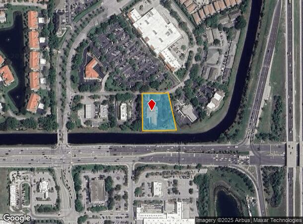
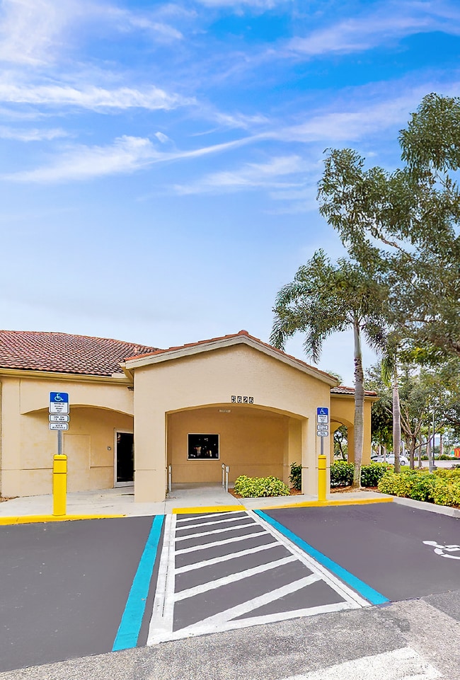
Property Record
5626 Tavilla Cir, Naples, FL 34110
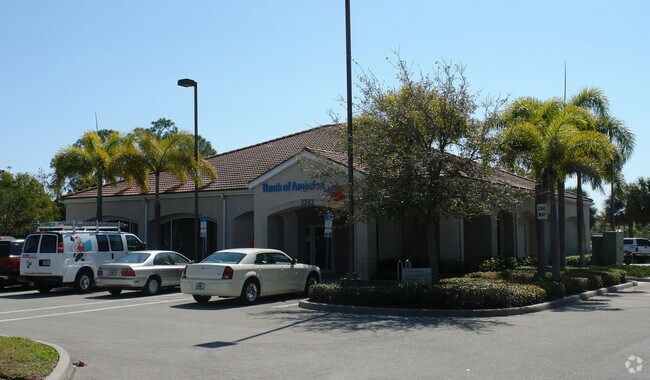
This Property Is For Sale
NEARBY LISTINGS FOR SALE OR LEASE
Property Detail
5626 Tavilla Cir
Naples-Immokalee-Marco Island, FL
Pelican Strand
66679700885
PELICAN STRAND LOT G3
Financialbuilding
Collier
X
Florida
12021C0213H
g3
2024
1.27 AC
2025
North Naples
011213
Southwest Florida
3,840 SF
DEMOGRAPHICS near 5626 Tavilla Cir
1 Mile
3 Mile
5 Mile
2024 Total Population
7,656
50,026
134,286
2029 Population
8,643
56,311
153,832
Pop Growth 2024-2029
+ 12.89%
+ 12.56%
+ 14.56%
Average Age
50
50
51
2024 Total Households
3,649
22,056
59,586
HH Growth 2024-2029
+ 12.52%
+ 12.23%
+ 14.27%
Median Household Inc
$62,621
$84,360
$85,961
Avg Household Size
2.00
2.20
2.20
2024 Avg HH Vehicles
1.00
2.00
2.00
Median Home Value
$382,395
$477,205
$479,533
Median Year Built
2000
2000
1999
Nearby Places
- Restaurants
- Banks
- Shops
- Fitness
- Groceries
PUBLIC TRANSPORTATION
AIRPORT
Southwest Florida International
DRIVE
WALK
Distance
Southwest Florida International
32 min
23.7 mi
Freight Ports
Port Everglades
DRIVE
WALK
Distance
Port Everglades
124 min
110.4 mi
Nearby Properties
Address
Land Use
TOTAL SIZE
Lot Size
Zoning
Address
Land Use
TOTAL SIZE
Lot Size
Zoning
688,632 SF
29.28 AC
A
Address
Land Use
TOTAL SIZE
Lot Size
Zoning
377,883 SF
20.34 AC
PUD
Address
Land Use
TOTAL SIZE
Lot Size
Zoning
906,730 SF
7.86 AC
Address
Land Use
TOTAL SIZE
Lot Size
Zoning
325,993 SF
35.92 AC
A
Address
Land Use
TOTAL SIZE
Lot Size
Zoning
463,985 SF
28.48 AC
Address
Land Use
TOTAL SIZE
Lot Size
Zoning
216,788 SF
85.21 AC
PUD
Address
Land Use
TOTAL SIZE
Lot Size
Zoning
110,908 SF
210.45 AC
A
Address
Land Use
TOTAL SIZE
Lot Size
Zoning
413,313 SF
48.48 AC
PUD
Address
Land Use
TOTAL SIZE
Lot Size
Zoning
376,493 SF
65.03 AC
RSF-3
Address
Land Use
TOTAL SIZE
Lot Size
Zoning
353,756 SF
23.26 AC
ROAD
Address
Land Use
TOTAL SIZE
Lot Size
Zoning
292,967 SF
13.12 AC
PUD
Address
Land Use
TOTAL SIZE
Lot Size
Zoning
426,074 SF
23.25 AC
PUD
Address
Land Use
TOTAL SIZE
Lot Size
Zoning
87,499 SF
4.36 AC
Address
Land Use
TOTAL SIZE
Lot Size
Zoning
174,770 SF
3.65 AC
PUD
Address
Land Use
TOTAL SIZE
Lot Size
Zoning
192,347 SF
7.84 AC
PUD
Address
Land Use
TOTAL SIZE
Lot Size
Zoning
174,365 SF
18.56 AC
PUD
Address
Land Use
TOTAL SIZE
Lot Size
Zoning
188,741 SF
9.04 AC
A
Address
Land Use
TOTAL SIZE
Lot Size
Zoning
128,681 SF
49.55 AC
A
Address
Land Use
TOTAL SIZE
Lot Size
Zoning
223,844 SF
27.55 AC
PUD
Address
Land Use
TOTAL SIZE
Lot Size
Zoning
329,031 SF
20 AC
A
Address
Land Use
TOTAL SIZE
Lot Size
Zoning
106,929 SF
23.05 AC
A
Address
Land Use
TOTAL SIZE
Lot Size
Zoning
104,317 SF
20 AC
PUD
Address
Land Use
TOTAL SIZE
Lot Size
Zoning
145,881 SF
142.48 AC
PUD
Address
Land Use
TOTAL SIZE
Lot Size
Zoning
86,254 SF
18.57 AC
A
Address
Land Use
TOTAL SIZE
Lot Size
Zoning
209,373 SF
23.76 AC
PUD
Address
Land Use
TOTAL SIZE
Lot Size
Zoning
52,370 SF
7.82 AC
PUD
Address
Land Use
TOTAL SIZE
Lot Size
Zoning
175,337 SF
14.61 AC
MPUD
Address
Land Use
TOTAL SIZE
Lot Size
Zoning
75,307 SF
2.49 AC
Address
Land Use
TOTAL SIZE
Lot Size
Zoning
81,202 SF
183.18 AC
GC
Address
Land Use
TOTAL SIZE
Lot Size
Zoning
52,150 SF
136.13 AC
PUD
The World's #1 Commercial Real Estate Marketplace
Connect with us
© 2025 CoStar Group
The information above has been obtained from sources believed reliable. While we do not doubt its accuracy we have not verified it and make no guarantee, warranty or representation about it. It is your responsibility to independently confirm its accuracy and completeness. Any projections, opinions, assumptions, or estimates used are for example only and do not represent the current or future performance of the property. The value of this transaction to you depends on tax and other factors which should be evaluated by your tax, financial, and legal advisors. You and your advisors should conduct a careful, independent investigation of the property to determine to your satisfaction the suitability of the property for your needs.