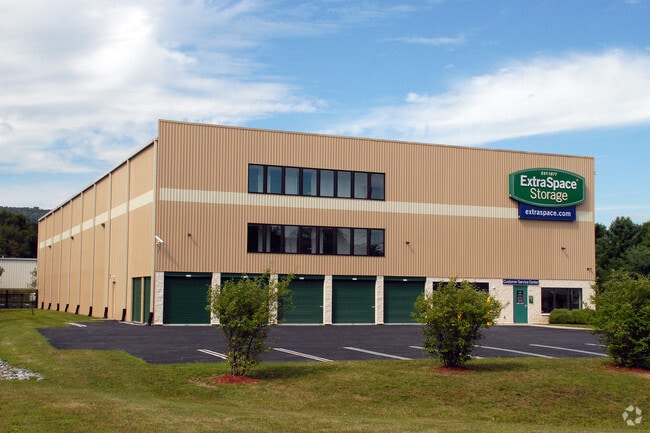
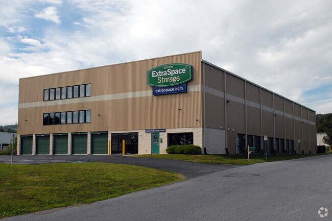
Property Record
5630 Linglestown Rd, Harrisburg, PA 17112

NEARBY LISTINGS FOR SALE OR LEASE
-
-
View all Harrisburg listings for sale on LoopNet.com
Property Detail
5630 Linglestown Rd
35-015-004
Blue Mountain Place
Warehouse
Dauphin
X
Pennsylvania
42043C0335D
1.40 AC
2025
Harrisburg Area East
2025
Philadelphia
022501
Harrisburg-Carlisle, PA
48,285 SF
DEMOGRAPHICS near 5630 Linglestown Rd
1 Mile
3 Mile
5 Mile
2024 Total Population
5,223
35,614
93,539
2029 Population
5,302
36,486
95,620
Pop Growth 2024-2029
+ 1.51%
+ 2.45%
+ 2.22%
Average Age
43
42
42
2024 Total Households
2,004
14,524
38,436
HH Growth 2024-2029
+ 1.65%
+ 2.53%
+ 2.32%
Median Household Inc
$105,188
$85,306
$80,520
Avg Household Size
2.60
2.40
2.40
2024 Avg HH Vehicles
2.00
2.00
2.00
Median Home Value
$266,850
$245,137
$234,247
Median Year Built
1985
1983
1979
Nearby Places
Map Layers
Map Styles
 Street
 Aerial
- Restaurants
- Banks
- Shops
- Fitness
- Groceries
PUBLIC TRANSPORTATION
COMMUTER RAIL
Harrisburg (Keystone Service - Amtrak, Pennsylvanian - Amtrak)
DRIVE
WALK
Distance
Harrisburg (Keystone Service - Amtrak, Pennsylvanian - Amtrak)
17 min
8.6 mi
AIRPORT
Harrisburg International
DRIVE
WALK
Distance
Harrisburg International
24 min
14.5 mi
Freight Ports
Port of Baltimore
DRIVE
WALK
Distance
Port of Baltimore
124 min
88.8 mi
Nearby Properties
Address
Land Use
TOTAL SIZE
Lot Size
Zoning
Address
Land Use
TOTAL SIZE
Lot Size
Zoning
2,856 SF
103 AC
Address
Land Use
TOTAL SIZE
Lot Size
Zoning
130,542 SF
28.94 AC
Address
Land Use
TOTAL SIZE
Lot Size
Zoning
2,129 SF
19.90 AC
Address
Land Use
TOTAL SIZE
Lot Size
Zoning
82,881 SF
16.90 AC
Address
Land Use
TOTAL SIZE
Lot Size
Zoning
2,823 SF
36.87 AC
Address
Land Use
TOTAL SIZE
Lot Size
Zoning
9.88 AC
Address
Land Use
TOTAL SIZE
Lot Size
Zoning
199,920 SF
16.67 AC
Address
Land Use
TOTAL SIZE
Lot Size
Zoning
24.77 AC
Address
Land Use
TOTAL SIZE
Lot Size
Zoning
880 SF
18.68 AC
Address
Land Use
TOTAL SIZE
Lot Size
Zoning
1,920 SF
38.44 AC
Address
Land Use
TOTAL SIZE
Lot Size
Zoning
11,928 SF
8.40 AC
Address
Land Use
TOTAL SIZE
Lot Size
Zoning
7,264 SF
13.84 AC
Address
Land Use
TOTAL SIZE
Lot Size
Zoning
64,329 SF
14.70 AC
Address
Land Use
TOTAL SIZE
Lot Size
Zoning
78,519 SF
48.60 AC
Address
Land Use
TOTAL SIZE
Lot Size
Zoning
371,502 SF
29.96 AC
Address
Land Use
TOTAL SIZE
Lot Size
Zoning
10,044 SF
12.94 AC
Address
Land Use
TOTAL SIZE
Lot Size
Zoning
8,230 SF
7.82 AC
Address
Land Use
TOTAL SIZE
Lot Size
Zoning
0.15 AC
Address
Land Use
TOTAL SIZE
Lot Size
Zoning
42,030 SF
10.29 AC
Address
Land Use
TOTAL SIZE
Lot Size
Zoning
54,630 SF
9.02 AC
Address
Land Use
TOTAL SIZE
Lot Size
Zoning
84,210 SF
14.90 AC
Address
Land Use
TOTAL SIZE
Lot Size
Zoning
72,474 SF
18 AC
Address
Land Use
TOTAL SIZE
Lot Size
Zoning
109,600 SF
11.13 AC
Address
Land Use
TOTAL SIZE
Lot Size
Zoning
16,872 SF
7.29 AC
Address
Land Use
TOTAL SIZE
Lot Size
Zoning
148,690 SF
16.03 AC
Address
Land Use
TOTAL SIZE
Lot Size
Zoning
89,040 SF
6.96 AC
Address
Land Use
TOTAL SIZE
Lot Size
Zoning
8,552 SF
14.04 AC
Address
Land Use
TOTAL SIZE
Lot Size
Zoning
207,116 SF
10.62 AC
Address
Land Use
TOTAL SIZE
Lot Size
Zoning
56,297 SF
5.70 AC
Address
Land Use
TOTAL SIZE
Lot Size
Zoning
26,552 SF
8.74 AC
The World's #1 Commercial Real Estate Marketplace
Connect with us
© 2026 CoStar Group
The information above has been obtained from sources believed reliable. While we do not doubt its accuracy we have not verified it and make no guarantee, warranty or representation about it. It is your responsibility to independently confirm its accuracy and completeness. Any projections, opinions, assumptions, or estimates used are for example only and do not represent the current or future performance of the property. The value of this transaction to you depends on tax and other factors which should be evaluated by your tax, financial, and legal advisors. You and your advisors should conduct a careful, independent investigation of the property to determine to your satisfaction the suitability of the property for your needs.