Property Record
5630 N Cloverdale Rd, Boise, ID 83713
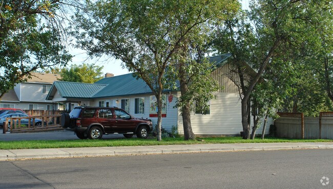


Property Detail
5630 N Cloverdale Rd
R6669270031
PORTION LOT 3
Commercialbuilding
Ada
R-1C
Idaho
B and X Area of moderate flood hazard, usually the area between the limits of the 100-year and 500-year floods.
03
2024
0.32 AC
2025
West Boise
002417
Boise City/Nampa
2,960 SF
Boise City, ID
NEARBY LISTINGS FOR SALE OR LEASE
DEMOGRAPHICS near 5630 N Cloverdale Rd
1 mile
3 mile
5 mile
2024 Total Population
9,582
96,292
226,299
2029 Population
9,969
100,679
236,681
Pop Growth 2024-2029
+ 4.04%
+ 4.56%
+ 4.59%
Average Age
42
42
41
2024 Total Households
3,366
36,950
86,887
HH Growth 2024-2029
+ 4.46%
+ 5.05%
+ 5.03%
Median Household Inc
$100,987
$93,211
$89,249
Avg Household Size
2.80
2.50
2.50
2024 Avg HH Vehicles
2.00
2.00
2.00
Median Home Value
$549,208
$498,913
$499,743
Median Year Built
1994
1998
1997
Nearby Places
Map Layers
Map Styles
 Street
 Aerial
Transit
 Traffic
 Biking
Places
Listings with unknown addresses are not visible on the map
- Restaurants
- Banks
- Shops
- Fitness
- Groceries
PUBLIC TRANSPORTATION
AIRPORT
Boise Air Trml/Gowen Field
Drive
Walk
Distance
Boise Air Trml/Gowen Field
24 min
14.6 mi
Nearby Properties
Address
Land Use
TOTAL SIZE
Lot Size
Zoning
Address
Land Use
TOTAL SIZE
Lot Size
Zoning
533,727 SF
22.89 AC
C-G
Address
Land Use
TOTAL SIZE
Lot Size
Zoning
789,114 SF
11.38 AC
C-G
Address
Land Use
TOTAL SIZE
Lot Size
Zoning
386,225 SF
13.46 AC
C-4D/DA
Address
Land Use
TOTAL SIZE
Lot Size
Zoning
334,124 SF
11.21 AC
R-3D
Address
Land Use
TOTAL SIZE
Lot Size
Zoning
301,800 SF
12.70 AC
R-3D
Address
Land Use
TOTAL SIZE
Lot Size
Zoning
305,889 SF
9.91 AC
R-40
Address
Land Use
TOTAL SIZE
Lot Size
Zoning
310,580 SF
2.44 AC
C-G
Address
Land Use
TOTAL SIZE
Lot Size
Zoning
203,377 SF
21.13 AC
C-G
Address
Land Use
TOTAL SIZE
Lot Size
Zoning
239,991 SF
8.09 AC
MU-DA
Address
Land Use
TOTAL SIZE
Lot Size
Zoning
230,810 SF
20.09 AC
C-G
Address
Land Use
TOTAL SIZE
Lot Size
Zoning
216,950 SF
9.03 AC
R-3D
Address
Land Use
TOTAL SIZE
Lot Size
Zoning
167,416 SF
18.57 AC
C-G
Address
Land Use
TOTAL SIZE
Lot Size
Zoning
150,584 SF
6.77 AC
M
Address
Land Use
TOTAL SIZE
Lot Size
Zoning
203,635 SF
4.76 AC
L-OD
Address
Land Use
TOTAL SIZE
Lot Size
Zoning
167,603 SF
6.60 AC
C-2DA
Address
Land Use
TOTAL SIZE
Lot Size
Zoning
98,738 SF
4.25 AC
CBD
Address
Land Use
TOTAL SIZE
Lot Size
Zoning
138,828 SF
4.22 AC
C-1D
Address
Land Use
TOTAL SIZE
Lot Size
Zoning
116,192 SF
7.14 AC
R-40
Address
Land Use
TOTAL SIZE
Lot Size
Zoning
106,397 SF
11.30 AC
C-G
Address
Land Use
TOTAL SIZE
Lot Size
Zoning
151,365 SF
12.03 AC
T-1D
Address
Land Use
TOTAL SIZE
Lot Size
Zoning
127,136 SF
7.59 AC
R-3D
Address
Land Use
TOTAL SIZE
Lot Size
Zoning
129,827 SF
3.08 AC
MU-DA
Address
Land Use
TOTAL SIZE
Lot Size
Zoning
124,286 SF
5 AC
R-3
Address
Land Use
TOTAL SIZE
Lot Size
Zoning
130,060 SF
3.42 AC
C-G
Address
Land Use
TOTAL SIZE
Lot Size
Zoning
102,272 SF
7.18 AC
R-20
Address
Land Use
TOTAL SIZE
Lot Size
Zoning
152,123 SF
6 AC
MU-DA
Address
Land Use
TOTAL SIZE
Lot Size
Zoning
69,546 SF
4.26 AC
MU-DA
Address
Land Use
TOTAL SIZE
Lot Size
Zoning
65,034 SF
4.44 AC
MU-DA
Address
Land Use
TOTAL SIZE
Lot Size
Zoning
89,693 SF
2.43 AC
R-3D
Address
Land Use
TOTAL SIZE
Lot Size
Zoning
204,033 SF
12.88 AC
C-1
The World's #1 Commercial Real Estate Marketplace
Connect with us
© 2026 CoStar Group
The information above has been obtained from sources believed reliable. While we do not doubt its accuracy we have not verified it and make no guarantee, warranty or representation about it. It is your responsibility to independently confirm its accuracy and completeness. Any projections, opinions, assumptions, or estimates used are for example only and do not represent the current or future performance of the property. The value of this transaction to you depends on tax and other factors which should be evaluated by your tax, financial, and legal advisors. You and your advisors should conduct a careful, independent investigation of the property to determine to your satisfaction the suitability of the property for your needs.