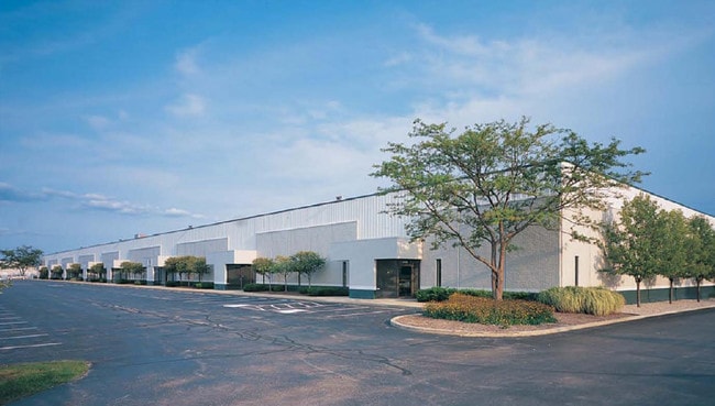
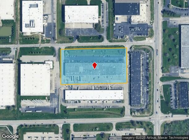
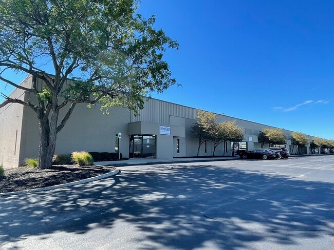
Property Record
5635 W 80Th St, Indianapolis, IN 46278
Current Lease Availabilities
NEARBY LISTINGS FOR SALE OR LEASE
Property Detail
5635 W 80Th St
49-04-23-106-013.000-600
PT SE1/4 S23 T17 R2 BEG 288.72 W & 355 N OF SE COR P.O.B. W639.32 N339.53 E638.70 S351.79 TO BEG (BLDG 25)
Warehouse
Marion
X
Indiana
18097C0020F
5.07 AC
2023
Park 100
2024
Indianapolis
310105
Indianapolis-Carmel-Anderson, IN
68,601 SF
DEMOGRAPHICS near 5635 W 80Th St
1 Mile
3 Mile
5 Mile
2024 Total Population
593
36,419
132,893
2029 Population
578
35,932
134,103
Pop Growth 2024-2029
(2.53%)
(1.34%)
+ 0.91%
Average Age
44
39
39
2024 Total Households
228
15,035
54,313
HH Growth 2024-2029
(2.63%)
(1.32%)
+ 0.56%
Median Household Inc
$145,192
$70,030
$70,268
Avg Household Size
2.50
2.40
2.40
2024 Avg HH Vehicles
2.00
2.00
2.00
Median Home Value
$452,499
$211,497
$245,282
Median Year Built
1982
1989
1986
Nearby Places
- Restaurants
- Banks
- Shops
- Fitness
- Groceries
PUBLIC TRANSPORTATION
AIRPORT
Indianapolis International
DRIVE
WALK
Distance
Indianapolis International
35 min
19.4 mi
Nearby Properties
Address
Land Use
TOTAL SIZE
Lot Size
Zoning
Address
Land Use
TOTAL SIZE
Lot Size
Zoning
278,637 SF
43.98 AC
ZO01
Address
Land Use
TOTAL SIZE
Lot Size
Zoning
18,569 SF
9.57 AC
ZO01
Address
Land Use
TOTAL SIZE
Lot Size
Zoning
10,380 SF
24 AC
ZO01
Address
Land Use
TOTAL SIZE
Lot Size
Zoning
168,710 SF
5.24 AC
ZO01
Address
Land Use
TOTAL SIZE
Lot Size
Zoning
68,990 SF
188.21 AC
ZO01
Address
Land Use
TOTAL SIZE
Lot Size
Zoning
1,904 SF
45.69 AC
ZO01
Address
Land Use
TOTAL SIZE
Lot Size
Zoning
204,544 SF
12.80 AC
ZO01
Address
Land Use
TOTAL SIZE
Lot Size
Zoning
301,907 SF
43.90 AC
ZO01
Address
Land Use
TOTAL SIZE
Lot Size
Zoning
521,092 SF
23.46 AC
ZO01
Address
Land Use
TOTAL SIZE
Lot Size
Zoning
512,730 SF
21.80 AC
ZO01
Address
Land Use
TOTAL SIZE
Lot Size
Zoning
742,342 SF
27.69 AC
ZO01
Address
Land Use
TOTAL SIZE
Lot Size
Zoning
110,373 SF
47.98 AC
ZO01
Address
Land Use
TOTAL SIZE
Lot Size
Zoning
179,586 SF
10.23 AC
ZO01
Address
Land Use
TOTAL SIZE
Lot Size
Zoning
405 SF
44.54 AC
ZO01
Address
Land Use
TOTAL SIZE
Lot Size
Zoning
89,704 SF
28.63 AC
ZO01
Address
Land Use
TOTAL SIZE
Lot Size
Zoning
158,292 SF
7.88 AC
ZO01
Address
Land Use
TOTAL SIZE
Lot Size
Zoning
9,139 SF
13 AC
ZO01
Address
Land Use
TOTAL SIZE
Lot Size
Zoning
3,750 SF
22.29 AC
ZO01
Address
Land Use
TOTAL SIZE
Lot Size
Zoning
17,780 SF
18.99 AC
ZO01
Address
Land Use
TOTAL SIZE
Lot Size
Zoning
106,474 SF
10.93 AC
ZO01
Address
Land Use
TOTAL SIZE
Lot Size
Zoning
2,703 SF
17.50 AC
ZO01
Address
Land Use
TOTAL SIZE
Lot Size
Zoning
143,992 SF
9.29 AC
ZO01
Address
Land Use
TOTAL SIZE
Lot Size
Zoning
2,958 SF
18.42 AC
ZO01
Address
Land Use
TOTAL SIZE
Lot Size
Zoning
458,000 SF
23.07 AC
ZO01
Address
Land Use
TOTAL SIZE
Lot Size
Zoning
370,962 SF
17.91 AC
ZO01
Address
Land Use
TOTAL SIZE
Lot Size
Zoning
463,506 SF
18.59 AC
ZO01
Address
Land Use
TOTAL SIZE
Lot Size
Zoning
3,339 SF
17.56 AC
ZO01
Address
Land Use
TOTAL SIZE
Lot Size
Zoning
312,690 SF
15.16 AC
ZO01
Address
Land Use
TOTAL SIZE
Lot Size
Zoning
146,899 SF
8.72 AC
ZO01
Address
Land Use
TOTAL SIZE
Lot Size
Zoning
155,187 SF
10.45 AC
ZO01
The World's #1 Commercial Real Estate Marketplace
Connect with us
© 2025 CoStar Group
The information above has been obtained from sources believed reliable. While we do not doubt its accuracy we have not verified it and make no guarantee, warranty or representation about it. It is your responsibility to independently confirm its accuracy and completeness. Any projections, opinions, assumptions, or estimates used are for example only and do not represent the current or future performance of the property. The value of this transaction to you depends on tax and other factors which should be evaluated by your tax, financial, and legal advisors. You and your advisors should conduct a careful, independent investigation of the property to determine to your satisfaction the suitability of the property for your needs.