Property Record
564 Us 1 Hwy, Youngsville, NC 27596


NEARBY LISTINGS FOR SALE OR LEASE
-
-
View all Youngsville listings for sale on LoopNet.com
Property Detail
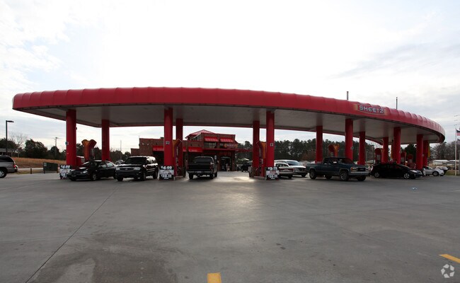
564 Us 1 Hwy
005859
Sheetz
Conveniencestore
Franklin
X
North Carolina
3720184200M
2.31 AC
2025
Franklin County
2025
Raleigh/Durham
060501
Raleigh, NC
5,715 SF
DEMOGRAPHICS near 564 Us 1 Hwy
1 Mile
3 Mile
5 Mile
2024 Total Population
2,417
25,813
66,380
2029 Population
2,948
30,015
75,810
Pop Growth 2024-2029
+ 21.97%
+ 16.28%
+ 14.21%
Average Age
37
40
40
2024 Total Households
813
9,434
24,441
HH Growth 2024-2029
+ 21.89%
+ 16.38%
+ 14.20%
Median Household Inc
$97,401
$93,589
$100,538
Avg Household Size
3.00
2.70
2.70
2024 Avg HH Vehicles
2.00
2.00
2.00
Median Home Value
$262,087
$339,305
$354,660
Median Year Built
2004
2001
2004
Nearby Places
Map Layers
Map Styles
 Street
 Aerial
- Restaurants
- Banks
- Shops
- Fitness
- Groceries
PUBLIC TRANSPORTATION
AIRPORT
Raleigh-Durham International
DRIVE
WALK
Distance
Raleigh-Durham International
37 min
24.5 mi
Nearby Properties
Address
Land Use
TOTAL SIZE
Lot Size
Zoning
Address
Land Use
TOTAL SIZE
Lot Size
Zoning
442,480 SF
52.02 AC
GR3
Address
Land Use
TOTAL SIZE
Lot Size
Zoning
283,795 SF
31.33 AC
ICD
Address
Land Use
TOTAL SIZE
Lot Size
Zoning
159,584 SF
67.12 AC
FCO GB
Address
Land Use
TOTAL SIZE
Lot Size
Zoning
136,644 SF
4.38 AC
RMX
Address
Land Use
TOTAL SIZE
Lot Size
Zoning
97,878 SF
26.85 AC
GR5
Address
Land Use
TOTAL SIZE
Lot Size
Zoning
216,580 SF
14.99 AC
FCO GB
Address
Land Use
TOTAL SIZE
Lot Size
Zoning
170,100 SF
15.41 AC
FCO GB
Address
Land Use
TOTAL SIZE
Lot Size
Zoning
91,233 SF
11.04 AC
GR10
Address
Land Use
TOTAL SIZE
Lot Size
Zoning
20,981 SF
30.74 AC
FCO GB
Address
Land Use
TOTAL SIZE
Lot Size
Zoning
103,310 SF
6.29 AC
RMX
Address
Land Use
TOTAL SIZE
Lot Size
Zoning
117,680 SF
11.99 AC
GR10
Address
Land Use
TOTAL SIZE
Lot Size
Zoning
364,500 SF
30.25 AC
IND
Address
Land Use
TOTAL SIZE
Lot Size
Zoning
77,343 SF
14.12 AC
GR5
Address
Land Use
TOTAL SIZE
Lot Size
Zoning
117,037 SF
13.88 AC
GR10
Address
Land Use
TOTAL SIZE
Lot Size
Zoning
105,912 SF
8.44 AC
GR10
Address
Land Use
TOTAL SIZE
Lot Size
Zoning
92,980 SF
145.72 AC
RMX
Address
Land Use
TOTAL SIZE
Lot Size
Zoning
81,604 SF
17.53 AC
CIVIC
Address
Land Use
TOTAL SIZE
Lot Size
Zoning
65,837 SF
30 AC
M U
Address
Land Use
TOTAL SIZE
Lot Size
Zoning
68,189 SF
8.46 AC
HB
Address
Land Use
TOTAL SIZE
Lot Size
Zoning
148,249 SF
8.45 AC
L I
Address
Land Use
TOTAL SIZE
Lot Size
Zoning
28,756 SF
100.63 AC
FCO GB
Address
Land Use
TOTAL SIZE
Lot Size
Zoning
34,176 SF
12.93 AC
CU-1
Address
Land Use
TOTAL SIZE
Lot Size
Zoning
112,694 SF
6.85 AC
M U
Address
Land Use
TOTAL SIZE
Lot Size
Zoning
73,722 SF
23.98 AC
IND
Address
Land Use
TOTAL SIZE
Lot Size
Zoning
880 SF
88.02 AC
MU-2
Address
Land Use
TOTAL SIZE
Lot Size
Zoning
63,930 SF
17.06 AC
CIVIC
Address
Land Use
TOTAL SIZE
Lot Size
Zoning
119,496 SF
6.97 AC
L I
Address
Land Use
TOTAL SIZE
Lot Size
Zoning
30,254 SF
117.38 AC
OS
Address
Land Use
TOTAL SIZE
Lot Size
Zoning
117,140 SF
8.62 AC
M U
Address
Land Use
TOTAL SIZE
Lot Size
Zoning
189,896 SF
10.01 AC
L I
The World's #1 Commercial Real Estate Marketplace
Connect with us
© 2025 CoStar Group
The information above has been obtained from sources believed reliable. While we do not doubt its accuracy we have not verified it and make no guarantee, warranty or representation about it. It is your responsibility to independently confirm its accuracy and completeness. Any projections, opinions, assumptions, or estimates used are for example only and do not represent the current or future performance of the property. The value of this transaction to you depends on tax and other factors which should be evaluated by your tax, financial, and legal advisors. You and your advisors should conduct a careful, independent investigation of the property to determine to your satisfaction the suitability of the property for your needs.