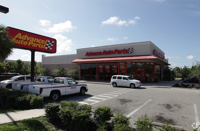
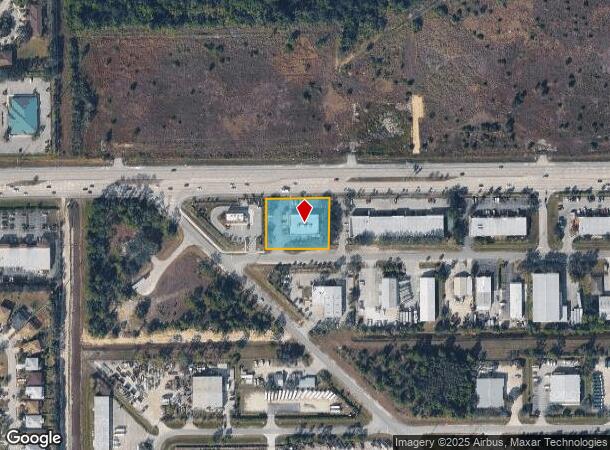
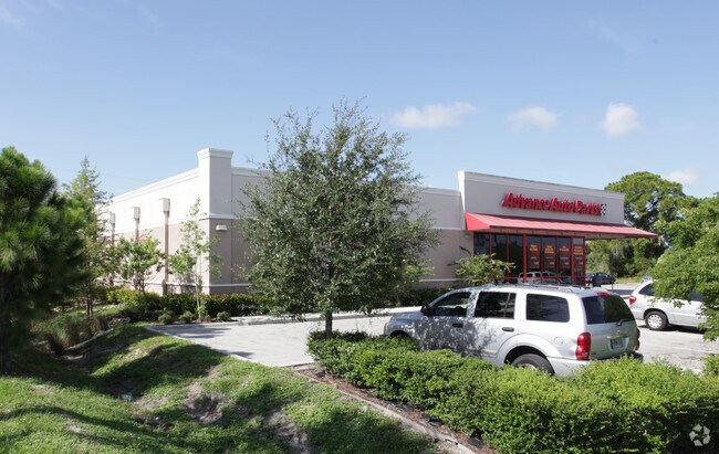
Property Record
5640 8Th St W, Lehigh Acres, FL 33971
NEARBY LISTINGS FOR SALE OR LEASE
Property Detail
5640 8Th St W
Cape Coral-Fort Myers, FL
Lee Blvd Corridor
30-44-26-00-00001.0350
PARCEL LYING SOUTH OF LEE BLVD + E OF LEONARD BLVD AS DESC IN OR 4097 PG 4210
Storemultistory
Lee
X
Florida
12071C0432F
35
2024
0.89 AC
2025
Lehigh
040121
Southwest Florida
7,618 SF
DEMOGRAPHICS near 5640 8Th St W
1 Mile
3 Mile
5 Mile
2024 Total Population
4,661
41,471
106,868
2029 Population
5,440
49,023
127,202
Pop Growth 2024-2029
+ 16.71%
+ 18.21%
+ 19.03%
Average Age
34
41
41
2024 Total Households
1,409
14,967
39,408
HH Growth 2024-2029
+ 16.25%
+ 18.16%
+ 19.17%
Median Household Inc
$72,110
$71,550
$68,756
Avg Household Size
3.20
2.60
2.60
2024 Avg HH Vehicles
2.00
2.00
2.00
Median Home Value
$258,126
$292,826
$285,421
Median Year Built
2004
2005
2005
Nearby Places
Map Layers
Map Styles
 Street
 Aerial
- Restaurants
- Banks
- Shops
- Fitness
- Groceries
PUBLIC TRANSPORTATION
AIRPORT
Southwest Florida International
DRIVE
WALK
Distance
Southwest Florida International
15 min
7.7 mi
Punta Gorda
DRIVE
WALK
Distance
Punta Gorda
36 min
28.6 mi
Freight Ports
Port Manatee
DRIVE
WALK
Distance
Port Manatee
116 min
100.3 mi
Nearby Properties
Address
Land Use
TOTAL SIZE
Lot Size
Zoning
Address
Land Use
TOTAL SIZE
Lot Size
Zoning
362,391 SF
12.80 AC
SDA
Address
Land Use
TOTAL SIZE
Lot Size
Zoning
24.69 AC
C-1
Address
Land Use
TOTAL SIZE
Lot Size
Zoning
432,890 SF
18.88 AC
SDA
Address
Land Use
TOTAL SIZE
Lot Size
Zoning
286,629 SF
13.01 AC
SDA
Address
Land Use
TOTAL SIZE
Lot Size
Zoning
519,706 SF
95.18 AC
RS-1
Address
Land Use
TOTAL SIZE
Lot Size
Zoning
111.70 AC
C1
Address
Land Use
TOTAL SIZE
Lot Size
Zoning
324,346 SF
20 AC
C1
Address
Land Use
TOTAL SIZE
Lot Size
Zoning
9.07 AC
SDA
Address
Land Use
TOTAL SIZE
Lot Size
Zoning
17.50 AC
C1
Address
Land Use
TOTAL SIZE
Lot Size
Zoning
260,320 SF
8.81 AC
SDA
Address
Land Use
TOTAL SIZE
Lot Size
Zoning
333,614 SF
294.30 AC
AG-2
Address
Land Use
TOTAL SIZE
Lot Size
Zoning
6.99 AC
C-1
Address
Land Use
TOTAL SIZE
Lot Size
Zoning
6.38 AC
SDA
Address
Land Use
TOTAL SIZE
Lot Size
Zoning
67.46 AC
C1
Address
Land Use
TOTAL SIZE
Lot Size
Zoning
154,653 SF
11.77 AC
SDA
Address
Land Use
TOTAL SIZE
Lot Size
Zoning
230,967 SF
8.31 AC
SDA
Address
Land Use
TOTAL SIZE
Lot Size
Zoning
135,503 SF
15.29 AC
AG-2
Address
Land Use
TOTAL SIZE
Lot Size
Zoning
68.11 AC
PUD
Address
Land Use
TOTAL SIZE
Lot Size
Zoning
123,378 SF
13.59 AC
SDA
Address
Land Use
TOTAL SIZE
Lot Size
Zoning
127,637 SF
6.50 AC
SDA
Address
Land Use
TOTAL SIZE
Lot Size
Zoning
75,477 SF
13.12 AC
SDA
Address
Land Use
TOTAL SIZE
Lot Size
Zoning
72,819 SF
7.97 AC
SDA
Address
Land Use
TOTAL SIZE
Lot Size
Zoning
29.75 AC
CI
Address
Land Use
TOTAL SIZE
Lot Size
Zoning
85,812 SF
15.76 AC
PUD
Address
Land Use
TOTAL SIZE
Lot Size
Zoning
60,633 SF
5.95 AC
SDA
Address
Land Use
TOTAL SIZE
Lot Size
Zoning
95,220 SF
3.23 AC
SDA
Address
Land Use
TOTAL SIZE
Lot Size
Zoning
103,801 SF
2.63 AC
SDA
Address
Land Use
TOTAL SIZE
Lot Size
Zoning
87,353 SF
3.70 AC
SDA
Address
Land Use
TOTAL SIZE
Lot Size
Zoning
66,292 SF
2.78 AC
SDA
Address
Land Use
TOTAL SIZE
Lot Size
Zoning
2.10 AC
C1
The World's #1 Commercial Real Estate Marketplace
Connect with us
© 2025 CoStar Group
The information above has been obtained from sources believed reliable. While we do not doubt its accuracy we have not verified it and make no guarantee, warranty or representation about it. It is your responsibility to independently confirm its accuracy and completeness. Any projections, opinions, assumptions, or estimates used are for example only and do not represent the current or future performance of the property. The value of this transaction to you depends on tax and other factors which should be evaluated by your tax, financial, and legal advisors. You and your advisors should conduct a careful, independent investigation of the property to determine to your satisfaction the suitability of the property for your needs.