Property Record
5640 Rand Blvd, Sarasota, FL 34238

NEARBY LISTINGS FOR SALE OR LEASE
-
-
View all Sarasota listings for sale on LoopNet.com
Property Detail
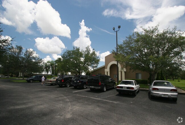
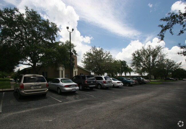
5640 Rand Blvd
North Port-Sarasota-Bradenton, FL
Not Part Of A Subdivision
0095-11-0001
COM AT NE COR OF NW 1/4 OF SEC 13 TH S-0-20-23-W 2097.14 FT TH S-89-41-50-W 160.01 FT FOR POB TH CONT S-89-41-50-W 441.26 FT TH N-0-32-41-E 6.46 FT TH NWLY ALG CURVE TO LEFT 50.64 FT TH N- 0-32-41-E
Hospitalprivate
Sarasota
X
Florida
12115C0164G
11
0
5 AC
2025
Sarasota
002013
Tampa/St Petersburg
40,430 SF
DEMOGRAPHICS near 5640 Rand Blvd
1 Mile
3 Mile
5 Mile
2024 Total Population
7,733
53,530
134,536
2029 Population
8,919
61,140
154,498
Pop Growth 2024-2029
+ 15.34%
+ 14.22%
+ 14.84%
Average Age
48
49
49
2024 Total Households
3,503
23,944
61,476
HH Growth 2024-2029
+ 15.39%
+ 14.25%
+ 15.01%
Median Household Inc
$75,777
$77,933
$77,619
Avg Household Size
2.10
2.20
2.10
2024 Avg HH Vehicles
2.00
2.00
2.00
Median Home Value
$371,380
$363,669
$368,207
Median Year Built
2003
1990
1984
Nearby Places
Map Layers
Map Styles
 Street
 Aerial
- Restaurants
- Banks
- Shops
- Fitness
- Groceries
PUBLIC TRANSPORTATION
AIRPORT
Sarasota/Bradenton International
DRIVE
WALK
Distance
Sarasota/Bradenton International
29 min
17.4 mi
Punta Gorda
DRIVE
WALK
Distance
Punta Gorda
55 min
45.8 mi
Freight Ports
Port Manatee
DRIVE
WALK
Distance
Port Manatee
41 min
29.9 mi
Nearby Properties
Address
Land Use
TOTAL SIZE
Lot Size
Zoning
Address
Land Use
TOTAL SIZE
Lot Size
Zoning
912,672 SF
88.39 AC
RMF1
Address
Land Use
TOTAL SIZE
Lot Size
Zoning
409,467 SF
36.72 AC
RMF2
Address
Land Use
TOTAL SIZE
Lot Size
Zoning
19,761 SF
119.20 AC
RMH
Address
Land Use
TOTAL SIZE
Lot Size
Zoning
912,253 SF
43.46 AC
PID
Address
Land Use
TOTAL SIZE
Lot Size
Zoning
370,367 SF
27.32 AC
OPI
Address
Land Use
TOTAL SIZE
Lot Size
Zoning
366,256 SF
32.53 AC
RMF3
Address
Land Use
TOTAL SIZE
Lot Size
Zoning
15,614 SF
104.95 AC
RMH
Address
Land Use
TOTAL SIZE
Lot Size
Zoning
318,414 SF
22.35 AC
RMF1
Address
Land Use
TOTAL SIZE
Lot Size
Zoning
242,685 SF
26.67 AC
RMF1
Address
Land Use
TOTAL SIZE
Lot Size
Zoning
258,994 SF
20.03 AC
PCD
Address
Land Use
TOTAL SIZE
Lot Size
Zoning
263,961 SF
18.88 AC
RMF3
Address
Land Use
TOTAL SIZE
Lot Size
Zoning
286,775 SF
10.85 AC
RMF3
Address
Land Use
TOTAL SIZE
Lot Size
Zoning
181,467 SF
59.39 AC
RMF1
Address
Land Use
TOTAL SIZE
Lot Size
Zoning
94,981 SF
6 AC
PCD
Address
Land Use
TOTAL SIZE
Lot Size
Zoning
150,433 SF
10.55 AC
RMF4
Address
Land Use
TOTAL SIZE
Lot Size
Zoning
223,929 SF
28.24 AC
RMF1
Address
Land Use
TOTAL SIZE
Lot Size
Zoning
87,816 SF
24.83 AC
ILW
Address
Land Use
TOTAL SIZE
Lot Size
Zoning
373,288 SF
53.07 AC
PID
Address
Land Use
TOTAL SIZE
Lot Size
Zoning
196,331 SF
55.82 AC
GU
Address
Land Use
TOTAL SIZE
Lot Size
Zoning
233,075 SF
19.49 AC
RMF2
Address
Land Use
TOTAL SIZE
Lot Size
Zoning
80,038 SF
28.10 AC
ILW
Address
Land Use
TOTAL SIZE
Lot Size
Zoning
89,418 SF
7.86 AC
GU
Address
Land Use
TOTAL SIZE
Lot Size
Zoning
205,136 SF
17.32 AC
RMF2
Address
Land Use
TOTAL SIZE
Lot Size
Zoning
166,310 SF
40.38 AC
GU
Address
Land Use
TOTAL SIZE
Lot Size
Zoning
140,372 SF
14.31 AC
CG
Address
Land Use
TOTAL SIZE
Lot Size
Zoning
56,885 SF
10.14 AC
ILW
Address
Land Use
TOTAL SIZE
Lot Size
Zoning
89,318 SF
13.62 AC
CSC
Address
Land Use
TOTAL SIZE
Lot Size
Zoning
128,023 SF
12.03 AC
CG
Address
Land Use
TOTAL SIZE
Lot Size
Zoning
43,181 SF
6.42 AC
PCD
Address
Land Use
TOTAL SIZE
Lot Size
Zoning
67,564 SF
121.85 AC
GU
The World's #1 Commercial Real Estate Marketplace
Connect with us
© 2026 CoStar Group
The information above has been obtained from sources believed reliable. While we do not doubt its accuracy we have not verified it and make no guarantee, warranty or representation about it. It is your responsibility to independently confirm its accuracy and completeness. Any projections, opinions, assumptions, or estimates used are for example only and do not represent the current or future performance of the property. The value of this transaction to you depends on tax and other factors which should be evaluated by your tax, financial, and legal advisors. You and your advisors should conduct a careful, independent investigation of the property to determine to your satisfaction the suitability of the property for your needs.