Property Record
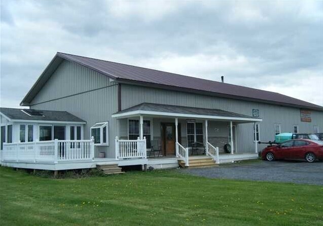
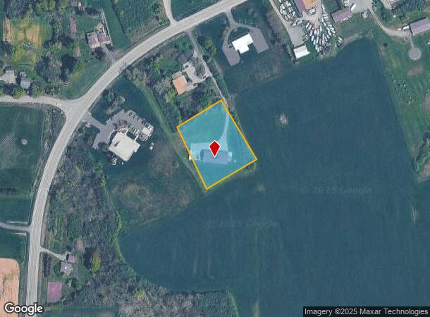
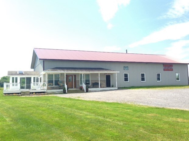
5640 S South Street Rd, Auburn, NY 13021
NEARBY LISTINGS FOR SALE OR LEASE
Property Detail
5640 S South Street Rd
Autorepair
Cayuga
X
New York
36011C0315E
24.732
2025
1.37 AC
2024
Other Market Areas
041101
Auburn, NY
4,000 SF
052800-129-000-0001-024-732-0000
DEMOGRAPHICS near 5640 S South Street Rd
1 Mile
3 Mile
5 Mile
2024 Total Population
747
19,450
35,047
2029 Population
745
19,205
34,630
Pop Growth 2024-2029
(0.27%)
(1.26%)
(1.19%)
Average Age
49
44
44
2024 Total Households
322
8,179
15,145
HH Growth 2024-2029
(0.31%)
(1.28%)
(1.33%)
Median Household Inc
$103,906
$59,232
$57,473
Avg Household Size
2.30
2.10
2.10
2024 Avg HH Vehicles
2.00
1.00
2.00
Median Home Value
$216,867
$167,714
$165,657
Median Year Built
1961
1950
1950
Nearby Places
Map Layers
Map Styles
 Street
 Aerial
- Restaurants
- Banks
- Shops
- Fitness
- Groceries
PUBLIC TRANSPORTATION
AIRPORT
Ithaca Tompkins International
DRIVE
WALK
Distance
Ithaca Tompkins International
49 min
31.3 mi
Syracuse Hancock International
DRIVE
WALK
Distance
Syracuse Hancock International
51 min
35.8 mi
Freight Ports
Albany, NY Port
DRIVE
WALK
Distance
Albany, NY Port
213 min
177.1 mi
SALE & LEASE HISTORY
LISTING DATE
SALE/LEASE

Sep 23, 2016
For Sale
Nearby Properties
Address
Land Use
TOTAL SIZE
Lot Size
Zoning
Address
Land Use
TOTAL SIZE
Lot Size
Zoning
6,085 SF
23 AC
CC
Address
Land Use
TOTAL SIZE
Lot Size
Zoning
200,000 SF
43.73 AC
AR
Address
Land Use
TOTAL SIZE
Lot Size
Zoning
2,496 SF
15.27 AC
R1
Address
Land Use
TOTAL SIZE
Lot Size
Zoning
300,342 SF
52 AC
R1
Address
Land Use
TOTAL SIZE
Lot Size
Zoning
Address
Land Use
TOTAL SIZE
Lot Size
Zoning
49,057 SF
9.89 AC
C
Address
Land Use
TOTAL SIZE
Lot Size
Zoning
88,967 SF
1.62 AC
D
Address
Land Use
TOTAL SIZE
Lot Size
Zoning
1,520 SF
14.50 AC
R2
Address
Land Use
TOTAL SIZE
Lot Size
Zoning
72,267 SF
2.75 AC
D
Address
Land Use
TOTAL SIZE
Lot Size
Zoning
3,920 SF
7.30 AC
R2
Address
Land Use
TOTAL SIZE
Lot Size
Zoning
117,877 SF
5.08 AC
D
Address
Land Use
TOTAL SIZE
Lot Size
Zoning
120,933 SF
1.47 AC
D
Address
Land Use
TOTAL SIZE
Lot Size
Zoning
1,015 SF
1.20 AC
C
Address
Land Use
TOTAL SIZE
Lot Size
Zoning
132,874 SF
37.95 AC
C
Address
Land Use
TOTAL SIZE
Lot Size
Zoning
74,514 SF
57.60 AC
R1
Address
Land Use
TOTAL SIZE
Lot Size
Zoning
309,234 SF
24.50 AC
I
Address
Land Use
TOTAL SIZE
Lot Size
Zoning
39,802 SF
24.80 AC
I
Address
Land Use
TOTAL SIZE
Lot Size
Zoning
68,890 SF
5.83 AC
C
Address
Land Use
TOTAL SIZE
Lot Size
Zoning
85,584 SF
1.97 AC
D
Address
Land Use
TOTAL SIZE
Lot Size
Zoning
6,670 SF
0.97 AC
D
Address
Land Use
TOTAL SIZE
Lot Size
Zoning
Address
Land Use
TOTAL SIZE
Lot Size
Zoning
70,425 SF
4.32 AC
D
Address
Land Use
TOTAL SIZE
Lot Size
Zoning
128,604 SF
1.37 AC
D
Address
Land Use
TOTAL SIZE
Lot Size
Zoning
35,476 SF
2.37 AC
D
Address
Land Use
TOTAL SIZE
Lot Size
Zoning
33,549 SF
1.75 AC
D
Address
Land Use
TOTAL SIZE
Lot Size
Zoning
56,720 SF
20.55 AC
I
Address
Land Use
TOTAL SIZE
Lot Size
Zoning
5,750 SF
4.30 AC
R2
Address
Land Use
TOTAL SIZE
Lot Size
Zoning
1,669 SF
216.80 AC
A
Address
Land Use
TOTAL SIZE
Lot Size
Zoning
4,500 SF
5.20 AC
R2
Address
Land Use
TOTAL SIZE
Lot Size
Zoning
2,505 SF
3.50 AC
R2
The World's #1 Commercial Real Estate Marketplace
Connect with us
© 2025 CoStar Group
The information above has been obtained from sources believed reliable. While we do not doubt its accuracy we have not verified it and make no guarantee, warranty or representation about it. It is your responsibility to independently confirm its accuracy and completeness. Any projections, opinions, assumptions, or estimates used are for example only and do not represent the current or future performance of the property. The value of this transaction to you depends on tax and other factors which should be evaluated by your tax, financial, and legal advisors. You and your advisors should conduct a careful, independent investigation of the property to determine to your satisfaction the suitability of the property for your needs.