Property Record
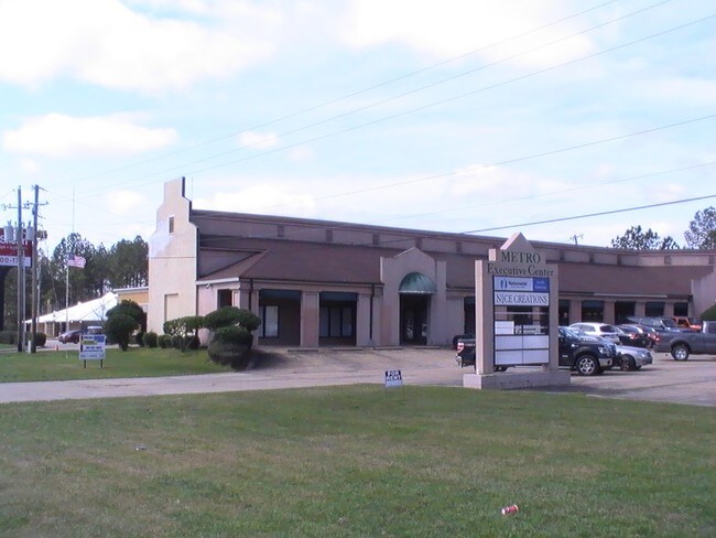
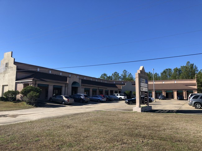
5643 Highway 18 W, Jackson, MS 39209
Property Detail
5643 Highway 18 W
0830-0090-002
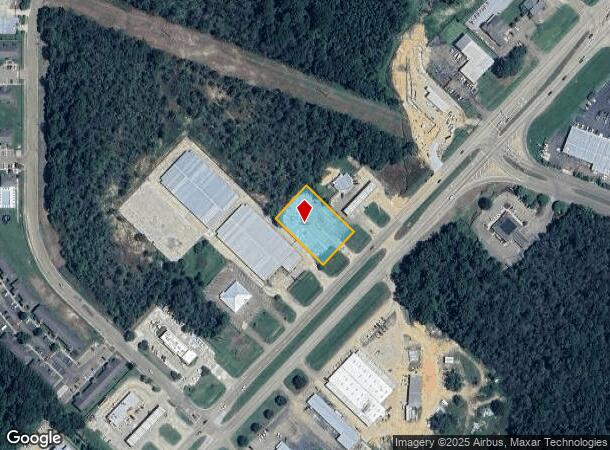
BEG INT N/L HWY 18 & E/L SW 1/4 SEC 11 SWLY ALONG N/L HWY APPROX 1530 FT TO POB SWLY 149.78 FT NWLY 220.7 FT NELY 149.78 FT SELY 220.7 FT TO POB IN SW 1/4 SEC 11 T5 R1W
Charitableorganization
Hinds
X
Mississippi
28049C0292J
0.75 AC
2024
South Jackson
2025
Jackson
011001
Jackson, MS
10,274 SF
NEARBY LISTINGS FOR SALE OR LEASE
DEMOGRAPHICS near 5643 Highway 18 W
1 mile
3 mile
5 mile
2024 Total Population
1,718
33,100
90,477
2029 Population
1,573
31,493
86,629
Pop Growth 2024-2029
(8.44%)
(4.85%)
(4.25%)
Average Age
34
37
37
2024 Total Households
758
13,240
35,341
HH Growth 2024-2029
(8.58%)
(5.04%)
(4.37%)
Median Household Inc
$16,094
$33,690
$35,010
Avg Household Size
2.20
2.40
2.40
2024 Avg HH Vehicles
1.00
2.00
2.00
Median Home Value
$350,000
$70,178
$82,213
Median Year Built
1983
1971
1971
Nearby Places
Map Layers
Map Styles
 Street
 Aerial
Transit
 Traffic
 Biking
Places
Listings with unknown addresses are not visible on the map
- Restaurants
- Banks
- Shops
- Fitness
- Groceries
PUBLIC TRANSPORTATION
COMMUTER RAIL
Drive
Walk
Distance
11 min
5.8 mi
AIRPORT
Jackson-Medgar Wiley Evers International
Drive
Walk
Distance
Jackson-Medgar Wiley Evers International
25 min
15.9 mi
SALE & LEASE HISTORY
LISTING DATE
SALE/LEASE

Mar 17, 2017
For Lease
Mar 10, 2017
For Sale
Dec 17, 2019
For Sale
Apr 24, 2017
For Sale
Nearby Properties
Address
Land Use
TOTAL SIZE
Lot Size
Zoning
Address
Land Use
TOTAL SIZE
Lot Size
Zoning
113,434 SF
82.60 AC
Address
Land Use
TOTAL SIZE
Lot Size
Zoning
191,128 SF
29.57 AC
Address
Land Use
TOTAL SIZE
Lot Size
Zoning
192,048 SF
23.70 AC
Address
Land Use
TOTAL SIZE
Lot Size
Zoning
545,127 SF
36 AC
Address
Land Use
TOTAL SIZE
Lot Size
Zoning
62,857 SF
4.79 AC
Address
Land Use
TOTAL SIZE
Lot Size
Zoning
41,110 SF
4.48 AC
Address
Land Use
TOTAL SIZE
Lot Size
Zoning
72,000 SF
0.01 AC
Address
Land Use
TOTAL SIZE
Lot Size
Zoning
41,616 SF
176,418.04 AC
Address
Land Use
TOTAL SIZE
Lot Size
Zoning
199,954 SF
23 AC
Address
Land Use
TOTAL SIZE
Lot Size
Zoning
108,878 SF
7.87 AC
Address
Land Use
TOTAL SIZE
Lot Size
Zoning
171,950 SF
9 AC
Address
Land Use
TOTAL SIZE
Lot Size
Zoning
138,086 SF
14 AC
Address
Land Use
TOTAL SIZE
Lot Size
Zoning
223,892 SF
15 AC
Address
Land Use
TOTAL SIZE
Lot Size
Zoning
148,263 SF
11.26 AC
Address
Land Use
TOTAL SIZE
Lot Size
Zoning
16,070 SF
6 AC
Address
Land Use
TOTAL SIZE
Lot Size
Zoning
11,950 SF
2 AC
Address
Land Use
TOTAL SIZE
Lot Size
Zoning
11,256 SF
3.60 AC
Address
Land Use
TOTAL SIZE
Lot Size
Zoning
7.28 AC
Address
Land Use
TOTAL SIZE
Lot Size
Zoning
13,721 SF
1.80 AC
Address
Land Use
TOTAL SIZE
Lot Size
Zoning
15.40 AC
Address
Land Use
TOTAL SIZE
Lot Size
Zoning
106,127 SF
8.27 AC
Address
Land Use
TOTAL SIZE
Lot Size
Zoning
35,884 SF
0.02 AC
Address
Land Use
TOTAL SIZE
Lot Size
Zoning
13.86 AC
Address
Land Use
TOTAL SIZE
Lot Size
Zoning
21.12 AC
Address
Land Use
TOTAL SIZE
Lot Size
Zoning
185,868 SF
12 AC
Address
Land Use
TOTAL SIZE
Lot Size
Zoning
96,372 SF
9.19 AC
Address
Land Use
TOTAL SIZE
Lot Size
Zoning
11,354 SF
50.54 AC
Address
Land Use
TOTAL SIZE
Lot Size
Zoning
174,366 SF
11.04 AC
Address
Land Use
TOTAL SIZE
Lot Size
Zoning
15,273 SF
1 AC
Address
Land Use
TOTAL SIZE
Lot Size
Zoning
14,075 SF
3.86 AC
The World's #1 Commercial Real Estate Marketplace
Connect with us
© 2026 CoStar Group
The information above has been obtained from sources believed reliable. While we do not doubt its accuracy we have not verified it and make no guarantee, warranty or representation about it. It is your responsibility to independently confirm its accuracy and completeness. Any projections, opinions, assumptions, or estimates used are for example only and do not represent the current or future performance of the property. The value of this transaction to you depends on tax and other factors which should be evaluated by your tax, financial, and legal advisors. You and your advisors should conduct a careful, independent investigation of the property to determine to your satisfaction the suitability of the property for your needs.