Property Record
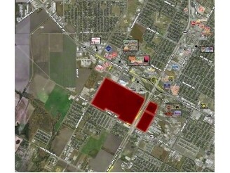
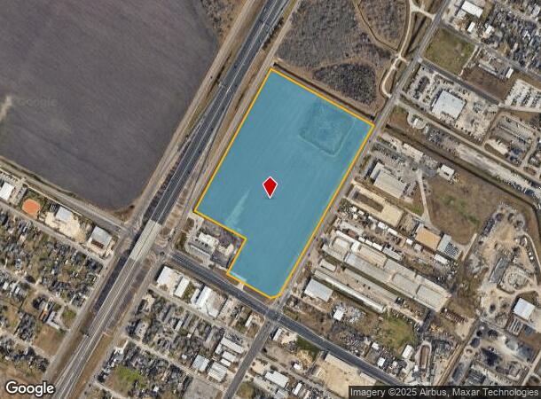
Crosstown Extension & Ayers St, Corpus Christi, TX 78417
Property Detail
Crosstown Extension & Ayers St
Corpus Christi, TX
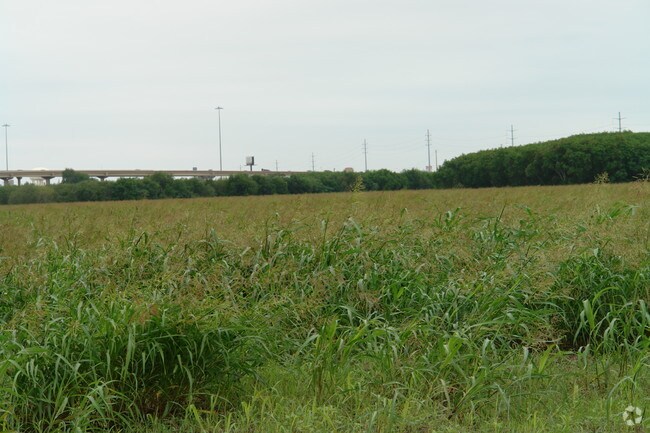
Bohemian Colony Lands
200076939
BOHEMIAN COLONY LANDS 28.8093 ACS OUT LTS 3 & 4 SEC 4 (E OF RR)
Ruralagriculturalresidence
Nueces
X
Texas
48355C0510G
3&4
2024
28.81 AC
2025
Southwest
001702
Corpus Christi
NEARBY LISTINGS FOR SALE OR LEASE
DEMOGRAPHICS near Crosstown Extension & Ayers St
1 mile
3 mile
5 mile
2024 Total Population
8,214
78,113
176,445
2029 Population
8,027
76,766
174,500
Pop Growth 2024-2029
(2.28%)
(1.72%)
(1.10%)
Average Age
37
38
39
2024 Total Households
2,722
27,670
65,707
HH Growth 2024-2029
(2.24%)
(1.77%)
(1.17%)
Median Household Inc
$54,512
$47,608
$50,096
Avg Household Size
2.90
2.70
2.60
2024 Avg HH Vehicles
2.00
2.00
2.00
Median Home Value
$131,535
$121,581
$140,916
Median Year Built
1983
1965
1971
Nearby Places
Map Layers
Map Styles
 Street
 Aerial
Transit
 Traffic
 Biking
Places
Listings with unknown addresses are not visible on the map
- Restaurants
- Banks
- Shops
- Fitness
- Groceries
PUBLIC TRANSPORTATION
AIRPORT
Corpus Christi International
Drive
Walk
Distance
Corpus Christi International
14 min
8.2 mi
Freight Ports
Port of Corpus Christi
Drive
Walk
Distance
Port of Corpus Christi
9 min
6.8 mi
SALE & LEASE HISTORY
LISTING DATE
SALE/LEASE

Sep 24, 2016
For Sale
Apr 15, 2017
For Sale
Nearby Properties
Address
Land Use
TOTAL SIZE
Lot Size
Zoning
Address
Land Use
TOTAL SIZE
Lot Size
Zoning
419,479 SF
32.65 AC
Address
Land Use
TOTAL SIZE
Lot Size
Zoning
176,076 SF
19.84 AC
R1B
Address
Land Use
TOTAL SIZE
Lot Size
Zoning
251,402 SF
7.17 AC
Address
Land Use
TOTAL SIZE
Lot Size
Zoning
469,785 SF
22.27 AC
A2
Address
Land Use
TOTAL SIZE
Lot Size
Zoning
111,464 SF
18.63 AC
R1C
Address
Land Use
TOTAL SIZE
Lot Size
Zoning
377,729 SF
15.19 AC
Address
Land Use
TOTAL SIZE
Lot Size
Zoning
278,919 SF
39.27 AC
R1B
Address
Land Use
TOTAL SIZE
Lot Size
Zoning
1 SF
40.02 AC
R1B
Address
Land Use
TOTAL SIZE
Lot Size
Zoning
293,917 SF
10.76 AC
A2
Address
Land Use
TOTAL SIZE
Lot Size
Zoning
74,247 SF
6.39 AC
Address
Land Use
TOTAL SIZE
Lot Size
Zoning
124,257 SF
7.63 AC
Address
Land Use
TOTAL SIZE
Lot Size
Zoning
65,301 SF
7.37 AC
B-4
Address
Land Use
TOTAL SIZE
Lot Size
Zoning
85,871 SF
18.68 AC
R1B
Address
Land Use
TOTAL SIZE
Lot Size
Zoning
148,104 SF
7.50 AC
B4
Address
Land Use
TOTAL SIZE
Lot Size
Zoning
89,537 SF
11.35 AC
R1B
Address
Land Use
TOTAL SIZE
Lot Size
Zoning
86,224 SF
33.89 AC
Address
Land Use
TOTAL SIZE
Lot Size
Zoning
83,835 SF
19.14 AC
Address
Land Use
TOTAL SIZE
Lot Size
Zoning
108,420 SF
20 AC
R1B
Address
Land Use
TOTAL SIZE
Lot Size
Zoning
74,261 SF
4.44 AC
R1B
Address
Land Use
TOTAL SIZE
Lot Size
Zoning
105.49 AC
R1B
Address
Land Use
TOTAL SIZE
Lot Size
Zoning
13,773 SF
28.82 AC
R1B
Address
Land Use
TOTAL SIZE
Lot Size
Zoning
114,121 SF
2.64 AC
B-4
Address
Land Use
TOTAL SIZE
Lot Size
Zoning
203,181 SF
9.98 AC
A-1
Address
Land Use
TOTAL SIZE
Lot Size
Zoning
140,058 SF
90.04 AC
I2
Address
Land Use
TOTAL SIZE
Lot Size
Zoning
214,846 SF
11.95 AC
A2
Address
Land Use
TOTAL SIZE
Lot Size
Zoning
95,658 SF
21.87 AC
I2
Address
Land Use
TOTAL SIZE
Lot Size
Zoning
292,524 SF
28.73 AC
A1
Address
Land Use
TOTAL SIZE
Lot Size
Zoning
60,934 SF
12.20 AC
R1B
Address
Land Use
TOTAL SIZE
Lot Size
Zoning
95,860 SF
10.80 AC
R1B
Address
Land Use
TOTAL SIZE
Lot Size
Zoning
25,998 SF
31.72 AC
R1B
The World's #1 Commercial Real Estate Marketplace
Connect with us
© 2026 CoStar Group
The information above has been obtained from sources believed reliable. While we do not doubt its accuracy we have not verified it and make no guarantee, warranty or representation about it. It is your responsibility to independently confirm its accuracy and completeness. Any projections, opinions, assumptions, or estimates used are for example only and do not represent the current or future performance of the property. The value of this transaction to you depends on tax and other factors which should be evaluated by your tax, financial, and legal advisors. You and your advisors should conduct a careful, independent investigation of the property to determine to your satisfaction the suitability of the property for your needs.