Property Record
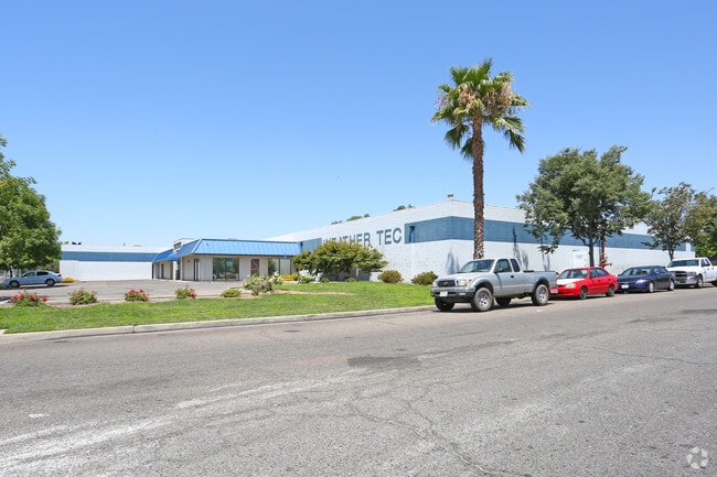
5645 E Clinton Ave, Fresno, CA 93727


Current Lease Availabilities
Property Detail
5645 E Clinton Ave
496-201-07
2.31 AC PAR F BK 7 PG 37 MAP 1581 SEC 28 T13R21
Lightindustrial
Fresno
M1
California
B and X Area of moderate flood hazard, usually the area between the limits of the 100-year and 500-year floods.
2.31 AC
2025
Northeast Fresno
2025
Fresno
005805
Fresno, CA
44,342 SF
NEARBY LISTINGS FOR SALE OR LEASE
DEMOGRAPHICS near 5645 E Clinton Ave
1 mile
3 mile
5 mile
2025 Total Population
2,984
121,823
343,482
2030 Population
3,050
124,050
348,688
Pop Growth 2025-2030
+ 2.21%
+ 1.83%
+ 1.52%
Average Age
36
35
35
2025 Total Households
926
38,556
108,035
HH Growth 2025-2030
+ 2.16%
+ 1.81%
+ 1.54%
Median Household Inc
$82,151
$75,827
$70,043
Avg Household Size
3.10
3.10
3.10
2025 Avg HH Vehicles
2.00
2.00
2.00
Median Home Value
$377,844
$392,615
$385,194
Median Year Built
1976
1977
1977
Nearby Places
Map Layers
Map Styles
 Street
 Aerial
Transit
 Traffic
 Biking
Places
Listings with unknown addresses are not visible on the map
- Restaurants
- Banks
- Shops
- Fitness
- Groceries
PUBLIC TRANSPORTATION
COMMUTER RAIL
Fresno (San Joaquins - Amtrak)
Drive
Walk
Distance
Fresno (San Joaquins - Amtrak)
10 min
6.9 mi
AIRPORT
Fresno Yosemite International
Drive
Walk
Distance
Fresno Yosemite International
5 min
2.3 mi
Freight Ports
Port of Stockton
Drive
Walk
Distance
Port of Stockton
159 min
133.9 mi
Nearby Properties
Address
Land Use
TOTAL SIZE
Lot Size
Zoning
Address
Land Use
TOTAL SIZE
Lot Size
Zoning
1,081,456 SF
113.56 AC
M1
Address
Land Use
TOTAL SIZE
Lot Size
Zoning
794,471 SF
73.71 AC
Address
Land Use
TOTAL SIZE
Lot Size
Zoning
74,499 SF
17.48 AC
M3
Address
Land Use
TOTAL SIZE
Lot Size
Zoning
2,008 SF
20.14 AC
M1
Address
Land Use
TOTAL SIZE
Lot Size
Zoning
202,149 SF
27.56 AC
SPLIT
Address
Land Use
TOTAL SIZE
Lot Size
Zoning
216,342 SF
28.49 AC
Address
Land Use
TOTAL SIZE
Lot Size
Zoning
385,529 SF
29.36 AC
R2
Address
Land Use
TOTAL SIZE
Lot Size
Zoning
268,956 SF
13.25 AC
R3
Address
Land Use
TOTAL SIZE
Lot Size
Zoning
249,818 SF
12.24 AC
PCC
Address
Land Use
TOTAL SIZE
Lot Size
Zoning
372,862 SF
42.43 AC
R1
Address
Land Use
TOTAL SIZE
Lot Size
Zoning
60,227 SF
4.72 AC
M1
Address
Land Use
TOTAL SIZE
Lot Size
Zoning
91,715 SF
4.50 AC
R3
Address
Land Use
TOTAL SIZE
Lot Size
Zoning
175,310 SF
19.22 AC
CMX
Address
Land Use
TOTAL SIZE
Lot Size
Zoning
94,584 SF
10.93 AC
M1
Address
Land Use
TOTAL SIZE
Lot Size
Zoning
152,918 SF
15.85 AC
C2
Address
Land Use
TOTAL SIZE
Lot Size
Zoning
93,172 SF
4.97 AC
Address
Land Use
TOTAL SIZE
Lot Size
Zoning
86,678 SF
4.16 AC
CP
Address
Land Use
TOTAL SIZE
Lot Size
Zoning
249,126 SF
17.33 AC
SPLIT
Address
Land Use
TOTAL SIZE
Lot Size
Zoning
83,458 SF
2.66 AC
PCC
Address
Land Use
TOTAL SIZE
Lot Size
Zoning
250,412 SF
16.09 AC
RM3
Address
Land Use
TOTAL SIZE
Lot Size
Zoning
190,006 SF
19.35 AC
RM1
Address
Land Use
TOTAL SIZE
Lot Size
Zoning
102,765 SF
8.90 AC
M1
Address
Land Use
TOTAL SIZE
Lot Size
Zoning
151,980 SF
4.94 AC
CM
Address
Land Use
TOTAL SIZE
Lot Size
Zoning
138,502 SF
3.46 AC
C2
Address
Land Use
TOTAL SIZE
Lot Size
Zoning
57,695 SF
4.99 AC
R2A
Address
Land Use
TOTAL SIZE
Lot Size
Zoning
401,192 SF
0.01 AC
PCC
Address
Land Use
TOTAL SIZE
Lot Size
Zoning
119,914 SF
4.50 AC
CMX
Address
Land Use
TOTAL SIZE
Lot Size
Zoning
67,394 SF
2.41 AC
C2
Address
Land Use
TOTAL SIZE
Lot Size
Zoning
141,577 SF
12.76 AC
IL
Address
Land Use
TOTAL SIZE
Lot Size
Zoning
132,293 SF
12.79 AC
C2
The World's #1 Commercial Real Estate Marketplace
Connect with us
© 2026 CoStar Group
The information above has been obtained from sources believed reliable. While we do not doubt its accuracy we have not verified it and make no guarantee, warranty or representation about it. It is your responsibility to independently confirm its accuracy and completeness. Any projections, opinions, assumptions, or estimates used are for example only and do not represent the current or future performance of the property. The value of this transaction to you depends on tax and other factors which should be evaluated by your tax, financial, and legal advisors. You and your advisors should conduct a careful, independent investigation of the property to determine to your satisfaction the suitability of the property for your needs.