Property Record
5645 W State Road 46, Sanford, FL 32771


Current Lease Availabilities
NEARBY LISTINGS FOR SALE OR LEASE
-
-
View all Sanford listings for lease on LoopNet.com
Property Detail
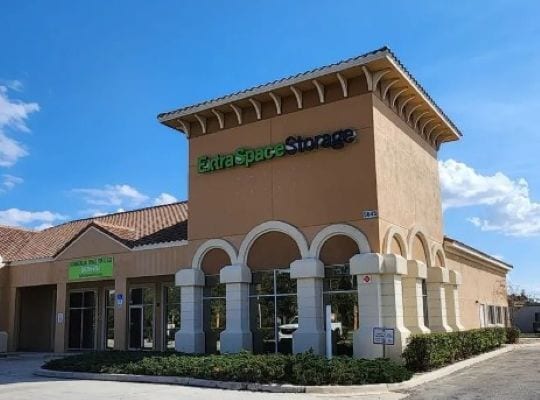
5645 W State Road 46
Orlando-Kissimmee-Sanford, FL
Westlake Center
30-19-30-527-0000-0010
LOTS 1 & 2 WESTLAKE CENTER PB 79 PGS 60 TO 62
Publicstorage
Seminole
AE
Florida
12069C0450E
1,2
2025
4.30 AC
2025
Lake Mary
020706
Orlando
5,990 SF
DEMOGRAPHICS near 5645 W State Road 46
1 Mile
3 Mile
5 Mile
2024 Total Population
6,430
44,450
95,392
2029 Population
6,756
46,735
100,367
Pop Growth 2024-2029
+ 5.07%
+ 5.14%
+ 5.22%
Average Age
41
39
40
2024 Total Households
2,406
17,571
37,071
HH Growth 2024-2029
+ 5.40%
+ 5.37%
+ 5.39%
Median Household Inc
$116,922
$98,062
$84,120
Avg Household Size
2.60
2.50
2.50
2024 Avg HH Vehicles
2.00
2.00
2.00
Median Home Value
$458,995
$414,076
$366,929
Median Year Built
2005
2003
1999
Nearby Places
Map Layers
Map Styles
 Street
 Aerial
- Restaurants
- Banks
- Shops
- Fitness
- Groceries
PUBLIC TRANSPORTATION
COMMUTER RAIL
Sanford (SunRail - Florida Department of Transportation)
DRIVE
WALK
Distance
Sanford (SunRail - Florida Department of Transportation)
9 min
4.8 mi
Debary (SunRail - Florida Department of Transportation)
DRIVE
WALK
Distance
Debary (SunRail - Florida Department of Transportation)
10 min
5.6 mi
AIRPORT
Orlando Sanford International
DRIVE
WALK
Distance
Orlando Sanford International
19 min
12.2 mi
Orlando International
DRIVE
WALK
Distance
Orlando International
48 min
39.0 mi
Freight Ports
Port Canaveral
DRIVE
WALK
Distance
Port Canaveral
84 min
72.0 mi
Nearby Properties
Address
Land Use
TOTAL SIZE
Lot Size
Zoning
Address
Land Use
TOTAL SIZE
Lot Size
Zoning
3,206 SF
47.56 AC
PUD
Address
Land Use
TOTAL SIZE
Lot Size
Zoning
1,225 SF
17 AC
Address
Land Use
TOTAL SIZE
Lot Size
Zoning
1,992 SF
4.76 AC
A1
Address
Land Use
TOTAL SIZE
Lot Size
Zoning
11.65 AC
Address
Land Use
TOTAL SIZE
Lot Size
Zoning
1,096 SF
22.55 AC
PUD
Address
Land Use
TOTAL SIZE
Lot Size
Zoning
18,728 SF
22.36 AC
Address
Land Use
TOTAL SIZE
Lot Size
Zoning
2,181 SF
4.92 AC
A1
Address
Land Use
TOTAL SIZE
Lot Size
Zoning
425,407 SF
19.88 AC
Address
Land Use
TOTAL SIZE
Lot Size
Zoning
600 SF
20.98 AC
PD
Address
Land Use
TOTAL SIZE
Lot Size
Zoning
0.93 AC
A1
Address
Land Use
TOTAL SIZE
Lot Size
Zoning
6.25 AC
Address
Land Use
TOTAL SIZE
Lot Size
Zoning
5,814 SF
0.87 AC
PUD
Address
Land Use
TOTAL SIZE
Lot Size
Zoning
92,995 SF
31.61 AC
PUD
Address
Land Use
TOTAL SIZE
Lot Size
Zoning
23,184 SF
31.05 AC
PUD
Address
Land Use
TOTAL SIZE
Lot Size
Zoning
4,254 SF
23.23 AC
PUD
Address
Land Use
TOTAL SIZE
Lot Size
Zoning
24,382 SF
18.45 AC
A1
Address
Land Use
TOTAL SIZE
Lot Size
Zoning
311,881 SF
10.52 AC
PCD
Address
Land Use
TOTAL SIZE
Lot Size
Zoning
120,877 SF
12 AC
Address
Land Use
TOTAL SIZE
Lot Size
Zoning
2,328 SF
28.61 AC
PUD
Address
Land Use
TOTAL SIZE
Lot Size
Zoning
605,535 SF
39.31 AC
PUD
Address
Land Use
TOTAL SIZE
Lot Size
Zoning
21,266 SF
14.61 AC
Address
Land Use
TOTAL SIZE
Lot Size
Zoning
241,653 SF
6.69 AC
Address
Land Use
TOTAL SIZE
Lot Size
Zoning
365,546 SF
50.24 AC
M1A
Address
Land Use
TOTAL SIZE
Lot Size
Zoning
220,400 SF
13.45 AC
Address
Land Use
TOTAL SIZE
Lot Size
Zoning
2.42 AC
A1
Address
Land Use
TOTAL SIZE
Lot Size
Zoning
269,490 SF
24.57 AC
PD
Address
Land Use
TOTAL SIZE
Lot Size
Zoning
3,433 SF
11.15 AC
Address
Land Use
TOTAL SIZE
Lot Size
Zoning
213,600 SF
8.79 AC
PUD
Address
Land Use
TOTAL SIZE
Lot Size
Zoning
62,547 SF
15.16 AC
Address
Land Use
TOTAL SIZE
Lot Size
Zoning
208,074 SF
13.17 AC
The World's #1 Commercial Real Estate Marketplace
Connect with us
© 2026 CoStar Group
The information above has been obtained from sources believed reliable. While we do not doubt its accuracy we have not verified it and make no guarantee, warranty or representation about it. It is your responsibility to independently confirm its accuracy and completeness. Any projections, opinions, assumptions, or estimates used are for example only and do not represent the current or future performance of the property. The value of this transaction to you depends on tax and other factors which should be evaluated by your tax, financial, and legal advisors. You and your advisors should conduct a careful, independent investigation of the property to determine to your satisfaction the suitability of the property for your needs.