Property Record
565 Boardman Canfield Rd, Youngstown, OH 44512


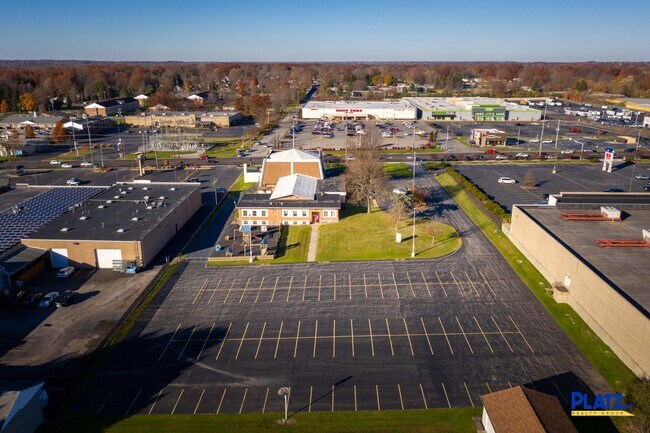
Property Detail
565 Boardman Canfield Rd
29-102-0-136.00-0
GL 23 DIV 3
Commercialnec
Mahoning
R1
Ohio
2025
4.44 AC
2025
Boardman
812002
Youngstown/Warren/Boardman
12,821 SF
Youngstown-Warren, OH
NEARBY LISTINGS FOR SALE OR LEASE
-
-
View all Youngstown listings for sale on LoopNet.com
DEMOGRAPHICS near 565 Boardman Canfield Rd
1 mile
3 mile
5 mile
2025 Total Population
6,863
45,442
112,858
2030 Population
6,781
45,053
112,050
Pop Growth 2025-2030
(1.19%)
(0.86%)
(0.72%)
Average Age
44
43
43
2025 Total Households
3,217
20,376
49,580
HH Growth 2025-2030
(1.21%)
(0.85%)
(0.74%)
Median Household Inc
$62,358
$62,283
$58,129
Avg Household Size
2.10
2.20
2.20
2025 Avg HH Vehicles
2.00
2.00
2.00
Median Home Value
$180,018
$167,494
$151,985
Median Year Built
1966
1969
1960
Nearby Places
Map Layers
Map Styles
 Street
 Aerial
Transit
 Traffic
 Biking
Places
Listings with unknown addresses are not visible on the map
- Restaurants
- Banks
- Shops
- Fitness
- Groceries
SALE & LEASE HISTORY
LISTING DATE
SALE/LEASE

Nov 12, 2020
For Sale
Nearby Properties
Address
Land Use
TOTAL SIZE
Lot Size
Zoning
Address
Land Use
TOTAL SIZE
Lot Size
Zoning
489,784 SF
22.26 AC
C
Address
Land Use
TOTAL SIZE
Lot Size
Zoning
252,909 SF
22.37 AC
C
Address
Land Use
TOTAL SIZE
Lot Size
Zoning
436,605 SF
64.24 AC
C
Address
Land Use
TOTAL SIZE
Lot Size
Zoning
318,339 SF
14.66 AC
R1
Address
Land Use
TOTAL SIZE
Lot Size
Zoning
88,996 SF
10.94 AC
C
Address
Land Use
TOTAL SIZE
Lot Size
Zoning
22.26 AC
Address
Land Use
TOTAL SIZE
Lot Size
Zoning
41,835 SF
7.46 AC
I
Address
Land Use
TOTAL SIZE
Lot Size
Zoning
47,538 SF
16.14 AC
C
Address
Land Use
TOTAL SIZE
Lot Size
Zoning
71,619 SF
12.76 AC
C
Address
Land Use
TOTAL SIZE
Lot Size
Zoning
140,889 SF
14.71 AC
C
Address
Land Use
TOTAL SIZE
Lot Size
Zoning
41,443 SF
0.93 AC
C
Address
Land Use
TOTAL SIZE
Lot Size
Zoning
134,650 SF
16.10 AC
C
Address
Land Use
TOTAL SIZE
Lot Size
Zoning
91,900 SF
7.60 AC
C
Address
Land Use
TOTAL SIZE
Lot Size
Zoning
57,178 SF
16.42 AC
R2
Address
Land Use
TOTAL SIZE
Lot Size
Zoning
123,712 SF
16.55 AC
MFR
Address
Land Use
TOTAL SIZE
Lot Size
Zoning
83,357 SF
6.96 AC
MFR
Address
Land Use
TOTAL SIZE
Lot Size
Zoning
100,565 SF
15.03 AC
R3
Address
Land Use
TOTAL SIZE
Lot Size
Zoning
61,141 SF
1.01 AC
C
Address
Land Use
TOTAL SIZE
Lot Size
Zoning
96,005 SF
3.89 AC
C
Address
Land Use
TOTAL SIZE
Lot Size
Zoning
108,150 SF
6.06 AC
C
Address
Land Use
TOTAL SIZE
Lot Size
Zoning
36,466 SF
6.49 AC
C
Address
Land Use
TOTAL SIZE
Lot Size
Zoning
Address
Land Use
TOTAL SIZE
Lot Size
Zoning
71,842 SF
2.10 AC
Address
Land Use
TOTAL SIZE
Lot Size
Zoning
39,370 SF
10.58 AC
C
Address
Land Use
TOTAL SIZE
Lot Size
Zoning
141,528 SF
16.11 AC
C
Address
Land Use
TOTAL SIZE
Lot Size
Zoning
23,583 SF
9.76 AC
C
Address
Land Use
TOTAL SIZE
Lot Size
Zoning
69,651 SF
2.82 AC
Address
Land Use
TOTAL SIZE
Lot Size
Zoning
140,132 SF
8.91 AC
C
Address
Land Use
TOTAL SIZE
Lot Size
Zoning
123,138 SF
8.16 AC
C
Address
Land Use
TOTAL SIZE
Lot Size
Zoning
29,735 SF
8.65 AC
C
The World's #1 Commercial Real Estate Marketplace
Connect with us
© 2026 CoStar Group
The information above has been obtained from sources believed reliable. While we do not doubt its accuracy we have not verified it and make no guarantee, warranty or representation about it. It is your responsibility to independently confirm its accuracy and completeness. Any projections, opinions, assumptions, or estimates used are for example only and do not represent the current or future performance of the property. The value of this transaction to you depends on tax and other factors which should be evaluated by your tax, financial, and legal advisors. You and your advisors should conduct a careful, independent investigation of the property to determine to your satisfaction the suitability of the property for your needs.