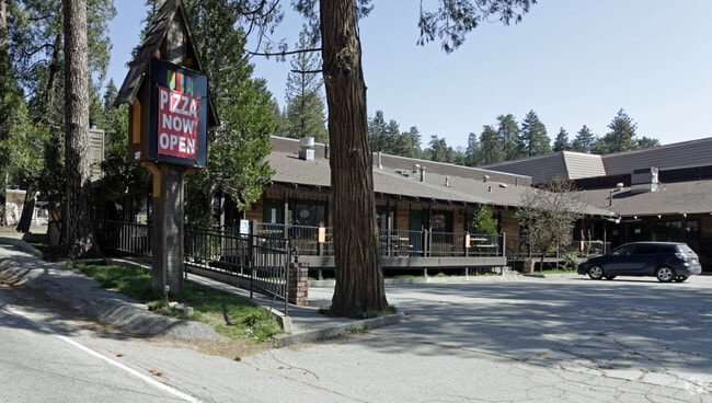
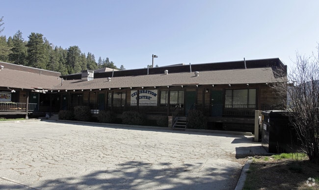
Property Record
565 Forest Shade Rd, Crestline, CA 92325


Property Detail
565 Forest Shade Rd
0338-343-18
TR 1990 CRESTLINE VILLAGE SUB NO 12 LOTS 1513 1514 AND 1515
Storebuilding
SAN BERNARDINO
CFCGSCP
California
AE The base floodplain where base flood elevations are provided. AE Zones are now used on new format FIRMs instead of A1-A30 Zones.
1513
2025
0.43 AC
2025
San Bernardino
010804
Inland Empire (California)
5,268 SF
Riverside-San Bernardino-Ontario, CA
NEARBY LISTINGS FOR SALE OR LEASE
DEMOGRAPHICS near 565 Forest Shade Rd
1 mile
3 mile
5 mile
2025 Total Population
4,329
10,235
25,346
2030 Population
3,987
9,487
24,495
Pop Growth 2025-2030
(7.90%)
(7.31%)
(3.36%)
Average Age
43
43
41
2025 Total Households
1,858
4,261
9,083
HH Growth 2025-2030
(8.02%)
(7.51%)
(3.96%)
Median Household Inc
$84,461
$81,799
$93,526
Avg Household Size
2.20
2.30
2.60
2025 Avg HH Vehicles
2.00
2.00
2.00
Median Home Value
$444,479
$439,888
$524,334
Median Year Built
1966
1966
1970
Nearby Places
Map Layers
Map Styles
 Street
 Aerial
Layers
 Traffic
 Biking
Places
Listings with unknown addresses are not visible on the map
- Restaurants
- Banks
- Shops
- Fitness
- Groceries
PUBLIC TRANSPORTATION
AIRPORT
Ontario International
Drive
Walk
Distance
Ontario International
51 min
36.1 mi
Freight Ports
Port of Long Beach
Drive
Walk
Distance
Port of Long Beach
108 min
84.2 mi
Nearby Properties
Address
Land Use
TOTAL SIZE
Lot Size
Zoning
Address
Land Use
TOTAL SIZE
Lot Size
Zoning
73,307 SF
32.90 AC
CFSDRES
Address
Land Use
TOTAL SIZE
Lot Size
Zoning
25.95 AC
CFSDRES
Address
Land Use
TOTAL SIZE
Lot Size
Zoning
30,529 SF
0.25 AC
Address
Land Use
TOTAL SIZE
Lot Size
Zoning
79,205 SF
17.72 AC
Address
Land Use
TOTAL SIZE
Lot Size
Zoning
38,415 SF
33.85 AC
CFRS14M
Address
Land Use
TOTAL SIZE
Lot Size
Zoning
43,673 SF
2.63 AC
Address
Land Use
TOTAL SIZE
Lot Size
Zoning
13,816 SF
28.10 AC
Address
Land Use
TOTAL SIZE
Lot Size
Zoning
46,398 SF
1.88 AC
CFCGSCP
Address
Land Use
TOTAL SIZE
Lot Size
Zoning
2,300 SF
2.71 AC
CFRS14M
Address
Land Use
TOTAL SIZE
Lot Size
Zoning
9,523 SF
0.67 AC
C
Address
Land Use
TOTAL SIZE
Lot Size
Zoning
1,922 SF
0.53 AC
CFCGSCP
Address
Land Use
TOTAL SIZE
Lot Size
Zoning
12,368 SF
1.42 AC
LARS14M
Address
Land Use
TOTAL SIZE
Lot Size
Zoning
39,816 SF
1.36 AC
CFCS
Address
Land Use
TOTAL SIZE
Lot Size
Zoning
10.79 AC
CFRL5
Address
Land Use
TOTAL SIZE
Lot Size
Zoning
2,916 SF
3.27 AC
LARS14M
Address
Land Use
TOTAL SIZE
Lot Size
Zoning
8,196 SF
0.72 AC
CFCGSCP
Address
Land Use
TOTAL SIZE
Lot Size
Zoning
8,284 SF
0.40 AC
CFCGSCP
Address
Land Use
TOTAL SIZE
Lot Size
Zoning
1,497 SF
0.27 AC
C1
Address
Land Use
TOTAL SIZE
Lot Size
Zoning
4,459 SF
0.13 AC
CFCGSCP
Address
Land Use
TOTAL SIZE
Lot Size
Zoning
40.39 AC
CFRL5
Address
Land Use
TOTAL SIZE
Lot Size
Zoning
6,960 SF
0.28 AC
LACS
Address
Land Use
TOTAL SIZE
Lot Size
Zoning
3,960 SF
0.15 AC
CFCGSCP
Address
Land Use
TOTAL SIZE
Lot Size
Zoning
7,094 SF
0.08 AC
CFCGSCP
Address
Land Use
TOTAL SIZE
Lot Size
Zoning
5,305 SF
0.34 AC
CFCGSCP
Address
Land Use
TOTAL SIZE
Lot Size
Zoning
6,156 SF
0.23 AC
CFCGSCP
Address
Land Use
TOTAL SIZE
Lot Size
Zoning
18,122 SF
1.18 AC
CFCGSCP
Address
Land Use
TOTAL SIZE
Lot Size
Zoning
4,776 SF
0.35 AC
CFRM
Address
Land Use
TOTAL SIZE
Lot Size
Zoning
2,408 SF
0.14 AC
CFCGSCP
Address
Land Use
TOTAL SIZE
Lot Size
Zoning
3,815 SF
0.32 AC
CFRS14M
The World's #1 Commercial Real Estate Marketplace
Connect with us
© 2026 CoStar Group
The information above has been obtained from sources believed reliable. While we do not doubt its accuracy we have not verified it and make no guarantee, warranty or representation about it. It is your responsibility to independently confirm its accuracy and completeness. Any projections, opinions, assumptions, or estimates used are for example only and do not represent the current or future performance of the property. The value of this transaction to you depends on tax and other factors which should be evaluated by your tax, financial, and legal advisors. You and your advisors should conduct a careful, independent investigation of the property to determine to your satisfaction the suitability of the property for your needs.