Property Record
565 N Route 73, West Berlin, NJ 08091
NEARBY LISTINGS FOR SALE OR LEASE
-
-
View all West Berlin listings for sale on LoopNet.com
Property Detail
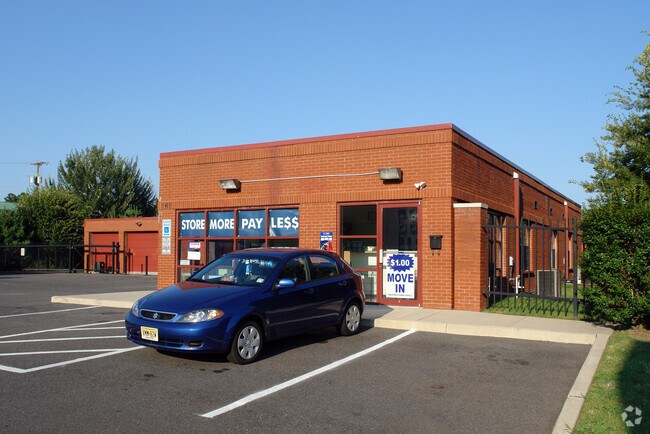
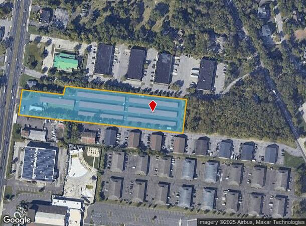
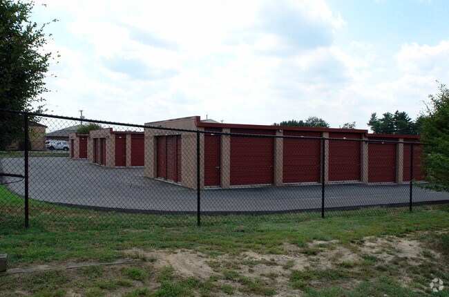
565 N Route 73
06-01002-0000-00003
1999 SUBDIVISION
Commercialnec
Camden
X
New Jersey
34005C0358F
3
2024
7 AC
2025
South Camden County
608800
Philadelphia
59,025 SF
Philadelphia-Camden-Wilmington, PA-NJ-DE-MD
DEMOGRAPHICS near 565 N Route 73
1 mile
3 mile
5 mile
2024 Total Population
6,515
42,837
142,197
2029 Population
6,486
42,917
142,353
Pop Growth 2024-2029
(0.45%)
+ 0.19%
+ 0.11%
Average Age
42
41
41
2024 Total Households
2,332
16,097
55,692
HH Growth 2024-2029
(0.43%)
+ 0.23%
+ 0.12%
Median Household Inc
$118,233
$91,515
$90,246
Avg Household Size
2.80
2.60
2.50
2024 Avg HH Vehicles
2.00
2.00
2.00
Median Home Value
$377,463
$320,282
$284,383
Median Year Built
1978
1976
1977
Nearby Places
Map Layers
Map Styles
 Street
 Aerial
Transit
 Traffic
 Biking
Places
Listings with unknown addresses are not visible on the map
- Restaurants
- Banks
- Shops
- Fitness
- Groceries
PUBLIC TRANSPORTATION
COMMUTER RAIL
Atco (Atlantic City Line - NJ Transit Commuter Rail (NJ Transit))
Drive
Walk
Distance
Atco (Atlantic City Line - NJ Transit Commuter Rail (NJ Transit))
8 min
4.6 mi
Lindenwold (Njt) (Atlantic City Line - NJ Transit Commuter Rail (NJ Transit))
Drive
Walk
Distance
Lindenwold (Njt) (Atlantic City Line - NJ Transit Commuter Rail (NJ Transit))
10 min
6.7 mi
AIRPORT
Philadelphia International
Drive
Walk
Distance
Philadelphia International
40 min
25.4 mi
Freight Ports
Broadway Terminal - Pier 5
Drive
Walk
Distance
Broadway Terminal - Pier 5
24 min
16.9 mi
Nearby Properties
Address
Land Use
TOTAL SIZE
Lot Size
Zoning
Address
Land Use
TOTAL SIZE
Lot Size
Zoning
58.91 AC
MB
Address
Land Use
TOTAL SIZE
Lot Size
Zoning
256,152 SF
58.91 AC
MB
Address
Land Use
TOTAL SIZE
Lot Size
Zoning
6,208 SF
30.73 AC
PARC
Address
Land Use
TOTAL SIZE
Lot Size
Zoning
186,464 SF
19.93 AC
MB
Address
Land Use
TOTAL SIZE
Lot Size
Zoning
44.34 AC
C1
Address
Land Use
TOTAL SIZE
Lot Size
Zoning
58,330 SF
5.08 AC
MB
Address
Land Use
TOTAL SIZE
Lot Size
Zoning
28.40 AC
Address
Land Use
TOTAL SIZE
Lot Size
Zoning
90,080 SF
5.22 AC
MB
Address
Land Use
TOTAL SIZE
Lot Size
Zoning
31.80 AC
Address
Land Use
TOTAL SIZE
Lot Size
Zoning
3.43 AC
O3
Address
Land Use
TOTAL SIZE
Lot Size
Zoning
1.82 AC
MB
Address
Land Use
TOTAL SIZE
Lot Size
Zoning
171,540 SF
0.02 AC
MB
Address
Land Use
TOTAL SIZE
Lot Size
Zoning
24.84 AC
Address
Land Use
TOTAL SIZE
Lot Size
Zoning
118,180 SF
2.71 AC
MB
Address
Land Use
TOTAL SIZE
Lot Size
Zoning
16.71 AC
MF
Address
Land Use
TOTAL SIZE
Lot Size
Zoning
14.53 AC
C2
Address
Land Use
TOTAL SIZE
Lot Size
Zoning
4.67 AC
INST
Address
Land Use
TOTAL SIZE
Lot Size
Zoning
18.72 AC
CP
Address
Land Use
TOTAL SIZE
Lot Size
Zoning
47,738 SF
8.03 AC
O3
Address
Land Use
TOTAL SIZE
Lot Size
Zoning
46,018 SF
0.19 AC
MB
Address
Land Use
TOTAL SIZE
Lot Size
Zoning
18.90 AC
Address
Land Use
TOTAL SIZE
Lot Size
Zoning
62,130 SF
9.61 AC
MB
Address
Land Use
TOTAL SIZE
Lot Size
Zoning
Address
Land Use
TOTAL SIZE
Lot Size
Zoning
6.27 AC
MB
Address
Land Use
TOTAL SIZE
Lot Size
Zoning
34.55 AC
INS
Address
Land Use
TOTAL SIZE
Lot Size
Zoning
19.46 AC
INST
Address
Land Use
TOTAL SIZE
Lot Size
Zoning
25.18 AC
Address
Land Use
TOTAL SIZE
Lot Size
Zoning
19,209 SF
1 AC
Address
Land Use
TOTAL SIZE
Lot Size
Zoning
69,324 SF
20.26 AC
Address
Land Use
TOTAL SIZE
Lot Size
Zoning
7.02 AC
O3
The World's #1 Commercial Real Estate Marketplace
Connect with us
© 2026 CoStar Group
The information above has been obtained from sources believed reliable. While we do not doubt its accuracy we have not verified it and make no guarantee, warranty or representation about it. It is your responsibility to independently confirm its accuracy and completeness. Any projections, opinions, assumptions, or estimates used are for example only and do not represent the current or future performance of the property. The value of this transaction to you depends on tax and other factors which should be evaluated by your tax, financial, and legal advisors. You and your advisors should conduct a careful, independent investigation of the property to determine to your satisfaction the suitability of the property for your needs.