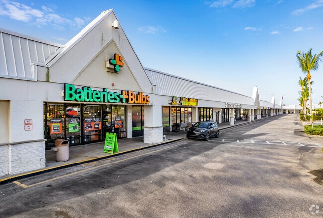
Property Record
565 Us 41 Byp N, Venice, FL 34285

Save to a Folder
{{folder.Name}}
{{folder.ListingIds.length}} Properties
{{folder.ListingIds.length}} Property
Create a New Folder
Property Detail
565 Us 41 Byp N
0407-02-0001
COM NE COR OF NW 1/4 OF NE 1/4 SEC 7-39-19 TH S 00-25-17 W 682.47 FT FOR POB TH S 66-04 E 195.38 FT ALG S R/W STATE RD 45A (VENICE BY-PASS) TH SELY ALG CURVE TO RIGHT 252.94 FT TH N 89-46-18 W
Regionalshoppingcenterormallwithanchorstore
SARASOTA
CSC
Florida
AE The base floodplain where base flood elevations are provided. AE Zones are now used on new format FIRMs instead of A1-A30 Zones.
14.60 AC
2024
Sarasota
2025
Tampa/St Petersburg
002404
North Port-Bradenton-Sarasota, FL
139,551 SF
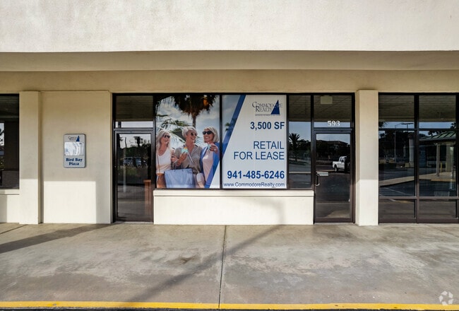
NEARBY LISTINGS FOR SALE OR LEASE
DEMOGRAPHICS near 565 Us 41 Byp N
1 mile
3 mile
5 mile
2025 Total Population
8,888
44,904
84,323
2030 Population
9,678
48,716
91,083
Pop Growth 2025-2030
+ 8.89%
+ 8.49%
+ 8.02%
Average Age
63
61
58
2025 Total Households
4,877
23,934
42,819
HH Growth 2025-2030
+ 9.10%
+ 8.60%
+ 8.13%
Median Household Inc
$60,719
$68,530
$74,164
Avg Household Size
1.70
1.80
1.90
2025 Avg HH Vehicles
1.00
1.00
2.00
Median Home Value
$356,111
$437,395
$442,517
Median Year Built
1977
1981
1986
Nearby Places
Map Layers
Map Styles
 Street
 Aerial
Layers
 Traffic
 Biking
Places
Listings with unknown addresses are not visible on the map
- Restaurants
- Banks
- Shops
- Fitness
- Groceries
PUBLIC TRANSPORTATION
AIRPORT
Sarasota/Bradenton International
Drive
Walk
Distance
Sarasota/Bradenton International
42 min
22.8 mi
Punta Gorda
Drive
Walk
Distance
Punta Gorda
49 min
37.4 mi
Freight Ports
Port Manatee
Drive
Walk
Distance
Port Manatee
54 min
41.2 mi
SALE & LEASE HISTORY
LISTING DATE
SALE/LEASE

Sep 25, 2016
For Lease
Mar 01, 2017
For Lease
Nearby Properties
Address
Land Use
TOTAL SIZE
Lot Size
Zoning
Address
Land Use
TOTAL SIZE
Lot Size
Zoning
738,835 SF
65.43 AC
LW
Address
Land Use
TOTAL SIZE
Lot Size
Zoning
26,265 SF
210.50 AC
RMH
Address
Land Use
TOTAL SIZE
Lot Size
Zoning
592,021 SF
75.99 AC
G
Address
Land Use
TOTAL SIZE
Lot Size
Zoning
565,625 SF
15.61 AC
ST2A
Address
Land Use
TOTAL SIZE
Lot Size
Zoning
421,272 SF
31.96 AC
PUD
Address
Land Use
TOTAL SIZE
Lot Size
Zoning
273,036 SF
28.76 AC
RMF3
Address
Land Use
TOTAL SIZE
Lot Size
Zoning
263,056 SF
25.54 AC
LW
Address
Land Use
TOTAL SIZE
Lot Size
Zoning
181,657 SF
56.90 AC
GU
Address
Land Use
TOTAL SIZE
Lot Size
Zoning
8,562 SF
58.92 AC
RMH
Address
Land Use
TOTAL SIZE
Lot Size
Zoning
23,348 SF
77.03 AC
RMH
Address
Land Use
TOTAL SIZE
Lot Size
Zoning
190,485 SF
5.81 AC
NTG
Address
Land Use
TOTAL SIZE
Lot Size
Zoning
48,681 SF
5 AC
OPI
Address
Land Use
TOTAL SIZE
Lot Size
Zoning
183,584 SF
14.54 AC
PUD
Address
Land Use
TOTAL SIZE
Lot Size
Zoning
223,397 SF
453.78 AC
G
Address
Land Use
TOTAL SIZE
Lot Size
Zoning
133,773 SF
6.29 AC
OPI
Address
Land Use
TOTAL SIZE
Lot Size
Zoning
5,396 SF
33.59 AC
RMH
Address
Land Use
TOTAL SIZE
Lot Size
Zoning
5,208 SF
38.03 AC
CG
Address
Land Use
TOTAL SIZE
Lot Size
Zoning
63,549 SF
6.26 AC
OPI
Address
Land Use
TOTAL SIZE
Lot Size
Zoning
127,135 SF
12.37 AC
CG
Address
Land Use
TOTAL SIZE
Lot Size
Zoning
111,306 SF
9.35 AC
CSC
Address
Land Use
TOTAL SIZE
Lot Size
Zoning
138,547 SF
18.63 AC
CSC
Address
Land Use
TOTAL SIZE
Lot Size
Zoning
101,219 SF
4.90 AC
OPI
Address
Land Use
TOTAL SIZE
Lot Size
Zoning
112,415 SF
8.77 AC
CSC
Address
Land Use
TOTAL SIZE
Lot Size
Zoning
76,247 SF
13.89 AC
CG
Address
Land Use
TOTAL SIZE
Lot Size
Zoning
70,220 SF
9.31 AC
LW
Address
Land Use
TOTAL SIZE
Lot Size
Zoning
8,040 SF
46.23 AC
RMH
Address
Land Use
TOTAL SIZE
Lot Size
Zoning
3,447 SF
65.66 AC
ROS
Address
Land Use
TOTAL SIZE
Lot Size
Zoning
49,400 SF
4.51 AC
OPI
Address
Land Use
TOTAL SIZE
Lot Size
Zoning
45,837 SF
3.06 AC
G
The World's #1 Commercial Real Estate Marketplace
Connect with us
© 2026 CoStar Group
The information above has been obtained from sources believed reliable. While we do not doubt its accuracy we have not verified it and make no guarantee, warranty or representation about it. It is your responsibility to independently confirm its accuracy and completeness. Any projections, opinions, assumptions, or estimates used are for example only and do not represent the current or future performance of the property. The value of this transaction to you depends on tax and other factors which should be evaluated by your tax, financial, and legal advisors. You and your advisors should conduct a careful, independent investigation of the property to determine to your satisfaction the suitability of the property for your needs.