Property Record
5650 County Line Rd, Ravenel, SC 29470
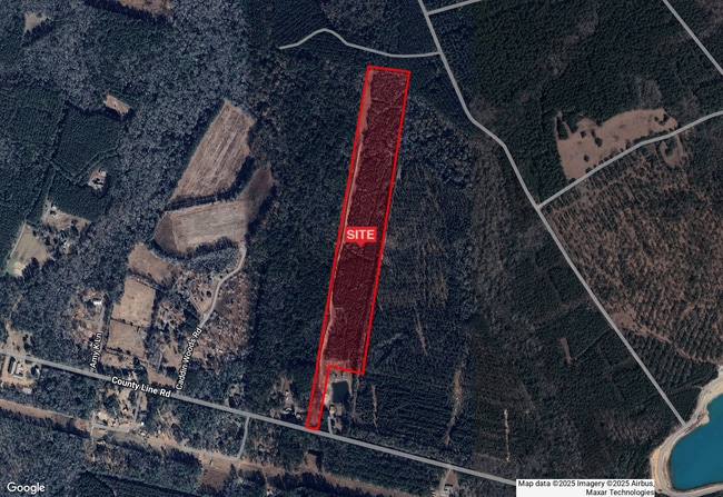
This Property Is For Sale
NEARBY LISTINGS FOR SALE OR LEASE
-
-
View all Ravenel listings for sale on LoopNet.com
Property Detail
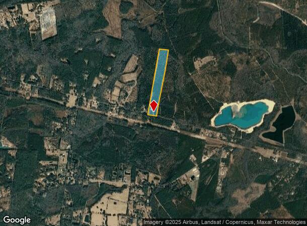
5650 County Line Rd
Charleston-North Charleston, SC
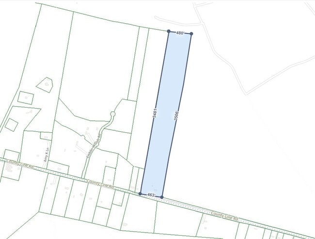
Plat Representing Thirty Acres Land Situ
200-00-00-018
Dorchester
Ruralagriculturalresidence
South Carolina
X
30 AC
45019C0455K
Dorchester County
1,238 SF
Charleston/N Charleston
DEMOGRAPHICS near 5650 County Line Rd
1 Mile
3 Mile
5 Mile
2024 Total Population
241
922
4,621
2029 Population
275
1,055
5,187
Pop Growth 2024-2029
+ 14.11%
+ 14.43%
+ 12.25%
Average Age
46
45
44
2024 Total Households
94
356
1,774
HH Growth 2024-2029
+ 14.89%
+ 14.61%
+ 12.46%
Median Household Inc
$67,500
$64,038
$64,030
Avg Household Size
2.60
2.60
2.60
2024 Avg HH Vehicles
2.00
2.00
2.00
Median Home Value
$437,500
$425,806
$318,902
Median Year Built
2005
2004
1994
Nearby Places
- Restaurants
- Banks
- Shops
- Fitness
- Groceries
PUBLIC TRANSPORTATION
AIRPORT
Charleston AFB/International
DRIVE
WALK
Distance
Charleston AFB/International
40 min
25.4 mi
Freight Ports
North Charleston Terminal
DRIVE
WALK
Distance
North Charleston Terminal
40 min
21.6 mi
Nearby Properties
Address
Land Use
TOTAL SIZE
Lot Size
Zoning
Address
Land Use
TOTAL SIZE
Lot Size
Zoning
2,135.94 AC
PD-ARHOD_D
Address
Land Use
TOTAL SIZE
Lot Size
Zoning
362.58 AC
Address
Land Use
TOTAL SIZE
Lot Size
Zoning
1,182.50 AC
AR-ARHOD_D
Address
Land Use
TOTAL SIZE
Lot Size
Zoning
1,123.78 AC
EE
Address
Land Use
TOTAL SIZE
Lot Size
Zoning
308.32 AC
AR-ARHOD_D
Address
Land Use
TOTAL SIZE
Lot Size
Zoning
Address
Land Use
TOTAL SIZE
Lot Size
Zoning
2,000 SF
37.93 AC
AR-ARHOD_D
Address
Land Use
TOTAL SIZE
Lot Size
Zoning
350.57 AC
PD-ARHOD_D
Address
Land Use
TOTAL SIZE
Lot Size
Zoning
142 AC
AR-ARHOD_D
Address
Land Use
TOTAL SIZE
Lot Size
Zoning
177.25 AC
PD-ARHOD_D
Address
Land Use
TOTAL SIZE
Lot Size
Zoning
109.14 AC
AR-ARHOD_D
Address
Land Use
TOTAL SIZE
Lot Size
Zoning
101 AC
Address
Land Use
TOTAL SIZE
Lot Size
Zoning
170.58 AC
PD-ARHOD_D
Address
Land Use
TOTAL SIZE
Lot Size
Zoning
61.81 AC
RR-ARHOD_D
Address
Land Use
TOTAL SIZE
Lot Size
Zoning
39.05 AC
PD-ARHOD_D
Address
Land Use
TOTAL SIZE
Lot Size
Zoning
37.50 AC
PD-ARHOD_D
Address
Land Use
TOTAL SIZE
Lot Size
Zoning
50 AC
AR-ARHOD_D
Address
Land Use
TOTAL SIZE
Lot Size
Zoning
48 AC
AR-ARHOD_D
Address
Land Use
TOTAL SIZE
Lot Size
Zoning
30.44 AC
PD-ARHOD_D
Address
Land Use
TOTAL SIZE
Lot Size
Zoning
42.99 AC
AR-ARHOD_D
Address
Land Use
TOTAL SIZE
Lot Size
Zoning
21.87 AC
PD-ARHOD_D
Address
Land Use
TOTAL SIZE
Lot Size
Zoning
10.11 AC
PD-ARHOD_D
Address
Land Use
TOTAL SIZE
Lot Size
Zoning
50.54 AC
PD-ARHOD_D
Address
Land Use
TOTAL SIZE
Lot Size
Zoning
61.53 AC
PD-ARHOD_D
Address
Land Use
TOTAL SIZE
Lot Size
Zoning
36.31 AC
AR-ARHOD_D
Address
Land Use
TOTAL SIZE
Lot Size
Zoning
28.32 AC
RR-ARHOD_D
Address
Land Use
TOTAL SIZE
Lot Size
Zoning
27.90 AC
AR-ARHOD_D
Address
Land Use
TOTAL SIZE
Lot Size
Zoning
27.88 AC
AR-ARHOD_D
Address
Land Use
TOTAL SIZE
Lot Size
Zoning
27.88 AC
AR-ARHOD_D
Address
Land Use
TOTAL SIZE
Lot Size
Zoning
27.88 AC
AR-ARHOD_D
The World's #1 Commercial Real Estate Marketplace
Connect with us
© 2025 CoStar Group
The information above has been obtained from sources believed reliable. While we do not doubt its accuracy we have not verified it and make no guarantee, warranty or representation about it. It is your responsibility to independently confirm its accuracy and completeness. Any projections, opinions, assumptions, or estimates used are for example only and do not represent the current or future performance of the property. The value of this transaction to you depends on tax and other factors which should be evaluated by your tax, financial, and legal advisors. You and your advisors should conduct a careful, independent investigation of the property to determine to your satisfaction the suitability of the property for your needs.