Property Record
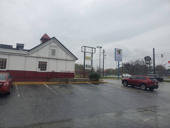
5651 Memorial Dr, Stone Mountain, GA 30083


NEARBY LISTINGS FOR SALE OR LEASE
Property Detail
5651 Memorial Dr
18-070-03-006
COMMENCE AT A REBAR MARKING THE INTERSECTION OF THE SOUTHERLY R/W LINE OF MEMORIAL DR WITH THE WESTERLY R/W LINE OF HAMBRICK RD SAID POINT LYING ON A CIRCULAR CURVE
Storebuilding
DeKalb
X
Georgia
13089C0087J
6
2025
0.41 AC
2025
Stone Mtn/Clarkston
021916
Atlanta
1,768 SF
Atlanta-Sandy Springs-Roswell, GA
DEMOGRAPHICS near 5651 Memorial Dr
1 Mile
3 Mile
5 Mile
2024 Total Population
13,222
107,479
230,604
2029 Population
12,972
107,195
230,346
Pop Growth 2024-2029
(1.89%)
(0.26%)
(0.11%)
Average Age
37
36
39
2024 Total Households
4,511
38,224
89,187
HH Growth 2024-2029
(2.17%)
(0.20%)
(0.01%)
Median Household Inc
$55,493
$48,285
$62,696
Avg Household Size
2.80
2.70
2.50
2024 Avg HH Vehicles
2.00
2.00
2.00
Median Home Value
$223,895
$219,316
$267,225
Median Year Built
1978
1977
1978
Nearby Places
Map Layers
Map Styles
 Street
 Aerial
- Restaurants
- Banks
- Shops
- Fitness
- Groceries
PUBLIC TRANSPORTATION
AIRPORT
Hartsfield - Jackson Atlanta International
DRIVE
WALK
Distance
Hartsfield - Jackson Atlanta International
32 min
21.1 mi
SALE & LEASE HISTORY
LISTING DATE
SALE/LEASE

Sep 23, 2016
For Sale
Mar 26, 2024
For Sale
Feb 10, 2022
For Sale
Dec 11, 2019
For Lease
Dec 10, 2019
For Sale
Aug 08, 2019
For Sale
Nearby Properties
Address
Land Use
TOTAL SIZE
Lot Size
Zoning
Address
Land Use
TOTAL SIZE
Lot Size
Zoning
656,837 SF
88.74 AC
RM100
Address
Land Use
TOTAL SIZE
Lot Size
Zoning
287,674 SF
17.63 AC
R75: SF RE
Address
Land Use
TOTAL SIZE
Lot Size
Zoning
819,703 SF
55.80 AC
M
Address
Land Use
TOTAL SIZE
Lot Size
Zoning
587,493 SF
29.79 AC
X
Address
Land Use
TOTAL SIZE
Lot Size
Zoning
222,799 SF
11.59 AC
X
Address
Land Use
TOTAL SIZE
Lot Size
Zoning
295,718 SF
25.64 AC
RM85
Address
Land Use
TOTAL SIZE
Lot Size
Zoning
385,221 SF
27.41 AC
RM85
Address
Land Use
TOTAL SIZE
Lot Size
Zoning
337,746 SF
29.94 AC
RM100
Address
Land Use
TOTAL SIZE
Lot Size
Zoning
339,262 SF
26.16 AC
RM100
Address
Land Use
TOTAL SIZE
Lot Size
Zoning
319,984 SF
24.70 AC
RM100
Address
Land Use
TOTAL SIZE
Lot Size
Zoning
224,812 SF
19.29 AC
RM75
Address
Land Use
TOTAL SIZE
Lot Size
Zoning
251,327 SF
19.92 AC
X
Address
Land Use
TOTAL SIZE
Lot Size
Zoning
269,639 SF
24.65 AC
RM100
Address
Land Use
TOTAL SIZE
Lot Size
Zoning
480,302 SF
34.46 AC
RM85
Address
Land Use
TOTAL SIZE
Lot Size
Zoning
358,818 SF
22.41 AC
RM100
Address
Land Use
TOTAL SIZE
Lot Size
Zoning
446,287 SF
31 AC
RM100
Address
Land Use
TOTAL SIZE
Lot Size
Zoning
299,798 SF
17.20 AC
X
Address
Land Use
TOTAL SIZE
Lot Size
Zoning
249,184 SF
20 AC
RM100
Address
Land Use
TOTAL SIZE
Lot Size
Zoning
240,276 SF
19.53 AC
RM85
Address
Land Use
TOTAL SIZE
Lot Size
Zoning
302,988 SF
41.36 AC
X
Address
Land Use
TOTAL SIZE
Lot Size
Zoning
180,410 SF
14.50 AC
RM85
Address
Land Use
TOTAL SIZE
Lot Size
Zoning
292,996 SF
15.84 AC
RM100
Address
Land Use
TOTAL SIZE
Lot Size
Zoning
373,062 SF
20.59 AC
RM100
Address
Land Use
TOTAL SIZE
Lot Size
Zoning
324,116 SF
19.90 AC
A
Address
Land Use
TOTAL SIZE
Lot Size
Zoning
312,258 SF
24.80 AC
X
Address
Land Use
TOTAL SIZE
Lot Size
Zoning
384,545 SF
35.93 AC
RM100
Address
Land Use
TOTAL SIZE
Lot Size
Zoning
273,192 SF
24.07 AC
RM100
Address
Land Use
TOTAL SIZE
Lot Size
Zoning
189,486 SF
18.57 AC
X
Address
Land Use
TOTAL SIZE
Lot Size
Zoning
490,343 SF
28.70 AC
X
Address
Land Use
TOTAL SIZE
Lot Size
Zoning
124,868 SF
14.82 AC
The World's #1 Commercial Real Estate Marketplace
Connect with us
© 2025 CoStar Group
The information above has been obtained from sources believed reliable. While we do not doubt its accuracy we have not verified it and make no guarantee, warranty or representation about it. It is your responsibility to independently confirm its accuracy and completeness. Any projections, opinions, assumptions, or estimates used are for example only and do not represent the current or future performance of the property. The value of this transaction to you depends on tax and other factors which should be evaluated by your tax, financial, and legal advisors. You and your advisors should conduct a careful, independent investigation of the property to determine to your satisfaction the suitability of the property for your needs.