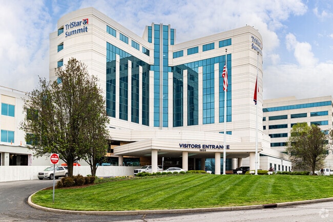
Property Record
5655 Frist Blvd, Hermitage, TN 37076
Current Lease Availabilities
NEARBY LISTINGS FOR SALE OR LEASE
Property Detail
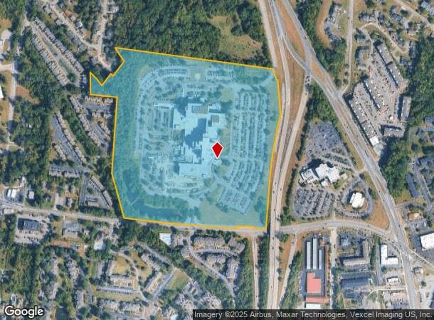
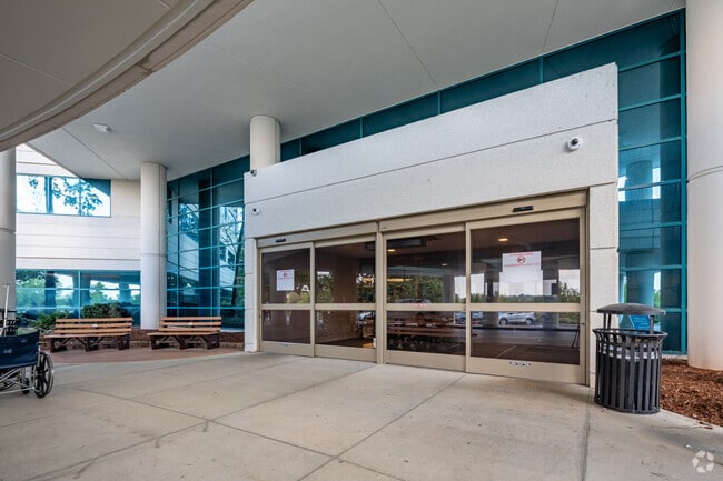
5655 Frist Blvd
086-00-0-064
W/S OLDW/S OLD HICKORY BLVD. E OF CHANDLER ROAD HICKORY BLVD. E OF CHANDLER ROAD
Hospitalpublic
Davidson
X
Tennessee
47189C0140E
47.85 AC
2025
Airport North
2025
Nashville
015623
Nashville-Davidson--Murfreesboro--Franklin, TN
503,878 SF
DEMOGRAPHICS near 5655 Frist Blvd
1 Mile
3 Mile
5 Mile
2024 Total Population
10,885
50,020
92,779
2029 Population
10,770
49,945
95,232
Pop Growth 2024-2029
(1.06%)
(0.15%)
+ 2.64%
Average Age
36
39
40
2024 Total Households
5,184
21,556
38,759
HH Growth 2024-2029
(1.54%)
(0.91%)
+ 1.57%
Median Household Inc
$55,265
$70,341
$74,008
Avg Household Size
2.10
2.30
2.30
2024 Avg HH Vehicles
1.00
2.00
2.00
Median Home Value
$287,553
$314,753
$322,861
Median Year Built
1994
1989
1986
Nearby Places
Map Layers
Map Styles
 Street
 Aerial
- Restaurants
- Banks
- Shops
- Fitness
- Groceries
PUBLIC TRANSPORTATION
COMMUTER RAIL
Hermitage (East Corridor Line - Tennessee Regional Transportation Authority Music City Star (Music City Star))
DRIVE
WALK
Distance
Hermitage (East Corridor Line - Tennessee Regional Transportation Authority Music City Star (Music City Star))
4 min
1.3 mi
Donelson (East Corridor Line - Tennessee Regional Transportation Authority Music City Star (Music City Star))
DRIVE
WALK
Distance
Donelson (East Corridor Line - Tennessee Regional Transportation Authority Music City Star (Music City Star))
8 min
4.5 mi
AIRPORT
Nashville International
DRIVE
WALK
Distance
Nashville International
10 min
6.9 mi
Freight Ports
Port of Mobile
DRIVE
WALK
Distance
Port of Mobile
494 min
453.6 mi
Nearby Properties
Address
Land Use
TOTAL SIZE
Lot Size
Zoning
Address
Land Use
TOTAL SIZE
Lot Size
Zoning
32,891 SF
10.65 AC
MUL
Address
Land Use
TOTAL SIZE
Lot Size
Zoning
25,068 SF
42.36 AC
MULTI-ZONE
Address
Land Use
TOTAL SIZE
Lot Size
Zoning
9,956 SF
81.09 AC
RM9
Address
Land Use
TOTAL SIZE
Lot Size
Zoning
102,162 SF
25.71 AC
RM9
Address
Land Use
TOTAL SIZE
Lot Size
Zoning
75,873 SF
8.88 AC
OR20
Address
Land Use
TOTAL SIZE
Lot Size
Zoning
21,061 SF
31.15 AC
RM9
Address
Land Use
TOTAL SIZE
Lot Size
Zoning
12,312 SF
21.51 AC
OR20
Address
Land Use
TOTAL SIZE
Lot Size
Zoning
49,660 SF
16.96 AC
MULTIZONE
Address
Land Use
TOTAL SIZE
Lot Size
Zoning
7,940 SF
28.01 AC
RM15
Address
Land Use
TOTAL SIZE
Lot Size
Zoning
10,280 SF
32.07 AC
RM15
Address
Land Use
TOTAL SIZE
Lot Size
Zoning
18,522 SF
22.42 AC
MULTI-ZONE
Address
Land Use
TOTAL SIZE
Lot Size
Zoning
52,305 SF
25.71 AC
MULTI-ZONE
Address
Land Use
TOTAL SIZE
Lot Size
Zoning
15,750 SF
19.47 AC
RM15
Address
Land Use
TOTAL SIZE
Lot Size
Zoning
49,140 SF
17.93 AC
OL
Address
Land Use
TOTAL SIZE
Lot Size
Zoning
23,328 SF
13.48 AC
RM20
Address
Land Use
TOTAL SIZE
Lot Size
Zoning
248,573 SF
25.36 AC
OL
Address
Land Use
TOTAL SIZE
Lot Size
Zoning
21,104 SF
21.07 AC
RM15
Address
Land Use
TOTAL SIZE
Lot Size
Zoning
64,560 SF
8.57 AC
MULTIZONE
Address
Land Use
TOTAL SIZE
Lot Size
Zoning
15,044 SF
20.63 AC
RM20
Address
Land Use
TOTAL SIZE
Lot Size
Zoning
21,580 SF
20.29 AC
RM9
Address
Land Use
TOTAL SIZE
Lot Size
Zoning
19,120 SF
22.25 AC
RM15
Address
Land Use
TOTAL SIZE
Lot Size
Zoning
37,050 SF
8.78 AC
OR20
Address
Land Use
TOTAL SIZE
Lot Size
Zoning
16,890 SF
8.28 AC
CS
Address
Land Use
TOTAL SIZE
Lot Size
Zoning
14,374 SF
19.16 AC
RM15
Address
Land Use
TOTAL SIZE
Lot Size
Zoning
13,616 SF
14.96 AC
MULTI-ZONE
Address
Land Use
TOTAL SIZE
Lot Size
Zoning
294,923 SF
17.91 AC
MULTI-ZONE
Address
Land Use
TOTAL SIZE
Lot Size
Zoning
10,704 SF
16.34 AC
R10
Address
Land Use
TOTAL SIZE
Lot Size
Zoning
2,914 SF
9.92 AC
RS15
Address
Land Use
TOTAL SIZE
Lot Size
Zoning
11,875 SF
21.25 AC
RM9
The World's #1 Commercial Real Estate Marketplace
Connect with us
© 2026 CoStar Group
The information above has been obtained from sources believed reliable. While we do not doubt its accuracy we have not verified it and make no guarantee, warranty or representation about it. It is your responsibility to independently confirm its accuracy and completeness. Any projections, opinions, assumptions, or estimates used are for example only and do not represent the current or future performance of the property. The value of this transaction to you depends on tax and other factors which should be evaluated by your tax, financial, and legal advisors. You and your advisors should conduct a careful, independent investigation of the property to determine to your satisfaction the suitability of the property for your needs.