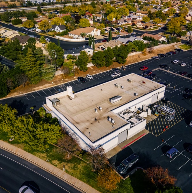
Property Record
566 N Mall Dr, Saint George, UT 84790

Current Lease Availabilities
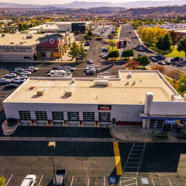
NEARBY LISTINGS FOR SALE OR LEASE
Property Detail
566 N Mall Dr
0451461
S: 21 T: 42S R: 15W BEG S89*0930 W 428.51 FT ALG C/S/L & N10*5030 W 41 FT FM CTR SEC 21 T42S R15W TH N10*5030 W 280.67 FT; TH S59*5512 W 266.45 FT TO E LN MALL DRIVE; TH S30*0448 E 265 FT ALG E LN MALL DR; TH N59*5512 E 173.97 FT TO POB
Commercialnec
Washington
X
Utah
49053C1031G
1.34 AC
2024
Cedar City & St George
2025
Other Market Areas
271102
St. George, UT
5,081 SF
DEMOGRAPHICS near 566 N Mall Dr
1 Mile
3 Mile
5 Mile
2024 Total Population
10,424
59,235
123,672
2029 Population
12,774
73,561
154,351
Pop Growth 2024-2029
+ 22.54%
+ 24.19%
+ 24.81%
Average Age
40
39
39
2024 Total Households
3,591
20,671
42,539
HH Growth 2024-2029
+ 23.22%
+ 25.05%
+ 25.59%
Median Household Inc
$60,779
$55,265
$63,644
Avg Household Size
2.70
2.70
2.80
2024 Avg HH Vehicles
2.00
2.00
2.00
Median Home Value
$348,780
$417,921
$433,316
Median Year Built
2001
1999
2001
Nearby Places
- Restaurants
- Banks
- Shops
- Fitness
- Groceries
PUBLIC TRANSPORTATION
AIRPORT
St George Regional
DRIVE
WALK
Distance
St George Regional
10 min
4.6 mi
Nearby Properties
Address
Land Use
TOTAL SIZE
Lot Size
Zoning
Address
Land Use
TOTAL SIZE
Lot Size
Zoning
1,120,988 SF
52.22 AC
PDCOM
Address
Land Use
TOTAL SIZE
Lot Size
Zoning
319,351 SF
31.39 AC
Address
Land Use
TOTAL SIZE
Lot Size
Zoning
319,351 SF
31.39 AC
PD
Address
Land Use
TOTAL SIZE
Lot Size
Zoning
252,737 SF
3.95 AC
C-4
Address
Land Use
TOTAL SIZE
Lot Size
Zoning
118,603 SF
16.56 AC
Address
Land Use
TOTAL SIZE
Lot Size
Zoning
141,151 SF
15 AC
PDCOM
Address
Land Use
TOTAL SIZE
Lot Size
Zoning
230,880 SF
25.58 AC
C-2
Address
Land Use
TOTAL SIZE
Lot Size
Zoning
87,826 SF
37.27 AC
Address
Land Use
TOTAL SIZE
Lot Size
Zoning
66,506 SF
15.12 AC
Address
Land Use
TOTAL SIZE
Lot Size
Zoning
97,572 SF
10.51 AC
PD
Address
Land Use
TOTAL SIZE
Lot Size
Zoning
141,567 SF
1.31 AC
C-4
Address
Land Use
TOTAL SIZE
Lot Size
Zoning
280,428 SF
1.96 AC
C-4
Address
Land Use
TOTAL SIZE
Lot Size
Zoning
91,517 SF
8.96 AC
C2
Address
Land Use
TOTAL SIZE
Lot Size
Zoning
84,384 SF
6.34 AC
C2
Address
Land Use
TOTAL SIZE
Lot Size
Zoning
88,445 SF
3.28 AC
C2
Address
Land Use
TOTAL SIZE
Lot Size
Zoning
86,875 SF
77.53 AC
Address
Land Use
TOTAL SIZE
Lot Size
Zoning
153,140 SF
17.17 AC
C-3
Address
Land Use
TOTAL SIZE
Lot Size
Zoning
120,219 SF
11.88 AC
Address
Land Use
TOTAL SIZE
Lot Size
Zoning
67,974 SF
7.04 AC
Address
Land Use
TOTAL SIZE
Lot Size
Zoning
76,907 SF
4 AC
PDCOM
Address
Land Use
TOTAL SIZE
Lot Size
Zoning
72,862 SF
3.20 AC
Address
Land Use
TOTAL SIZE
Lot Size
Zoning
59,500 SF
4.93 AC
R110
Address
Land Use
TOTAL SIZE
Lot Size
Zoning
137,662 SF
7.81 AC
PD
Address
Land Use
TOTAL SIZE
Lot Size
Zoning
158,638 SF
4.67 AC
C-3
Address
Land Use
TOTAL SIZE
Lot Size
Zoning
69,421 SF
5.73 AC
PDCOM
Address
Land Use
TOTAL SIZE
Lot Size
Zoning
34,097 SF
5.90 AC
Address
Land Use
TOTAL SIZE
Lot Size
Zoning
125,208 SF
4.15 AC
PDCOM
Address
Land Use
TOTAL SIZE
Lot Size
Zoning
54,787 SF
4.30 AC
R110
Address
Land Use
TOTAL SIZE
Lot Size
Zoning
58,937 SF
4.47 AC
C2
Address
Land Use
TOTAL SIZE
Lot Size
Zoning
135,592 SF
11.24 AC
PDCOM
The World's #1 Commercial Real Estate Marketplace
Connect with us
© 2025 CoStar Group
The information above has been obtained from sources believed reliable. While we do not doubt its accuracy we have not verified it and make no guarantee, warranty or representation about it. It is your responsibility to independently confirm its accuracy and completeness. Any projections, opinions, assumptions, or estimates used are for example only and do not represent the current or future performance of the property. The value of this transaction to you depends on tax and other factors which should be evaluated by your tax, financial, and legal advisors. You and your advisors should conduct a careful, independent investigation of the property to determine to your satisfaction the suitability of the property for your needs.