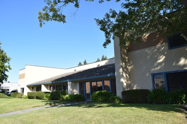
Property Record
566 Portal St, Cotati, CA 94931


Current Lease Availabilities
Property Detail
566 Portal St
144-010-075
81 FORM 144-010-59 CW 60 PER MD
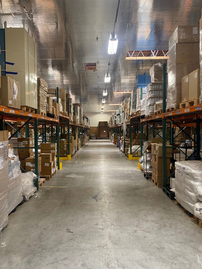
Lightindustrial
Sonoma
CITYCO
California
B and X Area of moderate flood hazard, usually the area between the limits of the 100-year and 500-year floods.
1,2
2025
0.77 AC
2025
Petaluma/Cotati/Rohnert
151206
North Bay/Santa Rosa
12,600 SF
Santa Rosa-Petaluma, CA
NEARBY LISTINGS FOR SALE OR LEASE
DEMOGRAPHICS near 566 Portal St
1 mile
3 mile
5 mile
2025 Total Population
12,274
61,401
85,714
2030 Population
12,422
61,635
85,543
Pop Growth 2025-2030
+ 1.21%
+ 0.38%
(0.20%)
Average Age
38
40
40
2025 Total Households
4,808
22,401
30,320
HH Growth 2025-2030
+ 1.08%
+ 0.34%
(0.31%)
Median Household Inc
$83,076
$99,783
$96,720
Avg Household Size
2.50
2.60
2.70
2025 Avg HH Vehicles
2.00
2.00
2.00
Median Home Value
$565,073
$697,632
$716,753
Median Year Built
1984
1981
1982
Nearby Places
Map Layers
Map Styles
 Street
 Aerial
Layers
 Traffic
 Biking
Places
Listings with unknown addresses are not visible on the map
- Restaurants
- Banks
- Shops
- Fitness
- Groceries
PUBLIC TRANSPORTATION
COMMUTER RAIL
Drive
Walk
Distance
4 min
1.7 mi
Drive
Walk
Distance
7 min
2.6 mi
AIRPORT
Charles M Schulz - Sonoma County
Drive
Walk
Distance
Charles M Schulz - Sonoma County
22 min
15.5 mi
Freight Ports
Port of Richmond
Drive
Walk
Distance
Port of Richmond
56 min
41.9 mi
Nearby Properties
Address
Land Use
TOTAL SIZE
Lot Size
Zoning
Address
Land Use
TOTAL SIZE
Lot Size
Zoning
23,112 SF
12.30 AC
Address
Land Use
TOTAL SIZE
Lot Size
Zoning
4,652 SF
11.09 AC
MLPD
Address
Land Use
TOTAL SIZE
Lot Size
Zoning
61,756 SF
15.83 AC
CITYRP
Address
Land Use
TOTAL SIZE
Lot Size
Zoning
238,800 SF
36.26 AC
Address
Land Use
TOTAL SIZE
Lot Size
Zoning
26,699 SF
6 AC
MLPD
Address
Land Use
TOTAL SIZE
Lot Size
Zoning
29,235 SF
8.08 AC
Address
Land Use
TOTAL SIZE
Lot Size
Zoning
59,370 SF
7.36 AC
Address
Land Use
TOTAL SIZE
Lot Size
Zoning
181,816 SF
8.64 AC
Address
Land Use
TOTAL SIZE
Lot Size
Zoning
10,134 SF
3.03 AC
RM
Address
Land Use
TOTAL SIZE
Lot Size
Zoning
12,640 SF
4.94 AC
CITYRP
Address
Land Use
TOTAL SIZE
Lot Size
Zoning
96,051 SF
5.55 AC
CITYRP
Address
Land Use
TOTAL SIZE
Lot Size
Zoning
5,370 SF
4.85 AC
M3
Address
Land Use
TOTAL SIZE
Lot Size
Zoning
213,331 SF
12.53 AC
CREC
Address
Land Use
TOTAL SIZE
Lot Size
Zoning
12,491 SF
5.40 AC
MLPD
Address
Land Use
TOTAL SIZE
Lot Size
Zoning
149,007 SF
0.25 AC
M1RP
Address
Land Use
TOTAL SIZE
Lot Size
Zoning
7,745 SF
2.28 AC
Address
Land Use
TOTAL SIZE
Lot Size
Zoning
55,826 SF
13.15 AC
CRPD
Address
Land Use
TOTAL SIZE
Lot Size
Zoning
87,286 SF
3.03 AC
Address
Land Use
TOTAL SIZE
Lot Size
Zoning
61,880 SF
2.53 AC
Address
Land Use
TOTAL SIZE
Lot Size
Zoning
107,599 SF
2.98 AC
Address
Land Use
TOTAL SIZE
Lot Size
Zoning
67,584 SF
4.79 AC
CITYRP
Address
Land Use
TOTAL SIZE
Lot Size
Zoning
144,198 SF
12.08 AC
CRPD
Address
Land Use
TOTAL SIZE
Lot Size
Zoning
26,390 SF
3.33 AC
MLPD
Address
Land Use
TOTAL SIZE
Lot Size
Zoning
5,760 SF
4.77 AC
CITYRP
Address
Land Use
TOTAL SIZE
Lot Size
Zoning
38,830 SF
2.09 AC
CITYRP
Address
Land Use
TOTAL SIZE
Lot Size
Zoning
138,134 SF
12.54 AC
C1
Address
Land Use
TOTAL SIZE
Lot Size
Zoning
85,844 SF
2.34 AC
MLPD
Address
Land Use
TOTAL SIZE
Lot Size
Zoning
55,387 SF
3.07 AC
CITYRP
Address
Land Use
TOTAL SIZE
Lot Size
Zoning
81,712 SF
5.64 AC
CITYRP
Address
Land Use
TOTAL SIZE
Lot Size
Zoning
69,431 SF
4.69 AC
The World's #1 Commercial Real Estate Marketplace
Connect with us
© 2026 CoStar Group
The information above has been obtained from sources believed reliable. While we do not doubt its accuracy we have not verified it and make no guarantee, warranty or representation about it. It is your responsibility to independently confirm its accuracy and completeness. Any projections, opinions, assumptions, or estimates used are for example only and do not represent the current or future performance of the property. The value of this transaction to you depends on tax and other factors which should be evaluated by your tax, financial, and legal advisors. You and your advisors should conduct a careful, independent investigation of the property to determine to your satisfaction the suitability of the property for your needs.